Breitalm - Hochlantsch (via Zachenkreuz)
Starting point: Breitalm (1245 m)
Starting point Lat/Lon: 47.36°N 15.46825°E 
Path name: via Zachenkreuz
Time of walking: 1 h 50 min
Difficulty: easy unmarked way
Difficulty of skiing: no data
Altitude difference: 477 m
Altitude difference (by path): 515 m
Map:
Access to starting point:
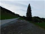
From the border crossing Šentilj we continue driving on the highway towards Gradec / Graz and forward towards Linz and Salzburg. Highway A9 we soon leave and we continue driving slightly right in the direction towards Dunaj / Wien and we continue driving on the highway S35. The mention we leave the highway at exit for Mixnitz, and then at the roundabout we go to the exit in the direction of Teichalm. Further, we still follow the signs for Teichalm. At the end of the settlement St. Erhard we once again turn right towards Teichalm, and then we start ascending steeply. When we reach the mountain pasture Breitalm, the road at the saddle stops ascending, and on the right, we notice a smaller marked parking lot where we park.
Path description:
From the parking lot, we head towards the west, where we first walk to the nearby stable, and then start ascending diagonally on a grassy path that leads us through a grazing area. When, with nice views, we reach the indistinct southern ridge of the peak Tonneggerkogel, we can turn right and ascend to the mentioned peak in less than three minutes; otherwise, we continue straight on the path, which turns slightly to the right, and on the western to southwestern slopes, we cross a grazing fence, where we leave the grazing area. Next follows a short descent on a slightly overgrown path, and we quickly reach the forest road, on which we continue the ascent. The road first leads through a panoramic area, then passes into the forest, and we continue along it to the point where we reach the marked path Teichalm - Hochlantsch.
Here we leave the road and start ascending more steeply on the marked path, which soon leaves the forest and leads us with beautiful views of the surrounding hills. When, higher up, the marked path flattens and starts turning to the left, we leave it and, by a cairn, continue right on an unmarked footpath, along which we ascend on and beside the ridge. Higher up, the path enters the forest and brings us to Zachenkreuz, where a wooden cross is located.
From the top, we continue towards the west, where the still unmarked path leads along and on the ridge, which is precipitous on the right side in many places, but the path runs slightly to the left, so there is no significant danger of slipping. The path, which continues with a few short, easy ascents and descents, then brings us back to the marked path, along which we continue.
When we reach the marked path, we start ascending again, initially still through the forest, and later on an increasingly panoramic path. We follow this path all the way to the top, where a large metal cross stands.
To the highest point of the peak, where the cross is located, the path is rockier and somewhat more challenging, but a relatively easy passage to the summit can also be found.
Breitalm - Tonneggerkogel 0:15, Tonneggerkogel - Zachenkreuz 1:00, Zachenkreuz - Hochlantsch 0:50.
Description refers to the condition in June 2025, and pictures are from various periods.
Pictures:
 1
1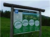 2
2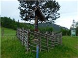 3
3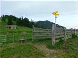 4
4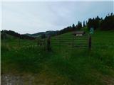 5
5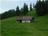 6
6 7
7 8
8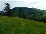 9
9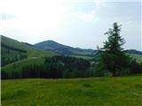 10
10 11
11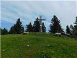 12
12 13
13 14
14 15
15 16
16 17
17 18
18 19
19 20
20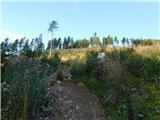 21
21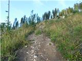 22
22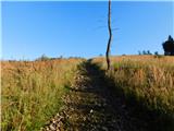 23
23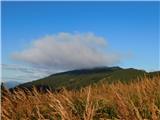 24
24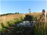 25
25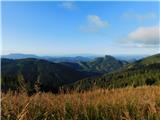 26
26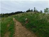 27
27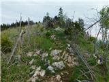 28
28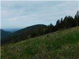 29
29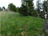 30
30 31
31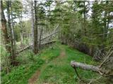 32
32 33
33 34
34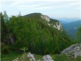 35
35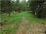 36
36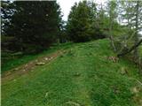 37
37 38
38 39
39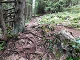 40
40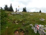 41
41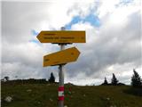 42
42 43
43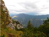 44
44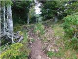 45
45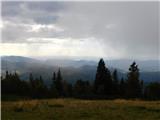 46
46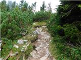 47
47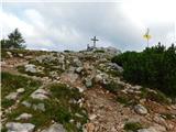 48
48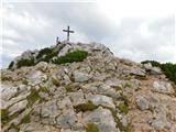 49
49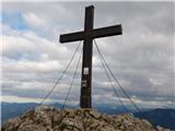 50
50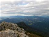 51
51