Bresternica (Šoberjev dvor) - Tojzlov vrh
Starting point: Bresternica (Šoberjev dvor) (319 m)
| Latitude/Longitude: | 46,5856°N 15,5684°E |
| |
Walking time: 1 h 15 min
Difficulty: easy marked way
Elevation gain: 384 m
Elevation difference along the route: 384 m
Map: Pohorje 1:50.000
Recommended equipment (summer):
Recommended equipment (winter):
Views: 10.895
 | 2 people like this post |
Access to starting point:
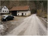
From the road Maribor - Dravograd, we will, in the settlement Bresternica (on maps Brestrnica), notice signs for the village Gaj, which direct us to the right (from the direction of Dravograd, to the left). After a few meters, at a poorly marked crossroad, we continue left and follow the road which leads us through the village to the chapel, where we continue left. The mostly ascending road brings us higher to a crossroad by which we notice mountain signposts for Tojzlov vrh. We park only a few meters ahead on a parking lot by the road.
Route description:
From the starting point, we continue on the asphalt road in the direction of Tojzlov vrh. The road, which is only gently ascending beside the stream, brings us after less than 10 minutes of walking to a crossroad, where we continue on the left road with signs Tojzlov vrh.
The road higher loses the asphalt surface and then brings us to the next crossroad, where we again continue left. Further, the road passes out of the forest onto panoramic slopes, from which a nice view opens up towards Pohorje and part of Maribor with surroundings.
The path then leads us through the village, behind which we come to a pleasant resting place by the chapel. We continue on a marked road, which soon returns into the forest and a little higher brings us to the spot where we leave it.
Blazes direct us to a marked footpath, on which in good 5 minutes of a somewhat steeper ascent we ascend to the mountain hut.
From the hut, we continue on a cart track which slightly ascends and after a few steps goes into the forest. We follow this gently sloping path all the way to Tojzlov vrh, which we reach after less than 5 minutes of additional walking.

Photos:
 1
1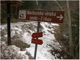 2
2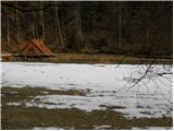 3
3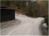 4
4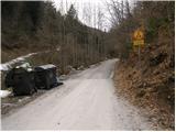 5
5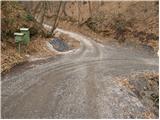 6
6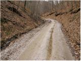 7
7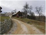 8
8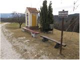 9
9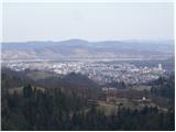 10
10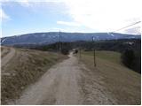 11
11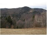 12
12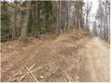 13
13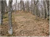 14
14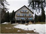 15
15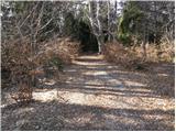 16
16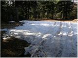 17
17 18
18
Discussion about the trip Bresternica (Šoberjev dvor) - Tojzlov vrh
|
| nahaha28. 02. 2013 |
Nice winter hike that we tried in mid-February. In the last 5 minutes we didn't head onto the marked hiking trail (too much snow) but continued along the road. We reached the hut in about 10 minutes, unfortunately it was closed.
|
|
|
To post a comment you must log in:
If you do not yet have a username, you must first
register.