Brinje - Planica (via Borovje)
Starting point: Brinje (1040 m)
Starting point Lat/Lon: 46.4749°N 13.9566°E 
Path name: via Borovje
Time of walking: 2 h 15 min
Difficulty: partly demanding unmarked way
Difficulty of skiing: no data
Altitude difference: 468 m
Altitude difference (by path): 550 m
Map: Kranjska Gora 1:30.000
Access to starting point:
We leave Gorenjska highway at exit Jesenice - west (Hrušica) and we continue driving towards Kranjska Gora. After approximately 5 km of driving from the spot, when we left the highway, signs for Dovje point us to the right. We drive into the mentioned settlement, through which we follow the signs for Kepa and Dovška Baba. Soon above Dovje asphalt ends, and the road only about 100 meters ahead brings us to the marked crossroad, where signs for Kepa point us sharply left (straight Dovška Baba). Ahead we drive for quite some time, and in doing so "we ignore" all smaller crossroads. Higher, we get to a little bigger crossroad, where a road branches off to the left towards Rovt Vrse, and straight the road continues towards Erjavčev rovt (signs by the road for Kepa). We park on a parking lot by the mentioned crossroad, or we can also for some time continue driving on the left road.
Path description:
From the parking lot, we go on the left road which starts at first moderately ascending, and then it entirely flattens and crosses slopes towards the left. The road, from which occasionally nice views open up on Julian Alps, after approximately 15 to 20 minutes brings us to the spot, where we will notice on the right side smaller cairn, where the footpath branches off, which leads on Borovje.
Here we continue right on the mentioned footpath (possible also straight over Rovt Vrse) and at first, it steeply ascends, and then passes into fern, where slowly starts vanishing, and higher it joins forest cart track which we follow to the right. When the slope flattens, we turn a little to the left and we ascend to the nearby well (trough with water), above which we quickly get to a smaller, at first still indistinct ridge (to here possible also over Rovt Vrse).
When we step on a ridge footpath becomes better visible and gradually steeper and steeper. The path ahead continues on occasionally slightly exposed ridge (mainly in wet and snow more caution is needed), from which here and there beautiful views opening up. The path ahead leads us past the bench, and then signs for Borovje (on a sign to a cross), point us to the left on a slope, on which we start steeply ascending. A pretty steep path, which runs through the forest, higher gradually flattens and turns slightly to the right. Here from the left the path on which we will later continue towards Planica joins, and we continue right and we for some time cross towards the right. After a shorter traversing, we step out of the forest on more rocky terrain, over which over slightly exposed slope we ascend to a cross on Borovje.
From the top, we return to the before mentioned crossing and we continue right (looking in the direction of descent). The path ahead at first diagonally descends on a relatively steep slope, and then it flattens and brings us on a forested ridge. After a minute or two of easy walking, the path starts descending steeply towards the saddle between Borovje and Planica.
When we reach the saddle named Šija 1, we continue left upwards (left downwards Rovt Vrse, straight Kepa via Kurejki, and right downwards we can on harder pathless terrain get to Erjavčev rovt) on the path which starts ascending on a side ridge. For a short time, we are ascending on the mentioned ridge and then the path turns a little to the left and it brings us on the main ridge of Planica. Here we go left and we continue the ascent on and by the ridge, from which at first only rarely views open up towards Kepa and surrounding peaks. A little higher, the footpath flattens and passes on the left side of the ridge, where it occasionally crosses some panoramic slopes. Higher, the path returns on the ridge and it narrows and becomes partly exposed. After the exposed ridge the path for some time returns into the forest and then in a gentle descent crosses another slightly exposed gully. Follows a short steep ascent and an increasingly panoramic path brings us to the top of Planica.
Pictures:
 1
1 2
2 3
3 4
4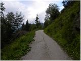 5
5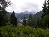 6
6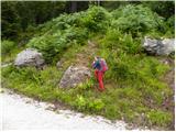 7
7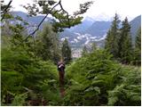 8
8 9
9 10
10 11
11 12
12 13
13 14
14 15
15 16
16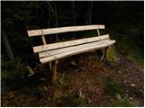 17
17 18
18 19
19 20
20 21
21 22
22 23
23 24
24 25
25 26
26 27
27 28
28 29
29 30
30 31
31 32
32 33
33 34
34 35
35 36
36 37
37 38
38 39
39 40
40 41
41 42
42 43
43 44
44 45
45 46
46 47
47 48
48 49
49 50
50 51
51 52
52 53
53 54
54 55
55 56
56 57
57 58
58 59
59 60
60 61
61