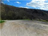
Starting point: Brzika (380 m)
Starting point Lat/Lon: 46.2672°N 15.71248°E 
Time of walking: 3 h
Difficulty: easy marked way
Difficulty of skiing: no data
Altitude difference: 244 m
Altitude difference (by path): 565 m
Map:
Access to starting point:
A) We drive to Rogaška Slatina, and then we continue driving towards Rogatec. In Rogatec at the roundabout we go to the exit "left" in the direction of Ptuj, and then we drive on the main road to mountain pass Brzika, where we notice red hiking signposts, by which we park on an appropriate place.
B) We drive to Majšperk, and then we follow the signs for Stoperce on Rogatec. After Stoperce the road starts ascending steeper, and we follow it to mountain pass Brzika, where we notice red hiking signposts, by which we park on an appropriate place.
Path description:
From the starting point, we continue a few dozen strides on the asphalt road towards Stoperce, then turn left onto a side road marked with signs for Ložno. Next follows a short ascent through the forest, then the road flattens and leads through the yard of a homestead. Behind the homestead, we descend along a marked cart track, which lower down transitions into the forest. At the forest entrance, we leave the track and continue slightly left onto a footpath, ascending again. Next follows a short descent, where we cross the route of a high-pressure gas line, then ascend more steeply for a few minutes. Higher up, we bypass an unnamed 499-meter-high peak on the left, as shown on maps, followed by a moderate descent, then an ascent to the next unnamed peak. From there, we descend slightly, and lower down we reach a cart track, which we follow to the tourist farm Ložno, where we continue right towards Boč (left to church of Our Lady of Loreto in Ložno, 5 minutes).
Next follows a few minutes of moderate ascent, then the path enters the forest, where it crosses the slopes to the left along a cart track. A little further, we approach a few houses, and by a fence, we reach a road, descending in a few minutes to an asphalt road, which we follow to the right. Next follows some walking on the asphalt road, passing under a high-voltage power line, after which a path from Okrepčevalnica Zelena dolina joins from the right.
Next follows an ascent on the asphalt road, from which a nice view of the surrounding hills occasionally opens up, and higher up, the road flattens and leads us past a chapel to the hamlet Ravnocerje.
Here, we go behind the homestead on the right, turning right onto a marked cart track, which we follow to ascend to a marked junction, where we join the path from Cerovec pod Bočem.
The path ahead ascends diagonally along a cart track and quickly brings us to the ridge west of Ravnocerje. Here, the path turns slightly to the left (sharply right to the peak Ravnocerje, 3 minutes) and leads us past a stream, which we see below the path. For a short time, we continue along the forested ridge, then the path turns right and moves onto a slope, where at several junctions we follow the blazes. Higher up, we leave the cart track to the left onto a marked footpath (the cart track soon joins a forest road), and along the path, we notice a sign indicating the Boč forest reserve. The path continues on the left, sunny side, bypassing the highest point of Plešivec, located on an indistinct summit, and then we gradually begin to descend. Lower down, we reach a marked junction where we join the path from Cerovec pod Bočem, and we continue to a nearby road.
When we reach the road, we go left, and we go left also at the nearby crossroad (right - Makole). Next follows some descent on a macadam road, and when we leave the forest, past a religious symbol we get to a crossroad, at which we go straight (to the left leads the road into a valley in the direction of Rogaška Slatina) and on the left side we bypass homestead Gavez, and on the right the nearby hunting lodge Rogaška Slatina.
Behind the lodge we descend to another road and we follow it to the right. When the road starts ascending we leave it and we continue right downwards (straight - Boč) and on a marked cart track we start descending through the forest. Lower, we reach another road and we follow it to the left, and we continue there with an easy descent. And after few minutes on the right we will notice signs for partisan hospital, which from the road point us to the right to the spot, where used to be a partisan hospital.
From the former partisan hospital we return on the road, and there we continue to the few minutes distant meadow Formila.
The starting point - Partisan hospital 2:55, Partisan hospital - Formila 0:05.
Description and pictures (except the penultimate) refer to conditions in January 2023 and March 2024.
Pictures:
 1
1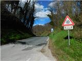 2
2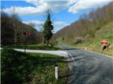 3
3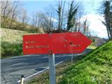 4
4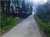 5
5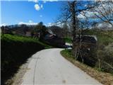 6
6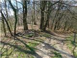 7
7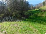 8
8 9
9 10
10 11
11 12
12 13
13 14
14 15
15 16
16 17
17 18
18 19
19 20
20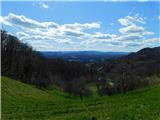 21
21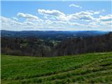 22
22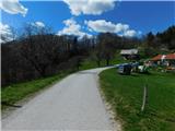 23
23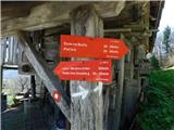 24
24 25
25 26
26 27
27 28
28 29
29 30
30 31
31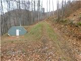 32
32 33
33 34
34 35
35 36
36 37
37 38
38 39
39 40
40 41
41 42
42 43
43 44
44 45
45 46
46 47
47 48
48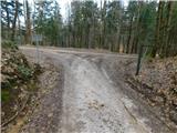 49
49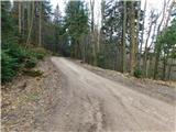 50
50 51
51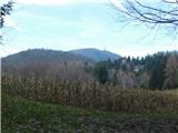 52
52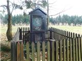 53
53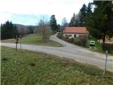 54
54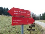 55
55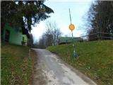 56
56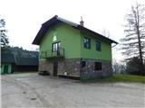 57
57 58
58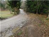 59
59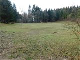 60
60 61
61 62
62 63
63 64
64 65
65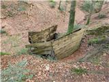 66
66 67
67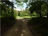 68
68 69
69