Cave del Mole - Viška planina
Starting point: Cave del Mole (1035 m)
Starting point Lat/Lon: 46.4023°N 13.5105°E 
Time of walking: 1 h 15 min
Difficulty: easy marked way
Difficulty of skiing: easily
Altitude difference: 495 m
Altitude difference (by path): 495 m
Map: Julijske Alpe - zahodni del 1:50.000
Access to starting point:
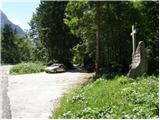
From Kranjska Gora over the border crossing Rateče we drive to Trbiž / Tarvisio. In Trbiž we continue left in the direction of Bovec and we follow the road to the crossroads near the lake Rabeljsko jezero. Here we continue right in the direction of Nevejski preval / Sella Nevea. We follow this road, which is mostly ascending, to the spot where a macadam road branches off to the right. At the turn-off there is a monument with a cross and on a tree a signpost with the caption “Corsi”. We then follow the macadam road for a few turns, after that a little before the gate we park on the parking lot by the road.
From Bovec, we drive to the border crossing Predel, from which we descend to the Italian side. Only a little after the lake Rabeljsko jezero we come to a crossroads, where we continue left in the direction of Nevejski preval / Sella Nevea. Further, follow the above description.
Path description:
From the parking lot, we continue on a macadam road which in zig-zags starts ascending. The road runs through the forest, so there is not much of a view. Only occasionally a view opens up towards the south and southeast. The road then turns to the left and starts ascending even a little steeper towards the north. A steep concrete-paved road then brings us out of the forest onto the mountain pasture Viška planina (1530m).
Pictures:
 1
1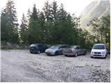 2
2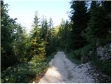 3
3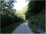 4
4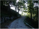 5
5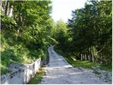 6
6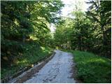 7
7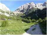 8
8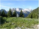 9
9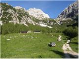 10
10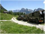 11
11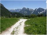 12
12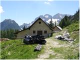 13
13