Čepovan (Želinc) - Vrh Skopice
Starting point: Čepovan (Želinc) (607 m)
Starting point Lat/Lon: 46.087°N 13.7971°E 
Time of walking: 50 min
Difficulty: easy unmarked way
Difficulty of skiing: no data
Altitude difference: 256 m
Altitude difference (by path): 260 m
Map: Goriška 1:50.000
Access to starting point:
A) First, we drive to Idrija, then continue driving towards Tolmin. When we arrive in Dolenja Trebuša, we leave the main road and continue driving left towards Čepovan. At the next crossroads, where the road to Oblakov Vrh branches off to the left, we continue right and drive past the church in Dolenja Trebuša. A bit higher up, the road splits into two parts again. This time we continue slightly right (slightly left to Gorenja Trebuša), cross the river Trebuščica, and then begin steeply ascending towards the mountain pass Drnulk. After the pass, the macadam road starts descending and after 2 km of further driving brings us to Čepovanski dol, where we continue right. We then drive a further good 3 km, then arrive at a smaller crossroads where we park by the information board. From the inn Podkorito in Dolenja Trebuša to the starting point it is approximately 13 km of driving.
B) From Most na Soči or Podbrdo, we drive to Bača pri Modreju, then continue driving towards Postaja and further towards Čepovan. Initially quite a steep road levels out higher up and brings us to Čepovanski dol. We then drive through the hamlet Vrata, where the road to Lokovec branches off to the right. From this crossroads, we drive only another 1 km on the road, then park in a suitable spot by the smaller crossroads, by which there is also an information board. From Postaja to the starting point it is approximately 9.5 km.
C) First, we drive to Nova Gorica or Solkan, then continue driving towards Lokve, Grgar, Čepovan and Sveta gora. A little above the quarry we arrive at a crossroads, from where we continue driving towards Grgar and Čepovan. The road then brings us to Čepovanski dol, through which it continues slightly to moderately ascending. A little further on, we arrive at the centre of the settlement Čepovan, but we follow the road through Čepovanski dol to the next crossroads, where the road to the mountain pass Drnulk branches off to the right. Here we continue straight for a further good 3 km, then arrive at a smaller crossroads where we park by the information board. From Solkan to the starting point it is approximately 22 km.
D) From the direction of Ajdovščina, we first drive to Predmeja, then continue driving towards Lokve and further to Čepovan. From Lokve the road starts descending more steeply towards Čepovan. In Čepovan we continue right and then at the next crossroads at the end of the compact part of the settlement go straight ahead (to the right: mountain pass Drnulk and Dolenja Trebuša). We then drive a further good 3 km, then arrive at a smaller crossroads where we park by the information board. From Predmeja to the starting point it is approximately 21 km.
Path description:
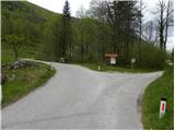
From the information board we head to the lower road, which continues towards the north. When we reach house Čepovan 159, we leave the road and continue the path right across the yard of the mentioned house, behind which we arrive at a nicely followable but unmarked path. The path ahead first runs through a smaller gully, then moves to the left side. For a short time we still walk along the edge of the meadow, then the path enters the forest, through which it starts to ascend more steeply. Higher up the path leads us past a smaller pond (the pond is located approximately 15 metres off the path), after which we quickly reach an abandoned house. At the house the path turns right and climbs to the nearby forest road, which we merely cross. A relatively steep ascent through the forest follows, then we cross the road again. When we next step onto the road, we continue along it. When the road flattens completely, a marked path from the saddle Drnulk joins almost unnoticeably from the right, but we continue straight on the road, which immediately afterwards makes a left bend. The path ahead leads us past a meadow with a hunting observatory, and after some 10 m of further walking we arrive at a small saddle, where the path to Vrh Skopice branches off to the right. We continue on the mountain path, along which in 2 minutes of further walking we reach the panoramic summit.
From the summit we can also descend along the ridge to the nearby viewpoint, from which we also get a nice view into the valley.
Pictures:
 1
1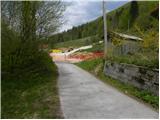 2
2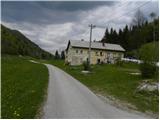 3
3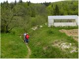 4
4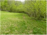 5
5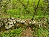 6
6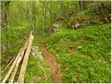 7
7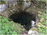 8
8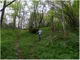 9
9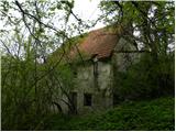 10
10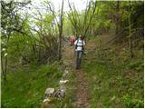 11
11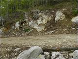 12
12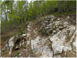 13
13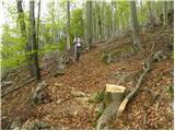 14
14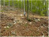 15
15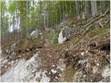 16
16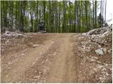 17
17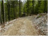 18
18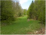 19
19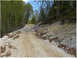 20
20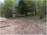 21
21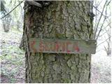 22
22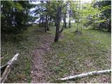 23
23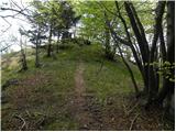 24
24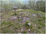 25
25 26
26