Ciampac - Colac (Ferrata dei Finanzieri)
Starting point: Ciampac (2142 m)
Starting point Lat/Lon: 46.4575°N 11.7881°E 
Path name: Ferrata dei Finanzieri
Time of walking: 2 h 50 min
Difficulty: extremely difficult marked way
Ferrata: C
Difficulty of skiing: no data
Altitude difference: 573 m
Altitude difference (by path): 650 m
Map: Tabacco 07 1:25.000
Access to starting point:
A) From Kranjska Gora over Korensko sedlo to Austria, where at the first larger crossroad, we continue left towards Podklošter / Arnoldstein and Trbiž / Tarvisio. By the end of the settlement Podklošter signs for Šmohor / Hermagor point us to the right on a regional road, on which past the mentioned settlement we drive to the end of the valley Gailtal, or more precisely to the settlement Kötschach-Mauthen, where we turn right towards the settlement Oberdrauburg. The path ahead leads us over an Alpine mountain pass Gailbergsattel (982 meters), after which we descend into the mentioned settlement. After we cross the bridge through river Drau, we continue left towards the settlement Lienz. In the main roundabout in Lienz we continue "left" in the direction of the settlement Sillian and Italy. Further, we cross the border between Austria and Italy, and we follow the main road to the settlement Dobbiaco / Toblach, where we turn left towards Cortina d'Ampezzo. When we get into Cortina d'Ampezzo, we follow the signs for Alpine mountain pass Passo Falzarego. On the mountain pass Falzarego (2105 meters) is a crossroad, where we continue straight downwards in the direction of Marmolada and mountain pass Passo Fedaia. At the next crossroads, we follow the road in the direction of Marmolada and mentioned mountain pass. After the mountain pass Fedaia (2057 meters), which is located by the artificial lake Lagho di Fedaia, the road again starts descending, and we follow it to the beginning of the settlement Alba, where we will on the left side notice a cableway Ciampac. We park on a large parking lot by the bottom station of the mentioned cableway. Then we buy a ticket and we go to the upper station of the cable car Ciampac. From Kranjska Gora to a starting point is approximately 280 km.
B) From Kranjska gora over a border crossing Rateče to Trbiž / Tarvisio and further on a highway towards Videm / Udine. We leave the highway at settlement Tolmezzo, from where we continue driving towards the settlement Ampezzo and forward towards Alpine mountain pass Passo della Mauria (1298 meters). The road then starts descending and brings us into a valley Cadore, where we continue right towards the settlement Auronzo di Cadore. At the next crossroads, we follow the signs for Cortina d'Ampezzo. When we get into Cortina d'Ampezzo, we follow the signs for Alpine mountain pass Passo Falzarego. On the mountain pass Falzarego (2105 meters) is a crossroad, where we continue straight downwards in the direction of Marmolada and mountain pass Passo Fedaia. At the next crossroads, we follow the road in the direction of Marmolada and mentioned mountain pass. After the mountain pass Fedaia (2057 meters), which is located by the artificial lake Lagho di Fedaia, the road again starts descending, and we follow it to the beginning of the settlement Alba, where we will on the left side notice a cableway Ciampac. We park on a large parking lot by the bottom station of the mentioned cableway. Then we buy a ticket and we go to the upper station of the cable car Ciampac. From Kranjska Gora to a starting point is approximately 270 km.
C) From Nova Gorica, we drive to Italy and drive forward on a highway to the settlement Portogruaro, where at the highway junction we turn in the direction of Belluno. We follow the highway to the exit for Belluno, and after the settlement Belluno we follow the road in the direction of the settlement Agordo and then Marmolada and Alpine mountain pass Passo Fedaia. After the mountain pass Fedaia (2057 meters), which is located by the artificial lake Lagho di Fedaia, the road starts descending, and we follow it to the beginning settlement Alba, where we will notice on the left side a cableway Ciampac. We park on a large parking lot by the bottom station of the mentioned cableway. Then we buy a ticket and we go to the upper station of the cable car Ciampac. From a border with Slovenia to a starting point is approximately 245 km.
Path description:
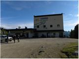
From the upper station of the cable car we continue few ten meters on the road which brings us to the signposts. At the signposts, we go left following the signs »Ferrata dei Finanzieri«. Further, we are then for some time slightly descending on a macadam road which brings us to another crossing. This time signposts point us to the right and then follows a short descent and then crossing of grassy slopes, which brings us below the slopes of the mountain Colac.
We continue slightly left and we start ascending on the scree, which brings us to the entry of a climbing part of the path.
In the initial part we ascend by the steel cable upwards, after that for a short time follows a little easier unsecured part of the path. Next follows a crossing by the steel cable to the left and then steep ascent on groove left upwards. Further, the path is quite steeply ascending on a rocky slope upwards and we also get help from few stemples. Such a path then brings us to slightly overhang jump over which we get with help from numerous stemples. Higher then the path is all the time steeply ascending and on some spots also some strength in arms is needed. Relatively long ascent on steep northern slopes of the mountain brings us on a ridge from which a nice view opens up towards Marmolada. We continue right and slightly less steep path soon brings us to the summit.
Climbing path Ferrata dei Finanzieri belongs among most difficult paths in the Dolomites and it is appropriate only for experienced mountaineers with mandatory self belaying.
We descend on a little easier path which runs on the southern slopes of the mountain. At the crossing, a little lower we can continue right towards the upper station of the cable car or left towards the parking lot at the bottom station of the cable car.
Pictures:
 1
1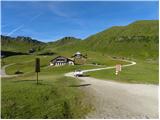 2
2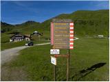 3
3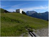 4
4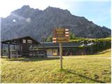 5
5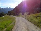 6
6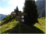 7
7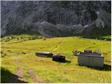 8
8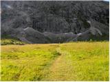 9
9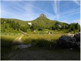 10
10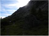 11
11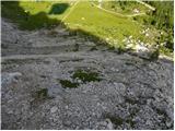 12
12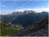 13
13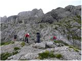 14
14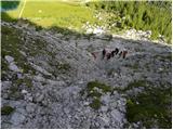 15
15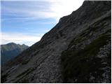 16
16 17
17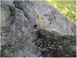 18
18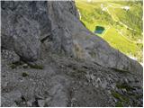 19
19 20
20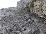 21
21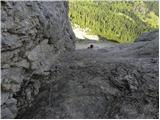 22
22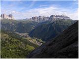 23
23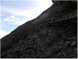 24
24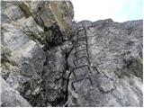 25
25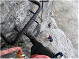 26
26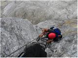 27
27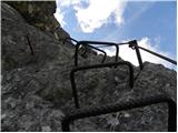 28
28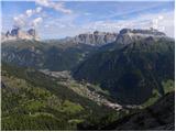 29
29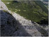 30
30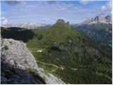 31
31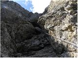 32
32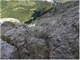 33
33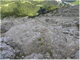 34
34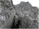 35
35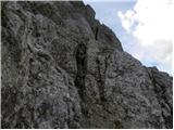 36
36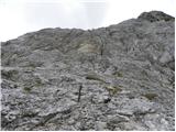 37
37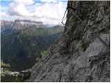 38
38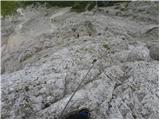 39
39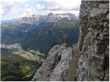 40
40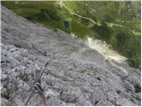 41
41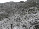 42
42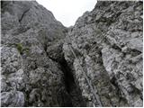 43
43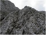 44
44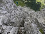 45
45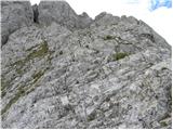 46
46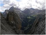 47
47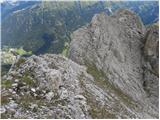 48
48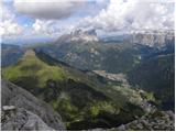 49
49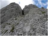 50
50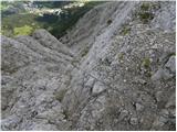 51
51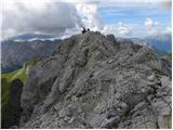 52
52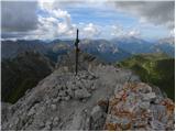 53
53