Starting point: Činžat (426 m)
Starting point Lat/Lon: 46.54164°N 15.43268°E 
Time of walking: 2 h 30 min
Difficulty: easy unmarked way
Difficulty of skiing: no data
Altitude difference: 804 m
Altitude difference (by path): 804 m
Map: Pohorje 1:50.000
Access to starting point:
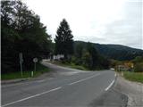
A) From the road Maribor - Dravograd, between HE Fala and HE Ožbalt we turn left towards Lovrenc na Pohorju (from the direction Dravograd we turn right). On the other side of Drava we start ascending along Radoljna, and at the marked crossroad, we go left towards Činžat and Ruše. Next follows some ascent, and on the saddle where we notice red hiking signposts there is the beginning of the described path. At the crossroad, there aren't any parking spots, so we park a little away on an appropriate place.
B) We drive into Ruše, and then we follow the road towards Lovrenc na Pohorju. In the settlement Činžat we get to the saddle where we notice red hiking signposts, where the described path begins. At the crossroad, there aren't any parking spots, so we park a little away on an appropriate place.
Path description:
From the starting point, we go on the road following the signs Činžat and Koča na Klopnem vrhu. At first, we walk on an asphalt road which leads us past few houses, and at the crossroads, we follow the blazes and signs for Koča na Klopnem vrhu. Above the settlement, the asphalt ends, and the road passes into the valley of the stream Lamprehtov potok, along which we continue the ascent. Further, the road for some time becomes asphalted and at 728 meters above the sea level turns sharply to the right. Next follows a diagonal ascent, so that we gradually go away from the stream. Higher follows few crossroads, and at all of them we continue left. Next follows some more of a moderate ascent towards the left and we get to the chapel of the Holy Cross, from which a view opens up a little on surroundings.
After the chapel, we on the upper side bypass homestead Lampreht, and then follows an easy ascent, which we overcome in a longer crossing of slopes of Lamprehtov vrh. When the crossing ends, we return to the stream Lamprehtov potok, which we cross over the bridge, and immediately after the bridge from the left joins the path from Ruše via Zgornji Smolnik.
We continue straight on a wider road towards Koča na Klopnem vrhu, and also at the next crossroad we go straight in the same direction (left - Areh and Šumik). Next follows some ascent by the stream and the path brings us to sawmill Fišerjeva žaga, where we go again on the other side of the stream.
Few 10 meters ahead from the stream, the marked path turns from the road sharply left, and we continue on the road. The road after the traffic sign with notification, that we continue on the forest road on our own responsibility, passes into the forest, and we leave it at the spot, where the first cart track branches off sharply to the left. We continue on the cart track, and at the nearby crossing we choose the bottom left cart track. Next follows some easy walking, and then we cross a shorter quite muddy part, where we cross a smaller torrent. Further follows few more crossings, and we stick to the right turn-offs. Higher, we cross a macadam road which we left before, after that from a smaller clearing, we continue right into the forest. The path ahead leads us on an older cart track which is lightly ascending through the forest. At the crossing, we choose a slightly left cart track, on which we ascend out of the forest through an overgrown clearing, where the footpath ends. From here follows few more strides to an indistinct peak.
Činžat - Sveti Križ 1:25, Sveti Križ - Lamprehtov vrh 1:05.
Description and pictures refer to a condition in September 2021.
Pictures:
 1
1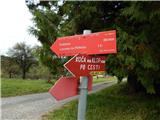 2
2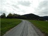 3
3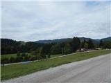 4
4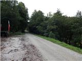 5
5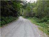 6
6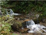 7
7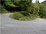 8
8 9
9 10
10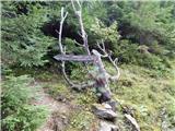 11
11 12
12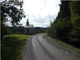 13
13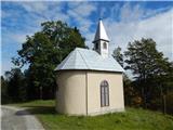 14
14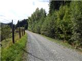 15
15 16
16 17
17 18
18 19
19 20
20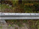 21
21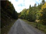 22
22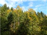 23
23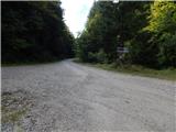 24
24 25
25 26
26 27
27 28
28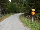 29
29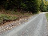 30
30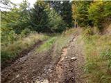 31
31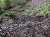 32
32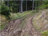 33
33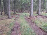 34
34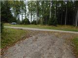 35
35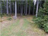 36
36 37
37 38
38 39
39 40
40 41
41 42
42