Črna na Koroškem (Mušenik) - Veliki vrh (above Mežiška dolina) (via Koča na Pikovem)
Starting point: Črna na Koroškem (Mušenik) (564 m)
Starting point Lat/Lon: 46.4779°N 14.8529°E 
Path name: via Koča na Pikovem
Time of walking: 2 h 25 min
Difficulty: easy unmarked way
Difficulty of skiing: no data
Altitude difference: 601 m
Altitude difference (by path): 655 m
Map: Koroška 1:50.000
Access to starting point:
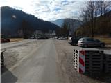
A) We drive to Mežica, and then we continue driving in the direction of Črna na Koroškem. At the beginning of Črna na Koroškem, a road branches off to the right, which leads towards the mountain hut Koča na Pikovem; here we continue straight and then approximately 20 meters ahead turn left onto a larger parking lot, where we park.
B) From Šoštanj over mountain pass Sleme (mountain pass near which there is the mountain hut Andrejev dom na Slemenu) we drive to Črna na Koroškem, where at the roundabout we take the exit in the direction of Mežica. At the end of the settlement (approximately 20 meters before the crossroad, where the road and footpath branch off to the left towards Koča na Pikovem) we turn right onto a larger parking lot, where we park.
C) From Solčava over mountain pass Spodnje Sleme we drive to Črna na Koroškem, where at the roundabout we take the exit in the direction of Mežica. At the end of the settlement (approximately 20 meters before the crossroad, where the road and footpath branch off to the left towards Koča na Pikovem) we turn right onto a larger parking lot, where we park.
Path description:
From the parking lot, we walk to the main road, where at the pedestrian crossing we carefully cross the main road, and then we continue right towards Mežica to the nearby crossroad, where we already notice signposts for mountain hut Koča na Pikovem, which point us to the left on a side road. The path ahead leads us on an asphalt road, where we go past a few houses, and at the smaller crossroad, we continue straight (right Igrčevo).
We walk a few more minutes on the asphalt road, and then the asphalt ends, and the main road turns left over a stream; at this spot, we continue straight on a side road, by which there are also signs for mountain hut Koča na Pikovem.
The path ahead on the right side bypasses homestead Kordež, and after the homestead, we start steeply ascending on the mountain path. Higher, the path reaches a macadam road which we follow to the right, and we walk there only a few dozen steps, because still before homestead Božiček we go left, where the mountain path continues. Here we at first ascend through a meadow, from which when we look back some views open up, and the path soon passes into the forest and occasionally ascends steeply. Higher, we step on a macadam road which we reach right at the crossroad, and we continue right on the upper road, by which there are signs for Pikovo (left leads the road towards the valley, and the lower right road leads to Šumahovo sedlo).
From the upper road, we soon go left and on a footpath in a few minutes we ascend to the church of St. Helena and mountain hut Koča na Pikovem.
From the mountain hut, we return to the church and continue on the path in the direction of Veliki vrh.
The path ahead leads us on a worse macadam road which at first runs through the forest and then across meadows, from which a beautiful view opens up. Behind homestead Pik the road changes into a cart track, and by the edge of the forest the path to Pikov vrh branches off to the right.
We continue in the direction of Pikov vrh and start ascending more steeply through the forest on an unmarked path. Higher from the left joins the path from Pikovo znamenje, and in a few minutes of additional walking we arrive at Pikov vrh, where there is a lookout tower.
We bypass the lookout tower on the right side, and then we at first descend a little along the ridge, and then the path continues with some shorter ascents and descents. When we already get quite close to Veliki vrh, the path to Pikovim jamam branches off to the right, and we continue left and diagonally ascend to the transmitters on Veliki vrh; the register box is located a few steps further to the right.
Starting point - Koča na Pikovem 1:15, Koča na Pikovem - Pikov vrh 0:30, Pikov vrh - Veliki vrh 0:40.
Description and pictures refer to the condition in May 2018 and February 2020.
On the way: Koča na Pikovem (992m), Pikov vrh (1149m)
Pictures:
 1
1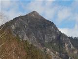 2
2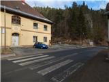 3
3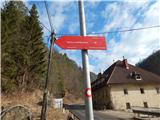 4
4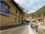 5
5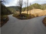 6
6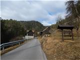 7
7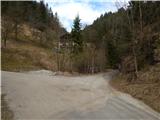 8
8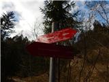 9
9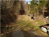 10
10 11
11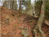 12
12 13
13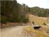 14
14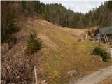 15
15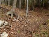 16
16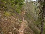 17
17 18
18 19
19 20
20 21
21 22
22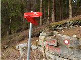 23
23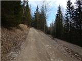 24
24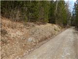 25
25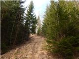 26
26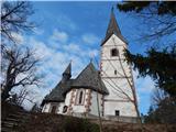 27
27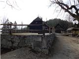 28
28 29
29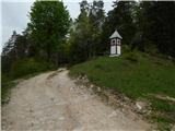 30
30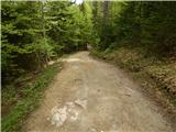 31
31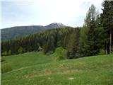 32
32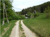 33
33 34
34 35
35 36
36 37
37 38
38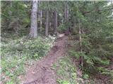 39
39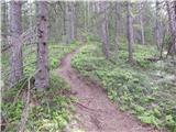 40
40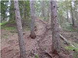 41
41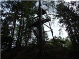 42
42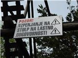 43
43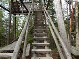 44
44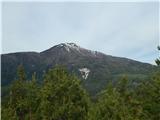 45
45 46
46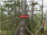 47
47 48
48 49
49 50
50 51
51 52
52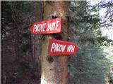 53
53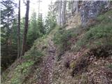 54
54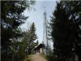 55
55 56
56 57
57