Crveni Vrh - Markovac (po IPP)
Starting point: Crveni Vrh (40 m)
Starting point Lat/Lon: 45.49194°N 13.53869°E 
Path name: po IPP
Time of walking: 2 h
Difficulty: partly demanding marked way
Difficulty of skiing: no data
Altitude difference: 122 m
Altitude difference (by path): 200 m
Map:
Access to starting point:
Leave the Primorska motorway at the Koper exit and continue towards Dragonja and Pula. Drive through Srgaše and Dragonja, then arrive in Croatia through the Dragonja border crossing. Follow the signs for the motorway and drive on it only to the first Umag exit. Then continue left towards Umag. Drive to the right turn-off for Crveni Vrh / Monte Rosso. When arriving in the village, notice the information board about the start of the Istrian Mountain Trail, where the described path begins. Park nearby.
Path description:
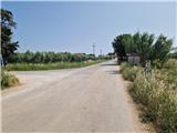
From the starting point, head past the board about the start of the Istrian Mountain Trail. The asphalt road gently descends through the village to a junction where markers and a signpost direct right onto a gravel road. The road ascends the slope of the nearby peak Glavica. Past vineyards and olive groves with increasingly beautiful views, arrive at a small woodland where a path branches right to the ruins of St. Peter's Church. Continue to an unmarked junction, go straight (right is possible but avoids the control point), and in a few minutes reach the 1st IPP control point on the right side of the road.
Continue along the road which gently descends and after a few minutes ascends again. The road enters the forest and soon reaches a wider road where the bypass road joins. Continue straight past pine forests, occasionally ascending and descending. After about 20 minutes of walking, diagonally cross the asphalt road to Kanegra camp. Continue along the Parenzana trail. The road barely noticeably descends through forest strips and crosses scenic slopes of the nearby peak Rujevec. On the left is a small observation tower from which the Sečovlje salt pans and Šavrinsko Hills are nicely visible. Continue along the road but stay alert as after about 10 minutes the Istrian Mountain Trail and E12 branch right. Signs are not immediately visible. Straight leads to the Sečovlje-Plovanija border crossing. Follow the path, initially well traceable and steeply ascending. Soon cross the edge to a larger meadow where E12 goes straight but the sign directs left to a barely visible path. Carefully follow it across the meadow. Reach a strip of low shrubbery and walk there for a while. The path mostly gently ascends; near the fence (also reached by the road from Plovanija-Umag main road), it leads left downhill. Soon ascend again over a short rocky section requiring caution—slippery when wet. Not technically demanding but hold small rocks. Then levels out; carefully follow markers. In summer watch for snakes and spiders. About 10 minutes from the rocky part, reach the 2nd IPP control point with stamping box for Markovac. Summit is 5 minutes more ascent. Top has antennas and fine views in several directions.
Description and photos refer to June 2025 status.
Pictures:
 1
1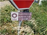 2
2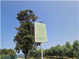 3
3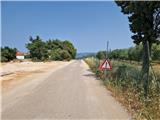 4
4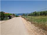 5
5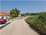 6
6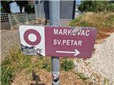 7
7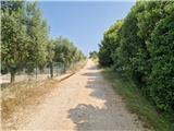 8
8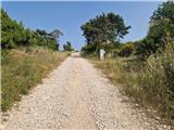 9
9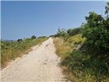 10
10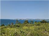 11
11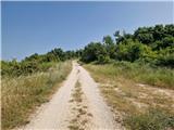 12
12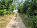 13
13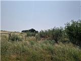 14
14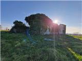 15
15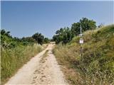 16
16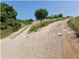 17
17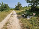 18
18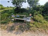 19
19 20
20 21
21 22
22 23
23 24
24 25
25 26
26 27
27 28
28 29
29 30
30 31
31 32
32 33
33 34
34 35
35 36
36 37
37 38
38 39
39 40
40 41
41 42
42 43
43 44
44 45
45 46
46 47
47 48
48 49
49 50
50 51
51 52
52 53
53 54
54 55
55 56
56 57
57 58
58 59
59 60
60 61
61 62
62 63
63 64
64 65
65 66
66 67
67 68
68 69
69 70
70 71
71 72
72 73
73 74
74 75
75 76
76 77
77 78
78 79
79 80
80