Cvetrež - Lašček (by road)
Starting point: Cvetrež (850 m)
Starting point Lat/Lon: 46.09°N 13.7565°E 
Path name: by road
Time of walking: 1 h 20 min
Difficulty: easy marked way
Difficulty of skiing: no data
Altitude difference: 221 m
Altitude difference (by path): 275 m
Map: Goriška 1:50.000
Access to starting point:
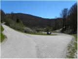
A) From Nova Gorica, we drive towards Tolmin or Most na Soči or vice versa and at the settlement Doblar we turn onto a local road in the direction of the settlement Avče. At the crossroads at the beginning of the settlement Avče we turn left and continue driving in the direction of Kal nad Kanalom. We follow the road, which then mostly ascends, at all crossroads in the direction of Kal nad Kanalom. When we arrive at the mentioned settlement, we continue left in the direction of the village Cvetrež. From Cvetrež we drive a little further along the road to the left bend, in the middle of which a macadam road branches off to the right. At the crossroads there are signposts for Lašček, and a few meters ahead also a suitable place where we can park. From the main road to the starting point there is approximately 13 km of driving.
B) From Zgornje Posočje, Baška grapa or the valley of the river Idrijca, we first drive to Most na Soči, and there at the gas station we turn onto a narrow road in the direction of Kanalski Lom. Further, we drive on a narrow and occasionally steep road, which at the crossroads is not well marked. We mostly stick to the "main" road, which higher first brings us to Tolminski Lom and higher also to Kanalski Lom. From Kanalski Lom we continue steeply ascending for some time, then the road gradually flattens. We follow the road towards Kal nad Kanalom for a few more kilometers, and then still before we arrive at the village Cvetrež, we arrive at the right bend, before which we turn left onto a macadam road. At the crossroads there are signposts for Lašček, and a few meters ahead also a suitable place where we can park. From Most na Soči to the starting point there is approximately 12 km of driving.
Path description:
The forest road alongside which we have parked immediately splits into two parts, and we choose the right one, which starts gently ascending. After approximately 10 minutes of walking we arrive at the next crossroads, where we continue left in the direction of "Bremci". From the crossroads onwards the road gradually starts descending and brings us to the place where a road branches off to the left towards the Vodičnik sinkhole (the Vodičnik sinkhole is 250 m deep and almost vertical), and we continue straight to the next crossroads, where we continue left in the direction towards Bremec. Further on the road starts ascending again, and we also follow the direction "Bremci" at the next crossroads. A somewhat longer descent follows, then the road ascends somewhat more steeply to the "former" Bremec homestead.
From Bremec onwards the forest thins out, so beautiful views start opening up on Matajur and Kanin, and higher also on Krn and other surrounding peaks. A little further we arrive at a larger meadow, where there is also a small saddle, and at this spot we leave the cart track and continue the path right across the meadow into the belt of shrubs.
The path across the meadow is poorly visible, but as soon as we step into the shrubs orientation is no problem. After a shorter gentle ascent we reach another cart track, follow it left and leave it after a few meters, as the blazes direct us right onto a somewhat steeper mountain path. Just a little further we arrive at a well-marked junction, where the path from Lokovec joins from the right (starting point Pri Cerkvi), the path descends to the left to the Vrh Ječmenc crossroads, and straight ahead the path continues to Lašček. From the junction onwards we mostly ascend moderately through low forest, and the path quickly brings us to the panoramic Lašček.
On the way: Bremec (950m)
Pictures:
 1
1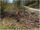 2
2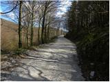 3
3 4
4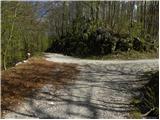 5
5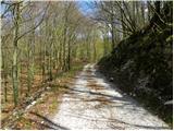 6
6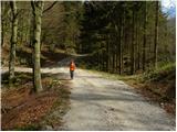 7
7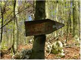 8
8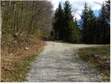 9
9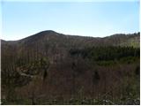 10
10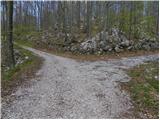 11
11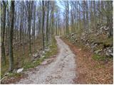 12
12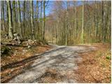 13
13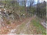 14
14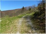 15
15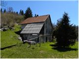 16
16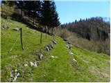 17
17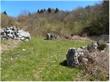 18
18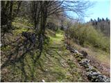 19
19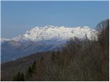 20
20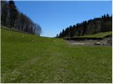 21
21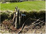 22
22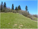 23
23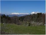 24
24 25
25 26
26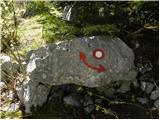 27
27 28
28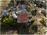 29
29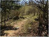 30
30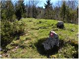 31
31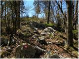 32
32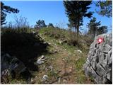 33
33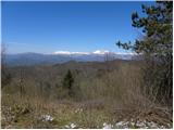 34
34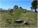 35
35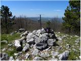 36
36 37
37