Dolina Krma - Koča na Doliču
Starting point: Dolina Krma (944 m)
| Latitude/Longitude: | 46,38510°N 13,90710°E |
| |
Walking time: 5 h 30 min
Difficulty: easy marked way
Elevation gain: 1207 m
Elevation difference along the route: 1525 m
Map: Triglav 1:25.000
Recommended equipment (summer): helmet
Recommended equipment (winter): helmet, ice axe, crampons
Views: 12.117
 | 1 person like this post |
Access to starting point:
a) Leave the Gorenjska motorway at the Hrušica exit and follow the road further in the direction of Kranjska Gora. Just before the village of Dovje, a road branches off to the left from the main road leading to Mojstrana (Vrata, Kot and Krma). Follow the road further in the direction of the village of Radovna and the valleys Krma and Kot. The relatively steep road then takes us past the TNP sign, after which the road soon flattens and brings us to a crossroads, where a macadam road branches off to the right into the Kot valley. Continue straight on the road that begins to descend. In the middle of the descent, a road branches off to the right into the Krma valley (straight Radovna). A little further on, we come to the next crossroads, where we continue to the right in the direction of Krma. The macadam road then takes us to the Kovinarska koča, and we follow it further. The occasionally somewhat worse road then takes us to the parking lot in front of the barrier.
b) Drive to Kranjska Gora, then continue driving in the direction of Jesenice. At Dovje, leave the main road and continue to the right in the direction of Mojstrana and the valleys Vrata, Kot and Krma, then at the following crossroads follow the signs for Krma. The relatively steep road then takes us past the TNP sign, after which the road soon flattens and brings us to a crossroads, where a macadam road branches off to the right into the Kot valley. Continue straight on the road that begins to descend. In the middle of the descent, a road branches off to the right into the Krma valley (straight Radovna). A little further on, we come to the next crossroads, where we continue to the right in the direction of Krma. The macadam road then takes us to the Kovinarska koča, and we follow it further. The occasionally somewhat worse road then takes us to the parking lot in front of the barrier.
Route description:
From the last parking lot in the Krma valley, called Pri lesi, we continue on a worse road that continues along the valley and soon brings us to a clearing, where we bypass the nearby object on the left side. We continue on a gravel path that approaches the torrent and crosses it a little further on. On the other side of the torrent, the path enters the forest and initially ascends moderately, then quite steeply for some time. Higher up, we pass from the forest into a belt of dwarf pines and bushes, and from the path beautiful views open up to the nearby walls of the peaks, which on the other side descend more gently towards Pokljuka.
Higher up, somewhere at an altitude of a little more than 1400 m, the path flattens transitionally and brings us to a beautiful grassy plain Vrtača.
After the grassy part, the path starts ascending again on a path that is often quite slippery in this part, which flattens on the plain Malo polje.
Here the path turns to the right and splits.
We continue left in the direction of Vodnikov dom na Velem polju (straight Planika and Kredarica) on the path that quickly starts ascending first through a larch forest, then up the scree. The path on the scree becomes increasingly steep and is dangerous for slipping in snow, which can linger here until mid-summer. Higher up, we ascend transversely to the left under the walls of Vernar and due to the narrowness of the last part of the path to Bohinjska vratca, there is also an increased danger of falling rocks. Under the vratca, the path turns slightly to the right and steeply ascends to Bohinjska vratca, from where a beautiful view opens up.
At Bohinjska vratca, an unmarked path to Vernar branches off to the right (higher up the path turns into very demanding pathlessness), but we start descending towards Vodnikov dom, which we reach after about 15 minutes of descent.
From the dom, we continue a few steps in the direction of Triglav, then the signpost for Koča na Doliču directs us to the left, where the path further leads us transversely downward across the scree above Velo polje. Later, we arrive in a sparse larch forest, where we cross a wide torrent bed, then join the path that leads across Velo polje.
We continue slightly to the right towards Dolič (left Velo polje), the path ahead still ascends moderately along the torrent for some time, then steeply ascends under the walls of Šmarjetna glava. The steepness then quickly eases, and the increasingly stony path under the walls and screes of the surrounding peaks brings us to the Dolič saddle, where there is a marked crossroads.
We continue straight (left Hribarice, right Dom Planika under Triglav) on the path that starts gradually descending and brings us to Koča na Doliču after less than ten minutes.
Krma - Malo Polje 2:05, Malo Polje - Bohinjska vratca 1:10, Bohinjska vratca - Vodnikov dom 0:15, Vodnikov dom - Velska dolina 0:40, Velska dolina - sedlo Dolič 1:15, sedlo Dolič - Koča na Doliču 0:05.

Along the route: Vrtača (1430m), Malo polje (1585m), Bohinjska vratca (1975m),
Vodnikov dom (1817m), Velska dolina (1738m), Sedlo Dolič (2165m)
Photos:
 1
1 2
2 3
3 4
4 5
5 6
6 7
7 8
8 9
9 10
10 11
11 12
12 13
13 14
14 15
15 16
16 17
17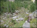 18
18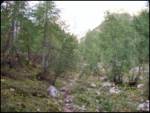 19
19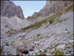 20
20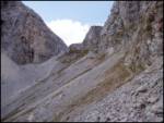 21
21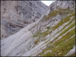 22
22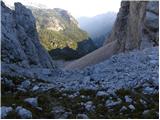 23
23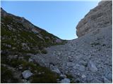 24
24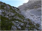 25
25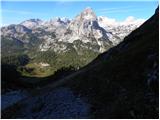 26
26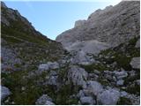 27
27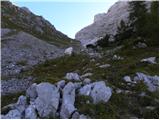 28
28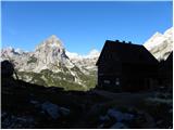 29
29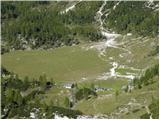 30
30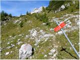 31
31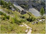 32
32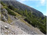 33
33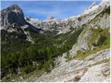 34
34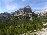 35
35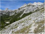 36
36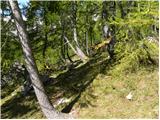 37
37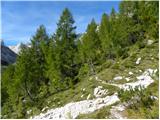 38
38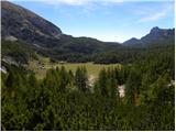 39
39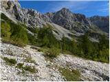 40
40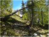 41
41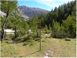 42
42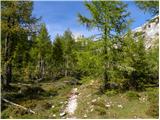 43
43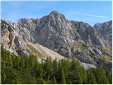 44
44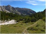 45
45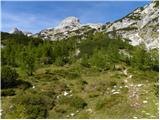 46
46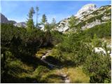 47
47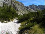 48
48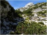 49
49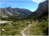 50
50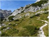 51
51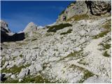 52
52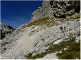 53
53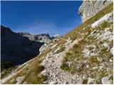 54
54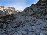 55
55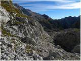 56
56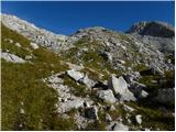 57
57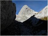 58
58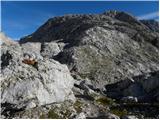 59
59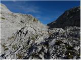 60
60 61
61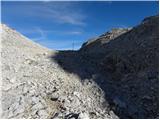 62
62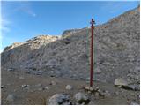 63
63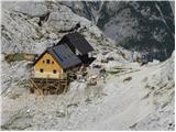 64
64
Discussion about the trip Dolina Krma - Koča na Doliču
To post a comment you must log in:
If you do not yet have a username, you must first
register.