Dolina Sopote (Zagrad) - Kum
Starting point: Dolina Sopote (Zagrad) (302 m)
Starting point Lat/Lon: 46.06989°N 15.10769°E 
Time of walking: 3 h 10 min
Difficulty: easy marked way
Difficulty of skiing: no data
Altitude difference: 918 m
Altitude difference (by path): 970 m
Map:
Access to starting point:
We drive to Radeče, then follow the road along the Sopota River upwards. Further on, we drive through Njivice, Jagnjenica to the settlement Zagrad, where the described path begins at the hiking signposts. At the starting point, there are no organized parking spaces.
Path description:
From the starting point, we head onto a side road with signs for Kum, Nebeška gora, and Čimerno, initially walking past individual houses. A little further, at a smaller crossroad, we turn slightly right, and then the road enters the forest, where we turn slightly right again. Further on, we ascend for quite some time along various poorer forest roads, following the blazes at crossroads or junctions. Higher up, the road forms a larger number of zig-zags, and from individual grassy areas, a beautiful view opens up of the surroundings and nearby hills. Eventually, the poorer road turns into a cart track that crosses onto steeper slopes, where we mostly ascend diagonally to the right. When the steepness eases, we leave the forest and reach the edge of a more plateau-like terrain, where the footpath disappears in a meadow. We continue through a small valley, reaching a small saddle in a few minutes, where a mountain signpost also stands. From here, a view opens up of the village Čimerno, which we reach via a cart track that leads us along a grazing fence. Upon reaching the settlement, we follow the blazes and signs for Kum and Nebeška gora at a few crossroads, quickly arriving at the church of the Holy Trinity, shortly after joining the path from Radeče.
We proceed along the asphalt road, which soon splits.
We continue on the asphalt road toward Kum (slightly left on a cart track to Nebeška gora) and gradually begin descending diagonally along the slopes of Nebeška gora, with Škratova dolina increasingly closer below us to the right. Further on, a short ascent follows, and at the homestead pr Kovačk, a path through Škratova dolina joins from the right.
We continue on the road, from which another path to Nebeška gora soon branches off to the left. When after a further shorter ascent we reach the crossroad of roads, we continue sharply right (straight - the old path which leads below the projecting roof of the nearby homestead) in the direction of Kum. From the crossroad, we walk a few more minutes on the road, and then signs for Kum point us to the left on a footpath, on which we continue the ascent. A few crossings follow, where we follow the blazes, and then we step on a macadam road which we follow to the left. After a short ascent on the road we arrive at some sort of flat area, where we continue left in the direction of Kum (right - Mežnarija and the church of St. Mary on Ključavica).
The path ahead leads us past the chapel, and then only a little behind it we continue right on a worse road, and from there a few steps further left on a cart track. With a view on the hill Ključavica we ascend on a grassy slope, and then the path flattens and crosses a lane of bushes. On the other side of the bushes we descend near the nearby house, which we bypass on the right side, and then we continue on a worse road which leads us left from the other house. Behind the house, the road widens, and then we quickly get to the forest, where there is a marked crossing.
We continue straight (left - Mali Kum and Podkum) in the direction of Kum, on the path which first ascends gently, and then steeper. Higher the forest ends and the path brings us right below the peak of Kum, where we join the road which leads to the mountain hut. On the road in a few steps we get to the mountain hut, and a few meters ahead also to the church of St. Neža on the top of Kum.
Zagrad - Čimerno 1:40, Čimerno - Kum 1:30.
Description and pictures refer to the condition in March 2016 and June 2024.
Pictures:
 1
1 2
2 3
3 4
4 5
5 6
6 7
7 8
8 9
9 10
10 11
11 12
12 13
13 14
14 15
15 16
16 17
17 18
18 19
19 20
20 21
21 22
22 23
23 24
24 25
25 26
26 27
27 28
28 29
29 30
30 31
31 32
32 33
33 34
34 35
35 36
36 37
37 38
38 39
39 40
40 41
41 42
42 43
43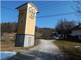 44
44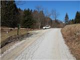 45
45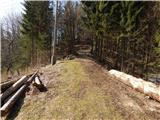 46
46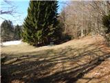 47
47 48
48 49
49 50
50 51
51 52
52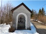 53
53 54
54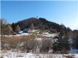 55
55 56
56 57
57 58
58 59
59 60
60 61
61 62
62 63
63 64
64 65
65 66
66 67
67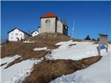 68
68 69
69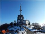 70
70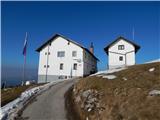 71
71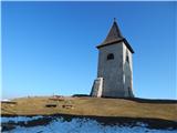 72
72 73
73