Dom na Smrekovcu - Smrekovec
Starting point: Dom na Smrekovcu (1375 m)
| Latitude/Longitude: | 46,41310°N 14,89970°E |
| |
Walking time: 30 min
Difficulty: easy marked way
Elevation gain: 202 m
Elevation difference along the route: 202 m
Map: Kamniške in Savinjske Alpe 1:50.000
Recommended equipment (summer):
Recommended equipment (winter):
Views: 46.614
 | 3 people like this post |
Access to starting point:
From the Ljubljana–Maribor motorway, take the Šentrupert exit and follow the road ahead towards Logarska dolina. In the village Ljubno ob Savinji, the signpost for Smrekovec directs us right. The road then takes us through the centre of the village, where we turn left again following the signs for Smrekovec. The road then brings us to Ljubenske Rastke, where we continue right. We follow the road, which is initially still asphalted, in the direction of Smrekovec (Dom na Smrekovcu) and drive along it to the parking lot near the mountain hut.
Route description:
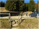
From Dom na Smrekovcu, we continue left in the direction of Komna and Smrekovec. The path ahead first moderately ascends over a panoramic grassy slope, then turns slightly to the left, bringing us into a belt of forest. When the forest thins out, we turn slightly right and the path brings us to a marked junction, where we continue right in the direction of Smrekovec (left Komen and Raduha). Further on, we ascend for a short time through increasingly sparse forest, then arrive at expansive grassy slopes, over which we ascend to the nearby Smrekovec amid ever more beautiful views, reaching it after approximately 10 to 15 minutes of further walking.
Photos:
 1
1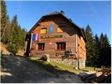 2
2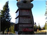 3
3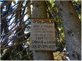 4
4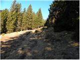 5
5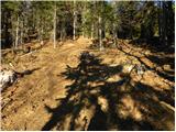 6
6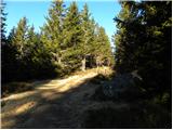 7
7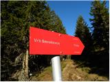 8
8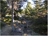 9
9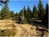 10
10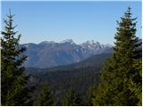 11
11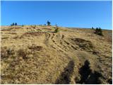 12
12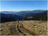 13
13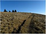 14
14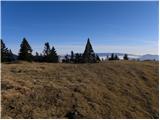 15
15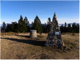 16
16 17
17
Discussion about the trip Dom na Smrekovcu - Smrekovec
|
| Gost15. 06. 2007 |
And who knows what the pyramid on the top is for?
|
|
|
|
| Gost15. 06. 2007 |
The pyramid is probably there so that the summit logbook stands on it, because they can't put it on the grass, as that would damage the grass! That's just my opinion.
|
|
|
|
| Gost13. 11. 2007 |
On 10 November my husband and I did the trail from the hut to the top of Smrekovec, extended it to Krnes and then also to Komen. Although it was quite windy and there was quite a lot of snow in certain places, the hike was unforgettable, especially the view of Ojstrica, Raduha, Peca, ...
I recommend it!
|
|
|
|
| storžek2. 01. 2010 |
Last day of the year, on Smrekovec the sun occasionally appeared too. First time up and not the last, nice trip.
|
|
|
|
| zile6720. 03. 2013 |
16.3.2013 Saturday nice sunny day, car had to be parked at the Smrekovec sign, about 1.5 km to Dom na Smrekovcu, track was made but still sinking in spite of that. About 50 min needed to the hut. Winter idyll, nice trip.
|
|
|
To post a comment you must log in:
If you do not yet have a username, you must first
register.