Dom pod Okićem - Okić (Dragojlina plezalna pot)
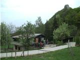
Starting point: Dom pod Okićem (411 m)
Path name: Dragojlina plezalna pot
Time of walking: 35 min
Difficulty: difficult marked way
Difficulty of skiing: no data
Altitude difference: 88 m
Altitude difference (by path): 120 m
Map:
Access to starting point:
a) Via the MP Brežice / Bregana border crossing we drive to Croatia, exiting the motorway at the Samobor exit. Upon arriving in the mentioned town we head south towards Zagreb. At the petrol station at the southern exit from the town we turn right and continue driving towards the villages of Mirnovec and Kladje. When the road takes us to the pass with serpentines we turn right into the village of Konščica and then drive westwards towards the village of Terihaji. Further along we will notice signs for Dom pod Okićem by the road, directing us left (Starogradska ulica).
b) From Prekmurje and the Maribor area we first drive to the MP Gruškovje / Macelj border crossing and continue on the motorway to the Jankomir junction, where we turn left towards Ljubljana and Samobor. We exit the motorway at the Samobor exit, then continue driving as per the above description.
As the parking lot by the hut is too small for all visitors and also quite difficult to reach orientation-wise, I recommend arriving at the hut along the footpath from Novo Selo Okićko.
Path description:
From the junction east of the Maks Plotnik hut we go straight ahead (left easy path, right Novo selo Okićko and Martin Podgrađe). The path initially goes across an undulating meadow. When the path enters the forest the ground becomes more rocky. We reach a junction where left is the Žoharjeva climbing path, we go right or straight. Our path now starts to descend, quite demanding in some places. When we reach the lowest point of our path there is a vertical wall above us with some free-climbing routes, we go slightly right to the start of the climbing section. At the beginning there is a crossing to the right secured by a wire rope. After crossing we start ascending very steeply along the southeast rocky slope of Okić. At some points pitons assist us. The path goes steeply upwards. When we reach the very exposed section the steepness ends. Here is the viewpoint "Kak taubeka dva" where we can rest. After the viewpoint there is another short secured section and then the protections end.
After the secured section there are a few technically demanding jumps and one short exposed section. From here a nice view opens up. From the left the Žoharjeva path joins us. A bit more steep easy terrain over rocky ground and we enter the forest. Here the Dragojlina path ends and we join the easy path, going right, and after a minute we are at the top of Okić. The summit is located in the ruins of an old castle, increasingly overgrown by forest.
The path is named after the Illyrian Dragojla Jarnević, who was the first to climb it. This is considered the first climbing project in Croatia.
Pictures:
 1
1 2
2 3
3 4
4 5
5 6
6 7
7 8
8 9
9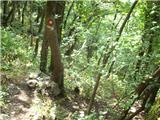 10
10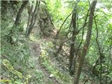 11
11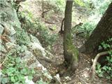 12
12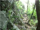 13
13 14
14 15
15 16
16 17
17 18
18 19
19 20
20 21
21 22
22 23
23 24
24 25
25 26
26 27
27 28
28 29
29 30
30 31
31 32
32