Dom Trilobit - Hochstuhl/Stol
Starting point: Dom Trilobit (939 m)
Starting point Lat/Lon: 46.4579°N 14.1031°E 
Time of walking: 4 h 30 min
Difficulty: easy marked way
Difficulty of skiing: partly demanding
Altitude difference: 1297 m
Altitude difference (by path): 1400 m
Map: Karavanke - osrednji del 1:50.000
Access to starting point:
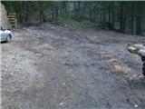
From highway Ljubljana - Jesenice we go to the exit Lipce, and in the direction to the right we drive towards Jesenice. In the settlement Javornik at the first traffic light crossroad we drive right (direction Lj.) towards Koroška Bela. At the next crossroad with a traffic lights we turn left, and soon once again left towards Javorniški Rovt. After few kilometers of driving uphill (when we already got to in the mentioned village), in sharp the left turn macadam road towards the mountain hut Dom Trilobit branches off straight (a sign). Over few 100 meters we get to the lake, by which runs the road, on the left we notice a mountain hut Dom Trolobit. When we drive past this structure, the road in the forest ends, and here is our starting point.
Path description:
On the left side from the starting point uphill leads a little wrecked cart track, on which we go and at the same time we run into the first a blaze. Over few minutes we notice a turn off where the cart track branches off to the right towards the mountain pasture Stamare, and we continue straight all the way to the spot, where the path gets close to a riverbed of the stream. Here is a cart track turn-off to the left and at the upper source of the stream Javornik ends or passes into a forest path. Which starts steeper, at first straight, then winding ascending through the forest. On the left we will be able to notice monument with a fence, and after only 45 minutes of walking get to the second monument (to hunter) by the path, where on the right is located entirely destroyed bench. Steepness a little decreases and the path goes left towards the north, where for some time runs through mixed forest. Here, on the right, at first we can observe scree of Srednica, later gradually a view opens up eastern towards amphitheater Rida. That one we can fully observe after the forest passes into a lane of dwarf pines. Few more turns and we are already near the mountain pasture Seča, where on a tree we run into signposts. We go right in the direction of Vajnež and Stol. The path at first moderately ascends, after that soon quite steep descends towards the scree of amphitheater, where to the right-circular direction runs for some time almost flat. Before the path brings us from Rida, for a short time, we ascend, on the top it turns left towards SE. By moderate ascending among dwarf pines, the path now brings us on a grassy slope of Belščica, where at first we are ascending a little and then the path almost flattens. Next follows approximately half an hour walk with a nice view towards Ljubljana basin, all the way to the turn-off for Vajnež, which is rising the last on the left.
At the sign with a caption Vajnež we continue straight, and we follow the blazes and outlined directions on rocks. Those lead us a little right, past saddle Vajneževo sedlo on the left, towards Potoški Stol, on which we ascend after few minutes of walking. Near the highest point of Potoški Stol path goes right (straight goes towards sign - cross), towards the south edge, where it is turn off left towards slightly exposed ridge, which separates Potoški and Veliki Stol. When we are on the ridge, we can at the same time observe landscapes on Austrian and Slovenian side, but at the same time we walk carefully. Over some time we pass on a slope of Veliki Stol, where the path is moderately ascending. When we run into a steep left turn off, we continue straight or right, over rough scree, where in a small valley between Mali and Veliki Stol we soon join left branches of the path which are coming from the direction of Valvazor. Here we turn left towards the saddle between the both peaks of Stol, where we once again go left and after 10 minutes of additional walking, we reach the peak.
Pictures:
 1
1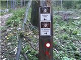 2
2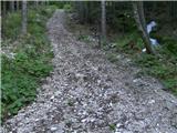 3
3 4
4 5
5 6
6 7
7 8
8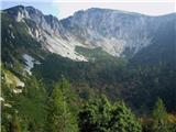 9
9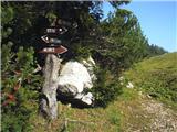 10
10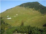 11
11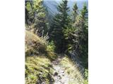 12
12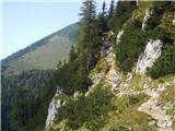 13
13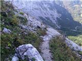 14
14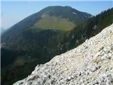 15
15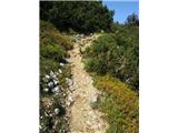 16
16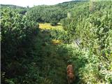 17
17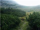 18
18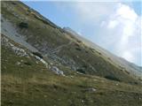 19
19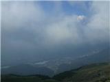 20
20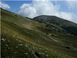 21
21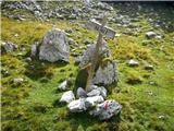 22
22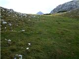 23
23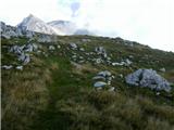 24
24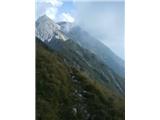 25
25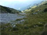 26
26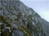 27
27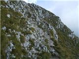 28
28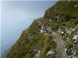 29
29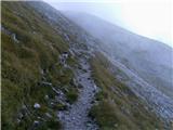 30
30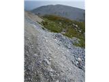 31
31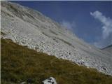 32
32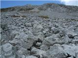 33
33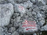 34
34 35
35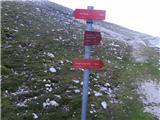 36
36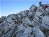 37
37