Dom Trilobit - Kamnitnik (Za Kraševcem)
Starting point: Dom Trilobit (939 m)
Starting point Lat/Lon: 46.4579°N 14.1031°E 
Path name: Za Kraševcem
Time of walking: 2 h 45 min
Difficulty: easy unmarked way, easy pathless terrain
Difficulty of skiing: no data
Altitude difference: 919 m
Altitude difference (by path): 919 m
Map: Karavanke - osrednji del 1:50.000
Access to starting point:
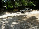
From highway Ljubljana - Jesenice we go to the exit Lipce and follow the road ahead in the direction of Jesenice. When we come to the traffic light crossroad, where we join an old road, we continue right in the direction of Žirovnica. And we follow this road only a short time because at the next little larger crossroad (traffic light) we continue left in the direction of Javorniški Rovt. The road then goes through the underpass (railway) and then turns left (right Koroška Bela). The road that higher starts ascending steeply we follow in the direction of Javorniški Rovt, but only to a crossroad, where in sharp the left turn, the road branches off to the right (straight) towards the mountain hut Dom Trilobit and source of Javornik (prohibited for buses). A little further, the road brings us to the mentioned mountain hut and artificial lake at hydropower plant Javornik. We park on the unmarked parking lot, which is situated behind the lake and mountain hut Dom Trilobit (parking in front of the mountain hut isn't allowed).
Path description:
From the parking lot, we go on a cart track in the direction of natural and mining learning trail. Cart track immediately starts relatively steeply ascending on the left side of the stream, which we hear in our vicinity. The path soon brings us to a wooden pole, on which signpost for mountain pasture Stamare points us right (straight mountain pasture Seča). We continue right and the cart track in few minutes brings us to interesting source of the stream Javornik.
We continue the ascent on a cart track which has few smaller crossings, but if we follow the signs of mining learning trail we won't have any bigger problems with orientation. Cart track then changes into a poorly visible footpath which only a little higher joins a wide cart track which we follow left upwards.
Often a quite muddy cart track, we then follow past a bigger rock (boulder), behind which we need to pay attention. Approximately 3 minutes of walking from the mentioned rock, cart track turns right, and right on that turn we leave it and we continue the ascent straight on a barely visible footpath which at first ascends through a quite thin forest. A poorly visible footpath then brings us into a dense forest, where it starts ascending steeply by small torrents (orientation on this part is quite demanding). Higher, the path becomes easier to follow and after few minutes of additional walking brings us to a grazing fence. Ahead we "cross" the fence and in few additional strides, we step on the mountain pasture Stamare (shepherd hut is situated on the eastern part of the mountain pasture).
We continue on the left side of the mountain pasture and the path after few steps of ascent brings us into the forest, where from the right side joins a little worse path, which comes from eastern part of the mountain pasture. We continue straight on a relatively steep path, which higher passes out of the forest on slopes covered with dwarf pines and it turns a little towards the left. Next follows light diagonal ascent and the path brings us to the mountain pasture Hrašenska planina, where we notice a shepherd hut.
Here before we cross a grazing fence we turn right and we ascend on at first still easy to follow path. After a short ascent through dwarf pines path passes on a slightly vegetated grassy slopes, where it starts vanishing. A little further, we come on unmarked and barely noticeable crossing, where "path" splits into two parts.
We continue on the left upper path (slightly right shepherd hut on Belska planina and bivouac on Belščica), by which we notice unofficial blazes (red dots). We further follow the mentioned dots, which lead us on the slope diagonally upwards. Higher, on the left side we notice an indistinct peak of Kamnitnik, to which we ascend on easier pathless terrain (peak is situated only few 10 meters away from the marked path which leads from Golica towards Stol).
Dom Trilobit - mountain pasture Stamare 1:15, mountain pasture Stamare - Hrašenska planina 45 minutes, Hrašenska planina - Kamnitnik 45 minutes.
Pictures:
 1
1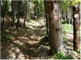 2
2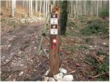 3
3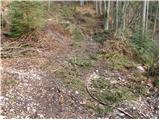 4
4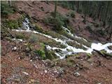 5
5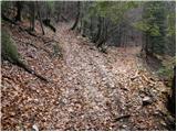 6
6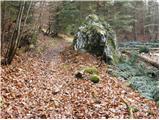 7
7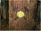 8
8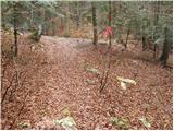 9
9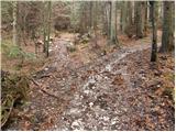 10
10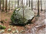 11
11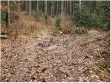 12
12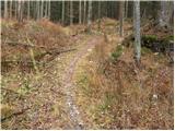 13
13 14
14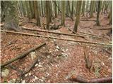 15
15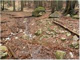 16
16 17
17 18
18 19
19 20
20 21
21 22
22 23
23 24
24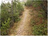 25
25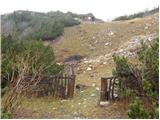 26
26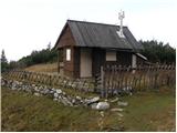 27
27 28
28 29
29 30
30 31
31 32
32 33
33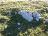 34
34 35
35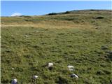 36
36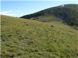 37
37 38
38 39
39 40
40 41
41