Dom Trilobit - Planina Seča
Starting point: Dom Trilobit (939 m)
Starting point Lat/Lon: 46.4579°N 14.1031°E 
Time of walking: 2 h
Difficulty: easy marked way
Difficulty of skiing: partly demanding
Altitude difference: 759 m
Altitude difference (by path): 741 m
Map: Karavanke - osrednji del 1:50.000
Access to starting point:
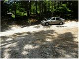
From highway Ljubljana - Jesenice we go to the exit Lipce and follow the road ahead in the direction of Jesenice. When we come to the traffic light crossroad, where we join an old road, we continue right in the direction of Žirovnica. And we follow this road only a short time because at the next little larger crossroad (traffic light) we continue left in the direction of Javorniški Rovt. The road then goes through the underpass (railway) and then turns left (right Koroška Bela). The road that higher starts ascending steeply we follow in the direction of Javorniški Rovt, but only to a crossroad, where in sharp the left turn, the road branches off to the right (straight) towards the mountain hut Dom Trilobit and source of Javornik (prohibited for buses). A little further, the road brings us to the mentioned mountain hut and artificial lake at hydropower plant Javornik. We park on the unmarked parking lot, which is situated behind the lake and mountain hut Dom Trilobit (parking in front of the mountain hut isn't allowed).
Path description:
From the parking lot, we go on a cart track in the direction of natural and mining learning trail. Cart track immediately starts relatively steeply ascending on the left side of the stream, which we hear in our vicinity. The path soon brings us to a wooden pole on which signpost for mountain pasture Seča point us on a slightly left path (right source of Javornik and mountain pasture Stamare). The cart track then brings us near the stream by which it is ascending to the source (one of sources of the stream Javornik). After the source cart track turns into a footpath which is occasionally relatively steeply ascending, on mostly quite overgrown forest. The path then gets closer to a wall and before it, it turns left. Next follows even less steep ascent to a bench, which isn't in the best condition. The path ahead is ascending through a thinner forest so that occasionally nice views open up on surroundings. A little further, we will on the right side notice some kind of amphitheater with a name Rida (right leads unmarked and quite an overgrown path towards Belščica). And our path turns left and after a short not steep ascent we get to the signposts at the beginning of the mountain pasture Seča. We go left towards Golica and in few minutes we come to the shepherd hut on the mountain pasture Seča.
Pictures:
 1
1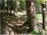 2
2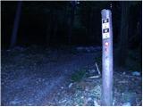 3
3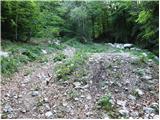 4
4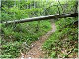 5
5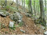 6
6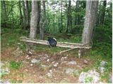 7
7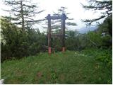 8
8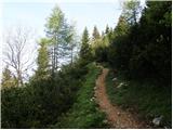 9
9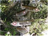 10
10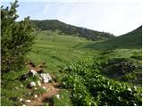 11
11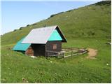 12
12