Dom Trilobit - Weinasch/Vajnež (via Skalaška pot)
Starting point: Dom Trilobit (939 m)
Starting point Lat/Lon: 46.4579°N 14.1031°E 
Path name: via Skalaška pot
Time of walking: 4 h
Difficulty: very difficult unmarked way
Difficulty of skiing: very demanding
Altitude difference: 1165 m
Altitude difference (by path): 1165 m
Map: Karavanke - osrednji del 1:50.000
Access to starting point:
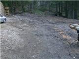
From highway Ljubljana - Jesenice we go to the exit Lipce, and in the direction to the right we drive towards Jesenice. In the settlement Javornik at the first traffic light crossroad we drive right (direction Lj.) towards Koroška Bela. At the next crossroad with a traffic lights we turn left, and soon once again left towards Javorniški Rovt. After few kilometers of driving uphill (when we already got to in the mentioned village), in sharp the left turn macadam road towards the mountain hut Dom Trilobit branches off straight (a sign). After few 100 meters we get to the lake, by which runs the road, and on the left we notice a mountain hut Dom Trilobit. When we drive past this structure, the road in the forest ends, and here is our starting point.
Path description:
On the left side from the starting point uphill leads a little wrecked cart track, on which we go and at the same time we run into the first a blaze. Over few minutes we notice a turn off where the cart track branches off to the right towards the mountain pasture Stamare, and we continue straight all the way to the spot, where the path gets close to a riverbed of the stream. Here the cart track is turning to the left and at the upper source of the stream Javornik ends or passes into a forest path. Which starts steeper, at first straight, then winding ascending through the forest. On the left we will be able to notice a monument with a fence, and after only 45 minutes of walking, we get to the second monument (to hunter) by the path, where on the right there is entirely wrecked bench. Steepness a little decreases and the path goes left towards the north, where for some time runs through mixed forest. Here, on the right, at first we can observe scree of Srednica, later gradually a view opens up eastern towards amphitheater Rida. We can fully observe it after the forest passes into a lane of dwarf pines. Few more turns and we are already near the mountain pasture Seča, where on a tree we run into signposts.
We continue only a little right on less distinct valley towards the border ridge on the north. When we reach it (border stone), we go right, where we continue uphill among dwarf pines on the border ridge, where the path occasionally runs on the right edge. When we get to a quite narrow part of the ridge, starts more demanding part of the path, after which follows at first steep rocky descent by unpleasant aluminum wire rope. After this we find ourselves on even narrower part of the ridge, where the path (at first right) runs among and by dwarf pines. Soon again follows a shorter descent on a very crumbly rocky terrain, and the path after this gradually turns on the left side of the ridge, where it soon by aluminum rope steeply ascends back to its peak. Exposure and problems don't decrease, and we find ourselves in front of third barrier: almost vertical chimney, equipped with equal rope and steel stemples. When we reach its peak, the path runs by the right side of the ridge, where it ascends a little and after this steeper descends, and soon by similar rope it also very steeply ascends in the direction of east (caution, wet terrain!). Towards the top of ascent the path is turning right, where later we find ourselves among dwarf pines at the end of the path Skalaška pot.
We continue on the top of the border ridge in the direction of Mali vrh, where the path with beautiful views brings us to its peak. From here we continue in the same direction, where we still walk on a ridge path by northern precipices of Belščica, which after some time eventually brings us near the notch west before the Vajnež, on which we ascend in few steps of additional walking.
Pictures:
 1
1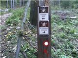 2
2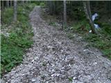 3
3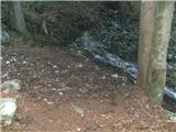 4
4 5
5 6
6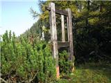 7
7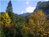 8
8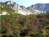 9
9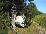 10
10 11
11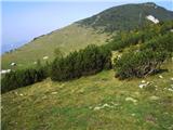 12
12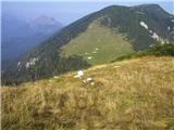 13
13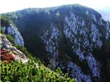 14
14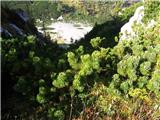 15
15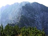 16
16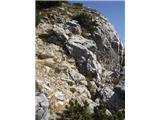 17
17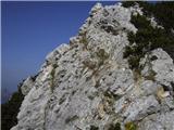 18
18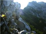 19
19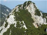 20
20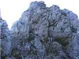 21
21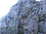 22
22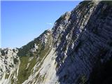 23
23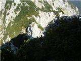 24
24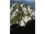 25
25 26
26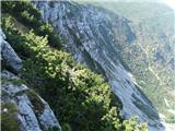 27
27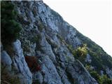 28
28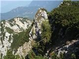 29
29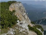 30
30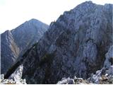 31
31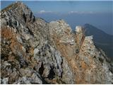 32
32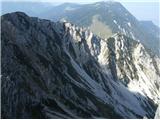 33
33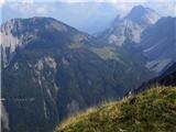 34
34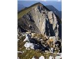 35
35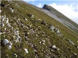 36
36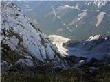 37
37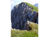 38
38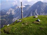 39
39