Dovje - Rovt Vrse (by road)
Starting point: Dovje (755 m)
| Latitude/Longitude: | 46,46820°N 13,95700°E |
| |
Route name: by road
Walking time: 1 h 30 min
Difficulty: easy unmarked way
Elevation gain: 445 m
Elevation difference along the route: 450 m
Map: Kranjska Gora 1:30.000
Recommended equipment (summer):
Recommended equipment (winter): crampons
Views: 1.996
 | 2 people like this post |
Access to starting point:
A) We leave the Gorenjska highway at the Jesenice - west (Hrušica) exit, and then continue driving towards Kranjska Gora. We will soon arrive at a junction, where signs for Dovje direct us right onto the road, along which we arrive in the village Dovje, where the road from the monument to Jakob Aljaž and the nearby parish church also joins from the left. At the mentioned junction, we continue right and drive past a few more houses. Above the village, the road becomes macadam and brings us to a junction, where the road towards Kepa continues left, and towards Dovška Baba right. We park at an appropriate place at the junction, or also lower or higher along the road. An arranged parking lot is located at the monument to Jakob Aljaž in Dovje or at the church in Dovje. If we park at the monument or church, the path is extended by 10 to 15 minutes.
B) First, we drive to Kranjska Gora, then continue driving towards Jesenice. Behind the settlement Belca, we arrive at the hamlet Na Belah (part of Dovje), where we leave the main road and continue driving towards the nearby church. From the church, we continue driving through the village and follow the signs for Dovška Baba. Above the village, the road becomes macadam and brings us to a junction, where the road towards Kepa continues left, and towards Dovška Baba right. We park at an appropriate place at the junction, or also lower or higher along the road. An arranged parking lot is located at the monument to Jakob Aljaž in Dovje or at the church in Dovje. If we park at the monument or church, the path is extended by 10 to 15 minutes.
Route description:
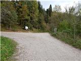
From the junction we continue on the left road in the direction of Kepa (right Dovška Baba), which continues moderately ascending. After a few minutes a walking path from Dovje also joins from the left, we continue slightly to the right and further ascend on a panoramic road, from which a nice view opens to Mojstrana and the peaks of the Julian Alps. We continue further on the road, which mainly enters the forest, through which it ascends in a few hairpin turns. Higher, a marked footpath branches off from the road, which crosses the road a few times, we walk on the road to a somewhat larger junction, beside which there is a small parking lot and signs for Dovška Baba and Kepa.
At the mentioned junction we continue left (right Erjavčev rovt, Kepa and Dovška Baba) on an unmarked road, which steeply ascends towards the left. After crossing a large torrent bed the path flattens completely, then continues without major changes in elevation. After approximately 15 to 20 minutes from the last junction we arrive at the place where the path to Borovje - path along the ridge branches off to the right (the branch-off is marked with a cairn), we continue further on the road, which occasionally also leads us across panoramic slopes. Somewhat further the road turns right, from the left an unmarked path from the farm Sedučnik also joins us. About 100 meters further from the mentioned bend a wide cart track branches off to the right, which leads towards Rovt Vrse.
We continue on the mentioned cart track, along which we quickly arrive at the cottages on Rovt Vrse.

The trip can be extended to the following destinations: Borovje,
Planica
Photos:
 1
1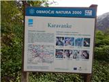 2
2 3
3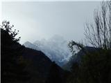 4
4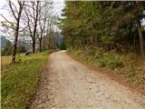 5
5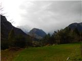 6
6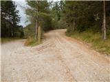 7
7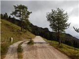 8
8 9
9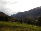 10
10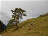 11
11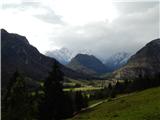 12
12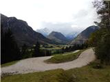 13
13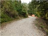 14
14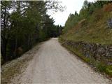 15
15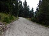 16
16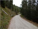 17
17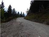 18
18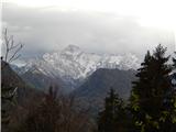 19
19 20
20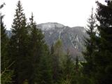 21
21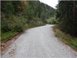 22
22 23
23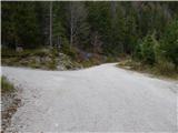 24
24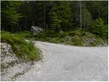 25
25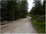 26
26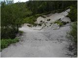 27
27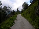 28
28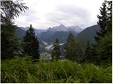 29
29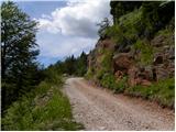 30
30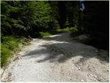 31
31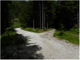 32
32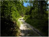 33
33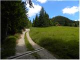 34
34 35
35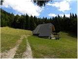 36
36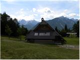 37
37
Discussion about the trip Dovje - Rovt Vrse (by road)
|
| tango8. 03. 2026 19:07:43 |
Nice spring excursion and since the road goes all the way through the southern slope the temperatures were really pleasant. From picture 32 onwards quite some snow, also on the alpine pasture, and since we weren't best equipped we abandoned the thought of Planica and Borovje. We returned via the path towards Sedučnik, which is steeply in places, but all nicely dry and thus we completed a loop of a bit more than 10 km. Recommended.
|
|
|
To post a comment you must log in:
If you do not yet have a username, you must first
register.