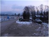
Starting point: Dovže (522 m)
Starting point Lat/Lon: 46.4526°N 15.1545°E 
Time of walking: 3 h 15 min
Difficulty: easy marked way
Difficulty of skiing: no data
Altitude difference: 1020 m
Altitude difference (by path): 1025 m
Map: Pohorje 1:50.000
Access to starting point:
A) From the Ljubljana - Maribor highway, take the Žalec exit, then continue driving towards Velenje. At the main roundabout in Velenje, continue right (direction Dravograd and Slovenj Gradec), then follow the main road to Mislinja and a little further to the spot where the road to the village Dovže branches off to the right. Park at a suitable spot at the crossroads.
B) From Koroška, first drive to Slovenj Gradec, then continue driving towards Velenje. A little after Turiška vas, we will come to a crossroads where the road to the village Dovže branches off to the left. Here, continue left and then after a few meters park at a suitable spot at the crossroads.
Path description:
At the starting point, we notice signs for Grmovškov dom, which direct us onto an asphalt road, along which we walk in a few minutes to Spodnje and then also to Zgornje Dovže. From the church of St. Ulrich in Dovže, we continue approximately 100 m along the main road, then the blazes direct us left onto a side road along which we continue almost to the fire station. Before the fire station, we continue right and then immediately after the small bridge left onto a cart track (direction Pungart), which gently ascends along the stream. After a few meters, we leave the cart track, as the signs for Grmovškov dom direct us right into the forest, through which we steeply ascend to the nearby macadam road, which we follow to the right. Along the road we walk only a short time, as soon after the left bend the blazes lead us back into the forest, through which we then moderately ascend. The path ahead passes from the forest onto the slopes of a panoramic grassy hillside, along which we quickly ascend to the nearby farm.
Above the farm, or behind the neatly arranged chapel, we step onto the road, which we follow to the right in a gentle ascent. The path ahead continues along the road for quite some time, which higher brings us to the next farm (Pušel farm).
From the farm, we continue along the road to the first left bend, where the blazes lead us left into the forest, through which we moderately ascend along an old tractor track. Soon we step back onto the road, reaching it right at a smaller crossroads. We continue along the ascending road, which bypasses the local landmark (cross) on the left side, but we quickly leave it as the blazes direct us slightly right onto an old cart track. The path quickly returns to the road, but we soon leave it too. Further, we follow the blazes, which lead us along an old cart track that moderately ascends along the forest-covered ridge of Razborca. Higher, the path brings us out of the forest onto a panoramic grassy ridge, along which we quickly walk to the nearby NOB monument.
Behind the monument, the path gently descends and brings us to the nearby forest road, along which we walk only a short time, as the blazes then direct us slightly right onto an ascending cart track, which further moderately ascends along the forest-covered ridge. The path ahead leads us for quite some time along and beside the ridge, and at the junctions we carefully follow the blazes so as not to stray from the right path. A little higher, we step onto the asphalt road that leads from Slovenj Gradec towards the Kope ski area. We follow the road to the right, which past Lukov dom quickly brings us to a large parking lot and above it to Grmovškov dom na Kopah.
Behind Grmovškov dom, we continue somewhat to the left, where we quickly reach the Pungart ski lift, and the marked path ascends for some time along the mentioned ski lift. A little higher, the marked path crosses the mentioned ski lift (during operation of the ski lift, cross it carefully) and turns slightly to the right, bringing us to the edge of the ski slope. We continue the ascent along the edge of the ski slope and further ascend along the edge of a smaller woodland, straight upwards. The marked path, which the entire upper section follows along the edge of the ski slope, levels out higher and a few steps higher brings us to the upper station of the Pungart ski lift. Here we cross the ski lift route (during ski area operation, be careful) and with a few dozen further steps walk to the panoramic summit.
Pictures:
 1
1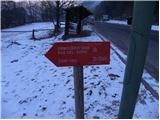 2
2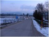 3
3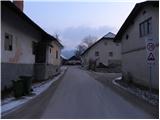 4
4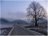 5
5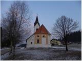 6
6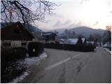 7
7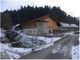 8
8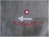 9
9 10
10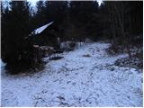 11
11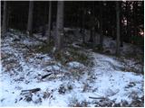 12
12 13
13 14
14 15
15 16
16 17
17 18
18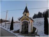 19
19 20
20 21
21 22
22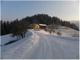 23
23 24
24 25
25 26
26 27
27 28
28 29
29 30
30 31
31 32
32 33
33 34
34 35
35 36
36 37
37 38
38 39
39 40
40 41
41 42
42 43
43 44
44 45
45 46
46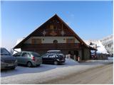 47
47 48
48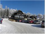 49
49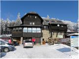 50
50 51
51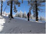 52
52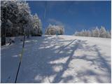 53
53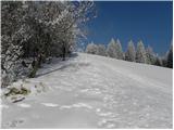 54
54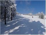 55
55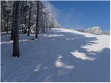 56
56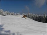 57
57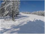 58
58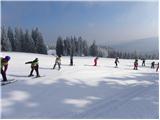 59
59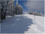 60
60 61
61 62
62 63
63 64
64 65
65 66
66 67
67 68
68 69
69 70
70