Dravograd (Meža) - Anski vrh (above Pameče)
Starting point: Dravograd (Meža) (363 m)
Starting point Lat/Lon: 46.5853°N 15.0264°E 
Time of walking: 3 h
Difficulty: easy marked way
Difficulty of skiing: no data
Altitude difference: 393 m
Altitude difference (by path): 600 m
Map: Koroška 1:50.000
Access to starting point:
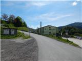
A) From Slovenj Gradec or Ravne na Koroškem we drive to Dravograd, and then still before we cross river Drava we continue right (we turn right at the first right turn off). Next follows crossing the railway track, and then we are already at the beginning of the described path at Agricultural forestry cooperative Koroška (Kmetijsko gozdarska zadruga Koroška). At the starting point, there aren't any parking spots for mountaineers.
B) From Maribor, we drive to Dravograd, where we continue left towards Slovenj Gradec and Ravne na Koroškem. After the bridge over the river Drava we continue at the second street left. Next follows crossing the railway track, and then we are already at the beginning of the described path at Agricultural forestry cooperative Koroška (Kmetijsko gozdarska zadruga Koroška). At the starting point, there aren't any parking spots for mountaineers.
Path description:
On the other side of the railway track we go right, and then before Agricultural forestry cooperative Koroška left on an ascending asphalt road. On the asphalt road, we continue to the near right hairpin turn, from where we continue straight in the direction of a marked path (near the crossroad there are few options for parking). Next follows an ascent on the macadam road to the near house, behind which the road changes into a cart track, on which we continue the ascent through the forest. Few minutes we are ascending on a cart track, and then we get to area, which was damaged by strong winds. Here we go from the cart track right on a nicely settled path, which is with nice views ascending on a slope, which is slowly getting overgrown. Well repaired path makes few hairpin turns, and then it ascends diagonally to the vantage point Skala, where there is an inscription box and from where a beautiful view opens up in the direction of Dravograd.
We continue on a marked path, which a little higher brings us on a cart track, where the path splits. We go left in the direction towards Šisernik (possible also right in the direction towards Vinkler), and the cart track a little ahead turns sharply to the right. Next follows a shorter diagonal ascent, and then the cart track ends. Next follows a shorter steep ascent, and then we reach another cart track which we follow to the right (on this part a beaten path leads a little away from the old marked path).
Next follows a shorter crossing towards the right, and then we join the path past Vinkler.
We continue left, where at first a nice view opens up, and then the path is ascending on a cart track, where at the crossings we continue straight. Higher, the path flattens, and the cart track with occasional views brings us to a crossroad at the farm Ošlovnik.
We continue right in the direction of the path Šisernikova pot and on the road we start descending diagonally. During the descent, the path leads also past few houses by the farm Kržečnik, and then through the forest we reach the saddle Cvitrško sedlo, where we step out of the forest and where there are some successive crossroads. We walk on the road to the religious symbol, and from the religious symbol we go on at first hard to follow path in the direction of Golarjev vrh, where we ascend by the edge of the meadow or indistinct ridge. Here when we look back a nice view opens up on Mežnarjev vrh and the church of St. Danijel, and the path a little higher passes into the forest and it brings us to a macadam road.
We follow the road to the right (straight - Golarjev vrh) and there in few minutes we get to homestead Kljuk, where a nice view opens up towards Peca, and the path after the farm turns slightly to the left into the forest, where in crossing it continues on a gentle cart track. In the forest, we follow the blazes, and when we step out of the forest we quickly descend to the road which we follow to the left. On the road which we reach at the farm Gnamuš, we quickly get to the chapel, which is situated on the saddle between Golarjev and Potoški vrh. We continue on the road which is for quite some time descending diagonally, and from there occasionally a view opens up towards the church of St. Ana on Anski vrh. A little further from the homestead Lubas signs for path Šisernikova pot point us to the left on a cart track which continues through the forest. After the crossing a well, the path ascends to a smaller saddle, where on the right we notice a religious symbol.
Here we leave the marked path and we continue right past a religious symbol (straight - Kremžarjev vrh), where we few minutes continue on a gently sloping path, and then we descend to a macadam road. For a short time, we walk on the road, and then we continue slightly right on a parallel cart track (we can continue also on the road), and from there soon a beaten path branches off slightly to the left, on which we continue. Few minutes we walk through the forest and then through a meadow we return on a macadam road which we follow to the right, and there we walk to the church of St. Ana, from which a beautiful view opens up.
Dravograd - Skala 0:25, Skala - saddle Cvitrško sedlo 1:00, saddle Cvitrško sedlo - Anski vrh 1:35.
Description and pictures refer to a condition in the year 2019 (May).
On the way: Skala (nad Dravogradom) (525m), Cvitrško sedlo (677m)
Pictures:
 1
1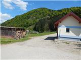 2
2 3
3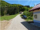 4
4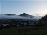 5
5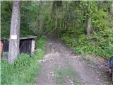 6
6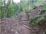 7
7 8
8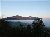 9
9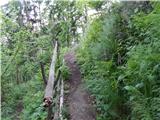 10
10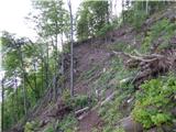 11
11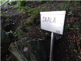 12
12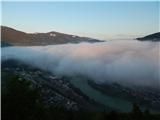 13
13 14
14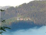 15
15 16
16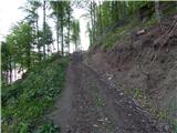 17
17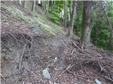 18
18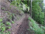 19
19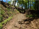 20
20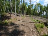 21
21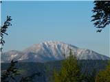 22
22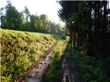 23
23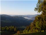 24
24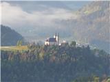 25
25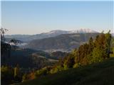 26
26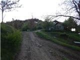 27
27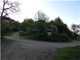 28
28 29
29 30
30 31
31 32
32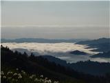 33
33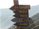 34
34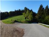 35
35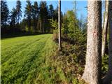 36
36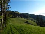 37
37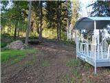 38
38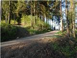 39
39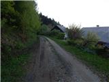 40
40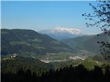 41
41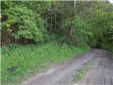 42
42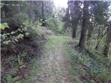 43
43 44
44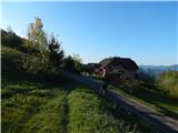 45
45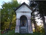 46
46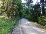 47
47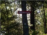 48
48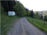 49
49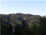 50
50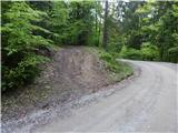 51
51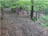 52
52 53
53 54
54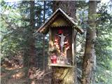 55
55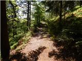 56
56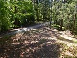 57
57 58
58 59
59 60
60 61
61 62
62 63
63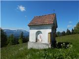 64
64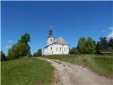 65
65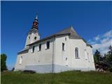 66
66 67
67