Drežniške Ravne - Lopatnik
Starting point: Drežniške Ravne (750 m)
Starting point Lat/Lon: 46.2729°N 13.6147°E 
Time of walking: 3 h
Difficulty: easy marked way
Difficulty of skiing: no data
Altitude difference: 1262 m
Altitude difference (by path): 1262 m
Map: Julijske Alpe - zahodni del 1:50.000
Access to starting point:
From the direction Tolmin or Bovec we drive to Kobarid. From Kobarid bypass road we follow the signs for Drežnica and Vrsno. We continue over the famous Napoleon bridge over the river Soča and immediately after the bridge we turn left in the direction of Drežnica. Right Vrsno and mountain pasture Planina Kuhinja. The two-lane road is a little less than 5 km ascending in zig-zags towards Drežnica. When the road flattens, we drive past a monument of the fallen in NOB, which is on our left. At the monument is placed panorama board, where we can view our destination and neighbouring peaks all from Krn to Krasji vrh. We continue driving to the village Drežnica. At the beginning of the village, we turn left and on a little narrower road we continue towards Drežniške Ravne. At the crossroad in Drežniške Ravne we get to big information board and signs. We continue right upward in the direction of the mountain pastures Zapleč and Zaprikraj and Krasji Vrh. At the next crossroad, we again turn right in the direction of the mountain pastures Zapleč and Zaprikraj. The road little narrows and in some steep turns brings us to a trough with water, where the asphalt ends. Here we park on a smaller parking lot. From Drežnica to Drežniške Ravne are approximately 2 km, and to the parking lot at the trough with water approximately 1.5 km.
From the trough with water, we can drive on a macadam road to the mountain pasture Zapleč and shorten ascent for 1 hour. But the road isn't always in the best condition, which is a problem especially for cars with lower chassis.
Path description:
From the parking lot above Drežniške Ravne we continue few meters on a macadam road to the signposts, where we turn right in the direction of the mountain pasture Zapleč, Vrata and Krn. Our destination Lopatnik on our right rises above the saddle Vrata, and over the road on our left is Krasji vrh. The footpath through a meadow leads to the forest, where it widens into a narrower cart track which moderately to mildly ascending through the forest. The path higher crosses bad macadam road, on which we continue few steps to the right, and then signpost behind the waterfall Curk and mountain pasture points left upwards. From here the path is a little steeper ascending on a grassy cart track among hazels and other lower trees. Higher, the path flattens a little and through a fence brings us in a smaller forest, which quickly gets thinner. We continue with a light ascent through grassy slopes, from which on our right a nice view opens up on Krnčica, Lopatnik and saddle Vrata and other peaks above mountain pastures Zapleč and Zaprikraj. On our left is rising Krasji vrh, behind us Matajur. The path crosses a worse road, by which there is also trough with water. We follow signposts for Vrata and Krn, which point us upwards over pastures. The more or less visible footpath is ascending by overgrown riverbed of a torrent. Here and there we will notice some old blaze, but there aren't any problems with orientation. After the ascent through the pasture, we come to the next wider cart track which branches off from the road towards the mountain pastures Zapleč and Zaprikraj. We cross the cart track and we are ascending ahead through a meadow to the mountain pasture Zapleč. If we find faded blazes, we follow them, otherwise we are ascending by the left edge of the pasture. In parts, an overgrown marked path and cow footpaths bring us of the road of road on the mountain pasture Zapleč. Above us, on our left, we will see the door in a fence, through which we step on the road. In front of us is a sign TNP and some space for parking cars. The road continues towards the mountain pasture Zaprikraj.
We step through the door of a fence, which closing the road before the mountain pasture Zapleč and then we immediately turn right. On a stone in front of the door of a fence we will notice a sign for Vrata. We have approximately 2 hours ascent to the destination, which is straight in front of us.
A well-marked path runs on a mule track, which is in countless zig-zags mostly moderately ascending. A larger part of the path is grassy. In the lower part is in the middle of the summer grass very high and it can entirely cover the mule track. All crossings are well marked, but in grass signs can be poorly visible. In the lower part of the path, it can quickly mislead us, that we turn too soon or we continue too much to the left in the direction of Vršič, so quite some attention is needed.
With every meter of ascent increasingly beautiful views are opening up on the mountain pasture Zapleč and Zaprikraj and Krasji vrh, which is rising above them. A view reaches to Kanin mountains, and behind us on Stol and Matajur.
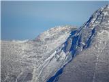
Higher, the path becomes more and more rocky and a little steeper. It seems, that our destination with each walked meter gets further away, even though it is all the time in front of us. Approximately 10 minutes below the saddle between Lopatnik and Krnčica marked mule track ascends diagonally to the right towards Krnčica and Krn. A little further footpath branches off to the left towards Vrata, which we follow few steps, and then we descend through the rocky-grassy slope on the saddle between Krnčica and Lopatnik, and from here in few minutes we reach the peak Lopatnik.
Our hike we can extend on a marked path to Krnčica or Krn, or on an unmarked path to Skutnik and ahead on pathless terrain to Krnčica.
From Lopatnik we descend on pathless terrain on a ridge to a saddle Vrata and from here on a mule track in the direction of the ascent on the mountain pasture Zapleč, or we can continue on an unmarked path on the ridge towards Vrh Ruš and Vršič, from where we on a mule track descend to the mountain pasture Zaprikraj. Unfortunately, the ridge is usually already in the morning veiled in fog and clouds, in poor visibility further path on the ridge isn't recommended.
From the mountain pasture Zapleč to the starting point instead over pastures we can go also on the road. After approximately 1 km we come to a bigger turn, where a sign for Walk of Peace (Pot miru) points us in the forest. Here we can join the mountain path which leads on Krasji vrh and we descend there to the starting point above Drežniške Ravne.
Pictures:
 1
1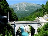 2
2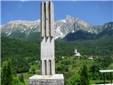 3
3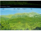 4
4 5
5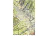 6
6 7
7 8
8 9
9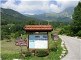 10
10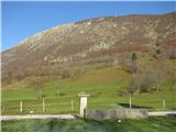 11
11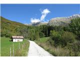 12
12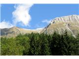 13
13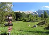 14
14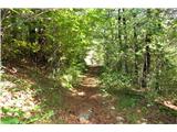 15
15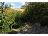 16
16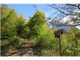 17
17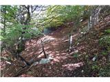 18
18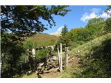 19
19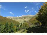 20
20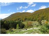 21
21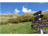 22
22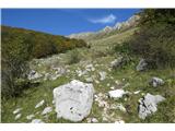 23
23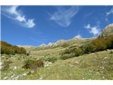 24
24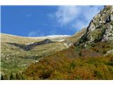 25
25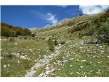 26
26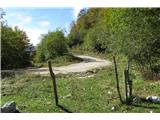 27
27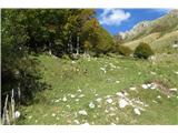 28
28 29
29 30
30 31
31 32
32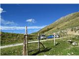 33
33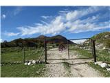 34
34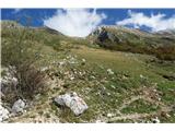 35
35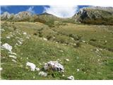 36
36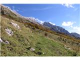 37
37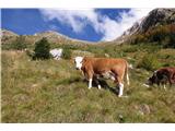 38
38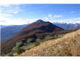 39
39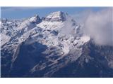 40
40 41
41 42
42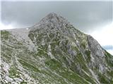 43
43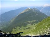 44
44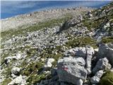 45
45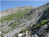 46
46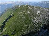 47
47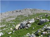 48
48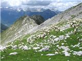 49
49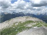 50
50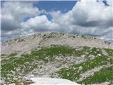 51
51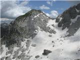 52
52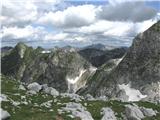 53
53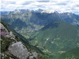 54
54 55
55 56
56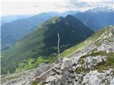 57
57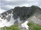 58
58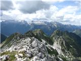 59
59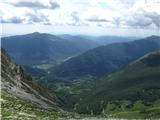 60
60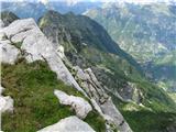 61
61 62
62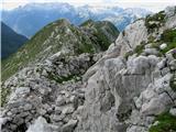 63
63 64
64 65
65 66
66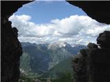 67
67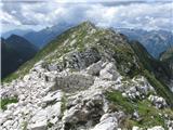 68
68 69
69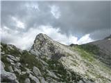 70
70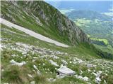 71
71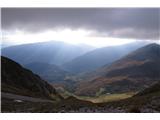 72
72 73
73 74
74 75
75 76
76 77
77 78
78 79
79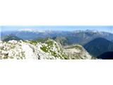 80
80