Eisenkappler Hutte - Kraguljše
Starting point: Eisenkappler Hutte (1553 m)
Starting point Lat/Lon: 46.5019°N 14.5121°E 
Time of walking: 45 min
Difficulty: easy marked way
Difficulty of skiing: no data
Altitude difference: 275 m
Altitude difference (by path): 275 m
Map: Karavanke - osrednji del 1:50.000
Access to starting point:
A) From highway Ljubljana - Jesenice we go to the exit Kranj - east and follow the road ahead in the direction of Jezersko. From Zgornje Jezersko we continue driving over alpine mountain pass Jezerski vrh to Železna Kapla / Bad Eisenkappel, where we turn left in the direction of the settlement Šajda / Zell Schaida. Further, we drive through the valley of the stream Obirski potok, and we follow the road only to the inn Obir Pepi, where we turn right in the direction of the mountain hut Eisenkappler Hütte. The road then starts ascending steeper and higher brings us to a saddle Kurnikovo sedlo (997 meters), where a road toll has to be paid. Next follows few more kilometers of driving and quite winding road brings us to a large parking lot at the mountain hut Eisenkappler Hütte.
B) From Štajerska we at first drive to Mozirje, and then we continue driving towards the valley Logarska dolina and later towards the saddle Pavličevo sedlo. From the saddle Pavličevo sedlo we descend into Bela / Bad Vellach, and then we continue driving towards Železna Kapla / Bad Eisenkappel, where we turn left in the direction of the settlement Šajda / Zell Schaida. Further, we drive through the valley of the stream Obirski potok, and we follow the road only to the inn Obir Pepi, where we turn right in the direction of the mountain hut Eisenkappler Hütte. The road then starts ascending steeper and higher brings us to a saddle Kurnikovo sedlo (997 meters), where a road toll has to be paid. Next follows few more kilometers of driving and quite winding road brings us to a large parking lot at the mountain hut Eisenkappler Hütte.
Path description:
From the parking lot, we at first walk to the nearby mountain hut, and then we continue on a marked path in the direction of the summit Ojstrc / Hochobir. The path soon above the mountain hut goes into the forest, through which it is then for some time ascending. Higher, the path, by which we notice a larger number of learning signposts flattens and out of the forest brings us into a lane of dwarf pines. Next follows few minutes of easy walking and the path brings us to benches on panoramic summit Kraguljše.
Pictures:
 1
1 2
2 3
3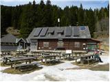 4
4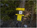 5
5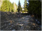 6
6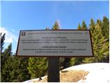 7
7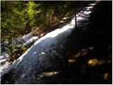 8
8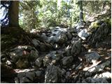 9
9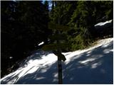 10
10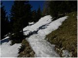 11
11 12
12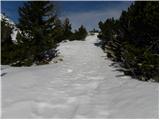 13
13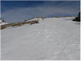 14
14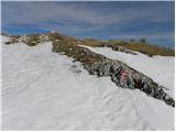 15
15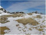 16
16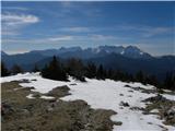 17
17