end of road on Pokljuka - Koča na Doliču
Starting point: end of road on Pokljuka (1340 m)
Starting point Lat/Lon: 46.3386°N 13.9045°E 
Time of walking: 5 h
Difficulty: easy marked way
Difficulty of skiing: partly demanding
Altitude difference: 811 m
Altitude difference (by path): 1100 m
Map: Triglav 1:25.000
Access to starting point:
From highway Ljubljana - Jesenice we go to the exit Lesce and follow the road ahead towards Bled. In Bled at the traffic lights, the signs for Pokljuka point us to the right. Ahead we drive through Gorje and past the abandoned ski slope Zatrnik to Rudno polje on Pokljuka (large parking lot, barracks and shooting range). From here we continue straight on a macadam road which a little further brings us to a crossroad, where we continue right (left Uskovnica). We follow this road to a parking lot at the end of the road (near are signposts for a mountain pasture Konjščica).
Path description:
From the parking lot, we continue right upward on a cart track in the direction of the mountain pasture Planina Konjščica.. Cart track that at first ascends steeply soon becomes gentle and a bit higher turns into a footpath. Next follows a moderate ascent on the path that is ascending by the stream Ribnica which in the upper part has a watterfall that we can see from the path. Further, the path crosses a well and passes to grazing area of the mountain pasture Konjščica. After few ten strides path crosses the next well and ascends a little to cheese cottage on the mountain pasture.
From the mountain pasture, we continue on a gently sloping meadow slightly upwards to the other side of the pasture.. There path passes into dwarf pines and at first, it starts gently ascending, but then it becomes steeper and steeper. In the last part of the ascent the path from Rudno polje joins us from the right. Only a short climb by the torrent follows to reach the grassy plain Jezerce. Here the path turns left and after few steps it brings us into central area of Triglav national park. Next, we ascend by a well towards Studorski preval. A little higher we cross a torrent and the path turns a little to the right into grassy slopes surrounded by dwarf pines. The path then ascends diagonally to Studorski preval from which a nice view opens up to Bohinj side. The path ahead at first descends a little and then crosses slopes of Veliki Draški vrh and Tosc with few gentle ascents and descends. Eventually, the path brings us to a grassy south slope of Tosc. Here the path on Tosc branches off to the right, and only few meters ahead, the path from Uskovnica joins from the left. We continue straight, and the path ahead continues crossing slopes of Tosc. The path then in a gentle descent crosses a shorter lane of thin forest and then it brings us on steep slopes. A little further ahead, the path on a carved wide ledge in a gentle descent crosses precipitous slopes of Tosc. Since the path is quite wide it doesn't cause problems (carefully because of falling stones, rockfall in the year 2008). The path then again slightly ascends and it brings us to a crossing, where we continue slightly left in the direction of Velo polje (sharply left Voje, straight Vodnikov dom). The path ahead starts descending diagonally towards the right and it quickly brings us to an unmarked crossing. We continue on the right marked path (left hunting cottage), which soon flattens, and then it continues by crossing the slopes below the mountain hut Vodnikov dom. After few minutes, the path turns slightly to the left and starts descending towards Malo and Velo polje. After a short descent from the left joins the path from the valley Voje, and we continue right and after few 10 strides, we get to shepherd huts on the mountain pasture Velo polje.
From the mountain pasture, we continue slightly right (straight) on the path which crosses wide mountain pasture. On the other side of the mountain pasture we come to rocky barriers, which preventing torrents to fill up this beautiful mountain pasture. Only few meters before the mentioned rocky barrier path turns slightly left and it ascends in thin mostly larch forest. After that, the path turns a little more to the left and on gentle and slightly vegetated grassy slopes brings us to the before mentioned torrent. The path ahead is for some time ascending gently by a torrent, and then it steeply ascends below the mountain walls of Šmarjetna glava. The steepness then quickly decreases and more and more rocky path below the mountain walls and scree of surrounding peaks brings us to a saddle Dolič. We continue straight (left Hribarice, right Planika) on the path which starts gradually descending and after a little less than 10 minutes brings us to the mountain hut Koča na Doliču.
Pictures:
 1
1 2
2 3
3 4
4 5
5 6
6 7
7 8
8 9
9 10
10 11
11 12
12 13
13 14
14 15
15 16
16 17
17 18
18 19
19 20
20 21
21 22
22 23
23 24
24 25
25 26
26 27
27 28
28 29
29 30
30 31
31 32
32 33
33 34
34 35
35 36
36 37
37 38
38 39
39 40
40 41
41 42
42 43
43 44
44 45
45 46
46 47
47 48
48 49
49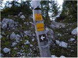 50
50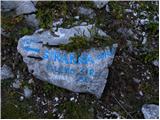 51
51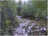 52
52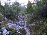 53
53 54
54 55
55 56
56 57
57 58
58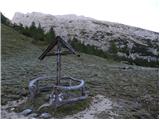 59
59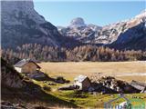 60
60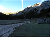 61
61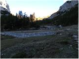 62
62 63
63 64
64 65
65 66
66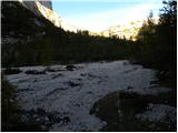 67
67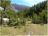 68
68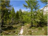 69
69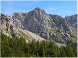 70
70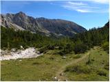 71
71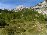 72
72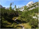 73
73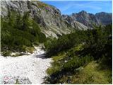 74
74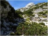 75
75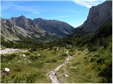 76
76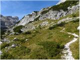 77
77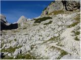 78
78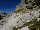 79
79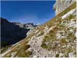 80
80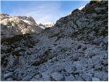 81
81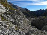 82
82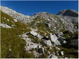 83
83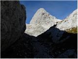 84
84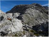 85
85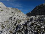 86
86 87
87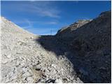 88
88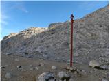 89
89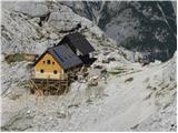 90
90