End of road on Pokljuka - Mali Draški vrh
Starting point: End of road on Pokljuka (1340 m)
Starting point Lat/Lon: 46.3386°N 13.9045°E 
Time of walking: 2 h 35 min
Difficulty: difficult unmarked way
Difficulty of skiing: no data
Altitude difference: 792 m
Altitude difference (by path): 800 m
Map: Triglav 1:25.000
Access to starting point:
From highway Ljubljana - Jesenice we go to the exit Lesce and follow the road ahead towards Bled. In Bled at the traffic lights, the signs for Pokljuka point us to the right. Ahead we drive through Gorje and past the abandoned ski slope Zatrnik to Rudno polje on Pokljuka (large parking lot, barracks and shooting range). From here we continue straight on a macadam road which a little further brings us to a crossroad, where we continue right (left Uskovnica). We follow this road to a parking lot at the end of the road (near are signposts for a mountain pasture Konjščica).
Path description:
From the parking lot at the end of the road, we continue on a wide and at first ascending cart track in the direction of the mountain pasture Konjščica. Cart track, which goes immediately into a dense forest, quickly flattens and after few minutes of easy walking turns into a footpath which continues by the left bank of the stream Ribnica. When the path gets very close to the mentioned stream it turns slightly to the right and it ascends steeper. Higher, the path flattens and out of the forest brings us on the bottom edge of ample Konjščica. Here the path turns slightly to the left, crosses a stream and after few additional strides, it brings us to cheese cottage on the mountain pasture Konjščica.
From the cheese cottage, we continue on a pleasant path, which in few minutes of a light ascent brings us on the upper edge of the mountain pasture. Here the path goes in a lane of dwarf pines and bushes and gradually starts ascending steeper. In the upper part of the ascent towards Jezerca the path from Rudno polje joins from the right, and we continue straight on a moderately steep path, which in few minutes of additional walking brings us to Jezerca, where the path flattens. Here are also signposts, which point us to the right following the signs »Viševnik«.
At first, we walk on a gentle footpath in the direction towards Mali Draški vrh. After that, the path turns a little to the right and starts ascending through the valley between Mali Draški vrh and Viševnik. At first, we are ascending on the left side of the valley, and in the upper part path turns slightly to the right and follows an ascent by a crumbly slope to Srenjski preval.
From the saddle Srenjski preval we continue left on unmarked and poorly visible path which starts ascending steeper and steeper on and by indistinct gully (sharply left Studorski preval). The path in the lower part is ascending a little right from the gully, after that for a short time passes on its left (direction of ascent) side. Higher gully ascends even steeper, and the path starts vanishing. Further, we are ascending through the gully steeply upwards (carefully because of very crumbly terrain) and by "path" we will notice some very old and already entirely faded blazes. After a good 20 minutes of ascent we step on precipitous ridge, from which a nice view opens up through a valley Krma and peaks, which surround it.
From here we can ascend on the nearby eastern peak, to which we have few meters of easy climbing on exposed ridge, or on a little more distant, but few meters higher western peak. To get there at first we have to descend a little and then on quite exposed ridge in few 10 strides we ascend on a panoramic peak.
Pictures:
 1
1 2
2 3
3 4
4 5
5 6
6 7
7 8
8 9
9 10
10 11
11 12
12 13
13 14
14 15
15 16
16 17
17 18
18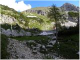 19
19 20
20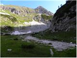 21
21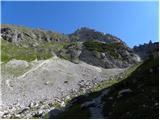 22
22 23
23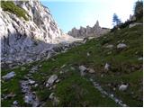 24
24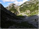 25
25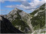 26
26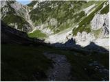 27
27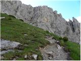 28
28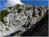 29
29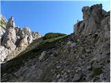 30
30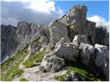 31
31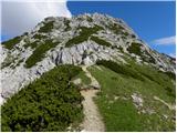 32
32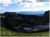 33
33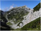 34
34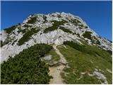 35
35 36
36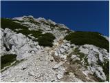 37
37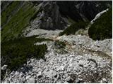 38
38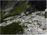 39
39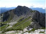 40
40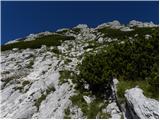 41
41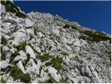 42
42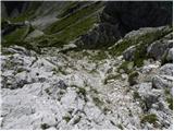 43
43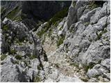 44
44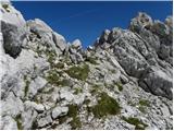 45
45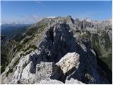 46
46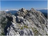 47
47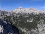 48
48