end of road on Pokljuka - Tosc
Starting point: end of road on Pokljuka (1340 m)
Starting point Lat/Lon: 46.3386°N 13.9045°E 
Time of walking: 3 h 45 min
Difficulty: easy unmarked way
Difficulty of skiing: demanding
Altitude difference: 935 m
Altitude difference (by path): 950 m
Map: Triglav 1:25.000
Access to starting point:
From highway Ljubljana - Jesenice we go to the exit Lesce and follow the road ahead towards Bled. In Bled at the traffic lights, the signs for Pokljuka point us to the right. Ahead we drive through Gorje and past the abandoned ski slope Zatrnik to Rudno polje on Pokljuka (large parking lot, barracks and shooting range). From here we continue straight on a macadam road which a little further brings us to a crossroad, where we continue right (left Uskovnica). We follow this road to a parking lot at the end of the road (near are signposts for a mountain pasture Konjščica).
Path description:
From the parking lot at the end of the road, we continue on a wide and at first ascending cart track in the direction of the mountain pasture Konjščica. Cart track, which goes immediately into a dense forest, quickly flattens and after few minutes of easy walking turns into a footpath which continues by the left bank of the stream Ribnica. When the path gets very close to the mentioned stream it turns slightly to the right and it ascends steeper. Higher, the path flattens and out of the forest brings us on the bottom edge of ample Konjščica. Here the path turns slightly to the left, crosses a stream and after few additional strides, it brings us to cheese cottage on the mountain pasture Konjščica.
From the cheese cottage, we continue on a pleasant path, which in few minutes of a light ascent brings us on the upper edge of the mountain pasture. Here the path goes in a lane of dwarf pines and bushes and gradually starts ascending steeper. In the upper part of the ascent towards Jezerca the path from Rudno polje joins from the right, and we continue straight on a moderately steep path, which in few minutes of additional walking brings us to Jezerca, where the path flattens and turns to the left.
Next follows easy walk to the signpost, which marks the main area of TNP, and then the path starts moderately ascending by the torrent (at first a well). The path higher passes on the right side of the torrent (looking from the direction of ascent) and then it ascends diagonally to a saddle Studorski preval.
From the saddle, from where a nice view opens up to Bohinj side, we continue straight (left Ablanca, right Veliki Draški vrh and sharply right saddle Srenjski preval) on the path which starts descending and after few steps of descent turns to the right. A short descent follows, and then the path continues in crossing, at first slopes below Veliki Draški vrh and later Tosc. When we come on unvegetated southern slopes of Tosc we will get to a smaller crossing, where the unmarked path on Tosc branches off to the right (turn-off is marked).
We continue on unmarked, but easy to follow path which starts ascending steeper and steeper over grassy slopes of Tosc. Increasingly steep path is slowly turning a little towards the right, and then turns sharply to the left and almost entirely flattens. Next follows traversing of short steep slope, and then the path brings us on less steep slopes, where it starts gradually vanishing. A poorly visible footpath then turns slightly to the right and starts ascending a little steeper. After few minutes of the ascent, we step on an indistinct Mali Tosc, from which a view opens up on Tosc. Next follows a short descent and the path past a bigger sinkhole, which we bypass on the right side brings us by the upper foot of Tosc. The path ahead moderately ascends over a pleasant grassy slope and after few minutes of additional walking brings us to the summit of Tosc.
Orientation in fog is difficult.
The starting point - Studorski preval 2:00, Studorski preval - Tosc 1:45.
Pictures:
 1
1 2
2 3
3 4
4 5
5 6
6 7
7 8
8 9
9 10
10 11
11 12
12 13
13 14
14 15
15 16
16 17
17 18
18 19
19 20
20 21
21 22
22 23
23 24
24 25
25 26
26 27
27 28
28 29
29 30
30 31
31 32
32 33
33 34
34 35
35 36
36 37
37 38
38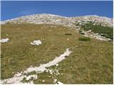 39
39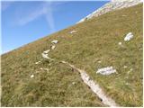 40
40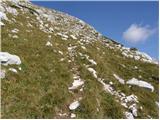 41
41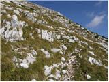 42
42 43
43 44
44 45
45 46
46 47
47 48
48 49
49 50
50 51
51 52
52 53
53 54
54 55
55 56
56 57
57 58
58 59
59 60
60 61
61 62
62