end of road on Pokljuka - Veliki Draški vrh
Starting point: end of road on Pokljuka (1340 m)
Starting point Lat/Lon: 46.3386°N 13.9045°E 
Time of walking: 3 h
Difficulty: partly demanding unmarked way
Difficulty of skiing: demanding
Altitude difference: 903 m
Altitude difference (by path): 903 m
Map: Triglav 1:25.000
Access to starting point:
From highway Ljubljana - Jesenice we go to the exit Lesce and follow the road ahead towards Bled. In Bled at the traffic lights, the signs for Pokljuka point us to the right. Ahead we drive through Gorje and past the abandoned ski slope Zatrnik to Rudno polje on Pokljuka (large parking lot, barracks and shooting range). From here we continue straight on a macadam road which a little further brings us to a crossroad, where we continue right (left Uskovnica). We follow this road to a parking lot at the end of the road (near are signposts for a mountain pasture Konjščica).
Path description:
From the parking lot at the end of the road, we continue on a wide and at first ascending cart track in the direction of the mountain pasture Konjščica. Cart track, which goes immediately into a dense forest, quickly flattens and after few minutes of easy walking turns into a footpath which continues by the left bank of the stream Ribnica. When the path gets very close to the mentioned stream it turns slightly to the right and it ascends steeper. Higher, the path flattens and out of the forest brings us on the bottom edge of ample Konjščica. Here the path turns slightly to the left, crosses a stream and after few additional strides, it brings us to cheese cottage on the mountain pasture Konjščica.
From the cheese cottage, we continue on a pleasant path, which in few minutes of a light ascent brings us on the upper edge of the mountain pasture. Here the path goes in a lane of dwarf pines and bushes and gradually starts ascending steeper. In the upper part of the ascent towards Jezerca the path from Rudno polje joins from the right, and we continue straight on a moderately steep path, which in few minutes of additional walking brings us to Jezerca, where the path flattens and turns to the left.
Next follows easy walk to the signpost, which marks the main area of TNP, and then the path starts moderately ascending by the torrent (at first a well). The path higher passes on the right side of the torrent (looking from the direction of ascent) and then it ascends diagonally to a saddle Studorski preval, from which a nice view opens up to Bohinj side.
From the saddle Studorski preval we continue right (left Ablanca, straight Vodnikov dom, sharply right Srenjski preval) on at first gently sloping path, which is ascending through a lane of dwarf pines. A little further, the path turns to the left and starts gradually ascending steeper and steeper. After few minutes of additional walking, the path brings us below short, but quite steep rocky jump, which we overcome with some help of hands (mainly for balance). Rocky jump is besides a risk of slipping, exposed also to falling stones (carefully!). Higher, the path flattens and passes on very panoramic and technically mostly undemanding ridge. The path, from which beautiful views opening up on Spodnje Bohinjske gore and also other Bohinj mountains, a little below the summit again starts ascending steeper. The path ahead ascends over short and steep rocky slope, and then it flattens and in few minutes of additional walking brings us on a panoramic peak.
The starting point - Studorski preval 2:00, Studorski preval - Veliki Draški vrh 1:00.
Pictures:
 1
1 2
2 3
3 4
4 5
5 6
6 7
7 8
8 9
9 10
10 11
11 12
12 13
13 14
14 15
15 16
16 17
17 18
18 19
19 20
20 21
21 22
22 23
23 24
24 25
25 26
26 27
27 28
28 29
29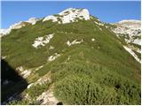 30
30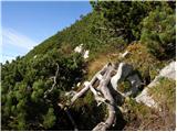 31
31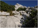 32
32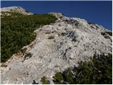 33
33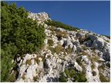 34
34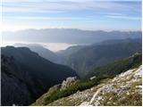 35
35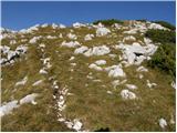 36
36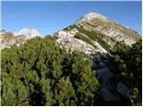 37
37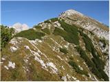 38
38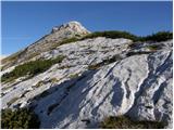 39
39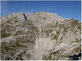 40
40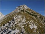 41
41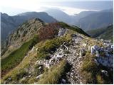 42
42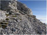 43
43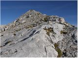 44
44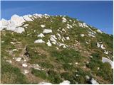 45
45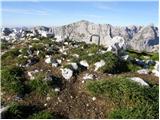 46
46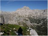 47
47