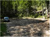
End of road on Vogar - Čelo (via Štapce)
Starting point: End of road on Vogar (1350 m)
Starting point Lat/Lon: 46.2956°N 13.8412°E 
Path name: via Štapce
Time of walking: 7 h 5 min
Difficulty: partly demanding marked way, easy pathless terrain
Difficulty of skiing: no data
Altitude difference: 878 m
Altitude difference (by path): 1500 m
Map: TNP 1:50.000
Access to starting point:
From the Ljubljana-Jesenice motorway, take the Lesce exit and follow the road towards Bled and further towards Bohinjska Bistrica. Continue driving towards Lake Bohinj (Ribčev laz), where you reach a junction; continue right towards Stara Fužina. In Stara Fužina, at the junction by the chapel, turn sharply left onto the ascending road towards Planina Blato, Planina Vogar and Voje Valley. The road then leads to the point where toll and parking fees are collected; continue following it to the next junction, turning left (right to Voje). Follow the road to the next junction (after quite some driving), continuing straight (sharp right to Planina Blato). Then follow the road past Planina Vogar and drive along it to the parking lot at the end of the road.
From the toll collection point to the starting point is just under 11 km of driving, the last half or slightly less is entirely gravel road.
Path description:
At the parking lot, notice the signs for Planina Viševnik, directing right onto a wide and initially quite steep tractor track. After a few minutes of steep ascent, the track levels out and continues through the forest without major elevation changes. When the track turns right, continue straight on the marked footpath, which ascends gently for a short time initially. When the path steepens, notice a cairn on the left and a path beside it leading to Pršivec (it later joins the usual path from Vogar); continue straight on the steep mountain path. The path ascends steeply through the forest for some time, then temporarily levels and leads to Brezno pri Gamsovi glavici (sinkhole explored to 817 m depth). Above the sinkhole, the path enters an indistinct, steeper upper valley section, ascending to a small pass between Pršivec (1761 m) left and Gornji Viševnik (1722 m) right. Here it fully levels, then continues across Gornji Viševnik pastures. On the other side, it re-enters forest and descends in minutes to Planina Viševnik, with Bregarjevo zavetišče in the middle.
From Planina Viševnik continue slightly left (sharp left Pršivec, left Črno jezero, slightly right Planina pri Jezeru past Krištofojce, right Planina pri Jezeru) towards Planina Ovčarija and Triglav Lakes. The path first traverses left across steeper slope, then levels gradually into plateau terrain. Continue southwest of Griva (1758 m) without major elevation changes. Further on at signs, unmarked path goes straight to Planina Dedno polje; turn sharply left to Planina Ovčarija. From signs, slight descent, then right turn along a bench or hollow. On other side, moderate ascent resumes, levels, leading to shepherd huts on Planina Ovčarija.
Continue between huts on marked path, descending moderately. Lower, passes more huts, then in minutes reaches junction with wider path from Planina Dedno polje. Continue left to next junction.
From junction follow signs for path via Štapce (straight via Prodov), both to Koča pri Triglavskih jezerih; right one (ours) also to Mala Tičarica and Zelnarice. Soon leave Planina Ovčarija; path ascends moderately to steeply through thinning forest into dwarf pines. After 30 min ascent, levels to Štapce junction.
Left towards Triglav Lakes (right Mala Tičarica and Zelnarice ridge); quickly to edge with fine view of Triglav Lakes Valley part, surrounding mountains to Krn.
From Štapce steep secured rocky descent, then scree to dwarf pine belt. Slight descent; left joins path via Prodov and from Koča pri Savici (via Komarčo); continue right along Dvojno jezero. After lake, few easy steps to Koča pri Triglavskih jezerih.
After rest and views, towards Dom na Komni along right (west) lake side, traversing ascent. Near unseen hunting hut, semi-circle right, gradual descent. Midway to Planina Lopučnica, on flat where marked path turns left, unmarked path right to Zgornje Komne plateau, Gladki and Debelem Laštu (lost in karst).
At Planina Lopučnica junction lower, right to Planina Za skalo (slight left Dom na Komni) on faint path crossing northwest slopes amid tall summer grasses, crossing sparse forest, turning left. Steep ascent to karst sinkholes/scree; levels, fades (follow marks). Fine view of mountains around Triglav Lakes Valley. Follow marks to Velika vrata pass after gentle ascent minutes.
Beyond Velika vrata leave seldom-used path, right pathless. Initial dwarf pine/scree passages easy with sparse cairns. Ascend roughly north, no direct due to karst; detour fissures. To ridge ends loops. Ascend scenic ridge to indistinct Glava za Bajto summit.
Slight descent, then grassy Čelo slope to little-known summit.
Parkirišče Hebed - Brezno pri gamsovi glavici 0:55, Brezno pri gamsovi glavici - Gornji Viševnik 0:10, Gornji Viševnik - Planina Viševnik 0:15, Planina Viševnik - Planina Ovčarija 0:50, Planina Ovčarija - razpotje na Planini Ovčarija 0:10, razpotje na Planini Ovčarija - Štapce 0:35, Štapce - Dvojno jezero 0:20, Dvojno jezero - Koča pri Triglavskih jezerih 0:05, Koča pri Triglavskih jezerih - Planina Lopučnica 0:30, Planina Lopučnica - Velika vrata 1:45, Glava za Bajto 1:05, Glava za Bajto - Čelo 0:25.
On the way: Brezno pri gamsovi glavici (1608m), Gornji Viševnik (1680m),
Planina Viševnik (1625m), Smodlakov brlog (1714m),
Planina Ovčarija (1660m), Štapce (1851m), Dvojno jezero (1689m),
Koča pri Triglavskih jezerih (1685m),
Planina Lopučnica (1558m), Velika vrata (1910m),
Glava za Bajto (2131m)
Pictures:
 1
1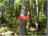 2
2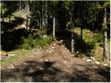 3
3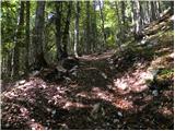 4
4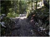 5
5 6
6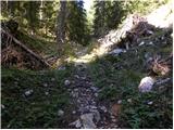 7
7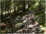 8
8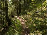 9
9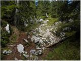 10
10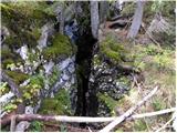 11
11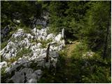 12
12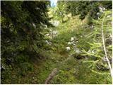 13
13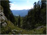 14
14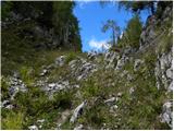 15
15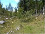 16
16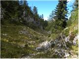 17
17 18
18 19
19 20
20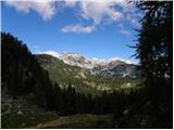 21
21 22
22 23
23 24
24 25
25 26
26 27
27 28
28 29
29 30
30 31
31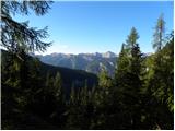 32
32 33
33 34
34 35
35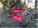 36
36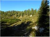 37
37 38
38 39
39 40
40 41
41 42
42 43
43 44
44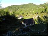 45
45 46
46 47
47 48
48 49
49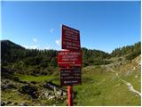 50
50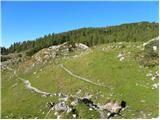 51
51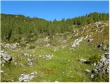 52
52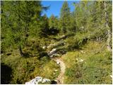 53
53 54
54 55
55 56
56 57
57 58
58 59
59 60
60 61
61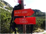 62
62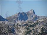 63
63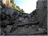 64
64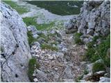 65
65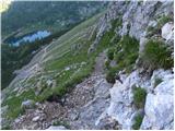 66
66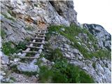 67
67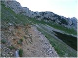 68
68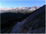 69
69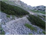 70
70 71
71 72
72 73
73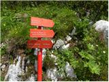 74
74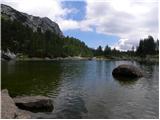 75
75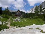 76
76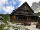 77
77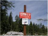 78
78 79
79 80
80 81
81 82
82 83
83 84
84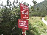 85
85 86
86 87
87 88
88 89
89 90
90 91
91 92
92 93
93 94
94 95
95 96
96 97
97 98
98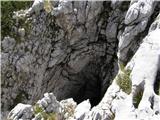 99
99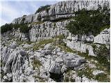 100
100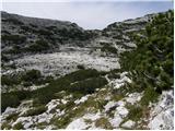 101
101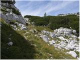 102
102 103
103 104
104 105
105 106
106 107
107 108
108 109
109 110
110 111
111 112
112 113
113 114
114 115
115 116
116 117
117 118
118 119
119