end of road on Vogar - Pršivec (direct way)
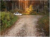
Starting point: end of road on Vogar (1350 m)
Starting point Lat/Lon: 46.2956°N 13.8412°E 
Path name: direct way
Time of walking: 1 h 30 min
Difficulty: easy marked way
Difficulty of skiing: demanding
Altitude difference: 411 m
Altitude difference (by path): 411 m
Map: Triglav 1:25.000
Access to starting point:
From highway Ljubljana - Jesenice we go to the exit Lesce and follow the road towards Bled and forward towards Bohinjska Bistrica. We continue driving towards the Lake Bohinj (Ribčev laz), where we come to the crossroad, where we continue right in the direction of Stara Fužina. In Stara Fužina at the crossroad at the chapel, we turn sharply left on an ascending road in the direction of the mountain pasture Blato, mountain pasture Vogar and valley Voje. The road ahead brings us to the spot, where the road toll or parking fee has to be paid, we follow it forward to the next crossroad, where we continue left (right Voje). The road we then follow to the next crossroad (we drive for quite some time), where we continue straight (sharply right mountain pasture Planina Blato). Then we follow the road past the mountain pasture Vogar and we drive there to the parking lot at the end of the road.
Path description:
Few meters before the beginning of the parking lot, we will on the left side of the road (direction of ascent) notice marked mountain path which leads from the mountain pasture Vogar on the mountain pasture Viševnik. On this path we descend few steps and the path quickly brings us to a crossing. We continue right in the direction of Pršivec (left downwards mountain pasture Vogar) on a cart track which is moderately, only occasionally a little steeper ascending. A little higher, the cart track changes into in parts a very steep footpath which is mostly ascending through a dense spruce forest. Higher the forest is becoming thinner, and to spruces more often larches are joining, which in the autumn with their colors fascinate almost every mountaineer.
And still steep path gradually passes on a panoramic ridge on which we are then ascending. In wet and snow is on this part dangerous for slipping. The path which offers nice views on Spodnje Bohinjske gore and the main Julian Alps flattens a little and among individual trees quickly brings us on a panoramic peak.
Pictures:
 1
1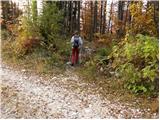 2
2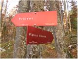 3
3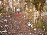 4
4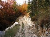 5
5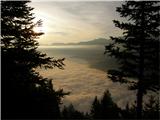 6
6 7
7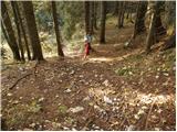 8
8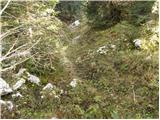 9
9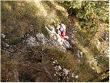 10
10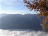 11
11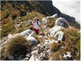 12
12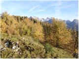 13
13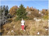 14
14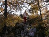 15
15 16
16