Gaber pri Semiču - Smuk (via Semenič)
Starting point: Gaber pri Semiču (415 m)
Starting point Lat/Lon: 45.645°N 15.1572°E 
Path name: via Semenič
Time of walking: 1 h 10 min
Difficulty: easy marked way
Difficulty of skiing: no data
Altitude difference: 130 m
Altitude difference (by path): 210 m
Map: Dolenjska - Gorjanci in Kočevski rog 1:50.000
Access to starting point:
A) From the Ljubljana - Brežice highway, take the Ivančna Gorica exit, then continue driving towards Črnomelj. After Črmošnjice, the road ascends for a short time longer, then starts to descend more steeply. At the end of the longer right bend, where we will notice the inscription "pozdravljeni v Beli krajini" on the support wall, turn left and then immediately right. Park about 50 meters further on in a suitable spot above the mountain direction signposts.
B) From the Brežice - Ljubljana highway, take the Novo mesto exit, then continue driving towards Dolenjske Toplice and Podturn pri Dolenjskih Toplicah. In Podturn, join the main road Ivančna Gorica - Črnomelj, which we follow to the left towards Črnomelj. After Črmošnjice, the road ascends for a short time longer, then starts to descend more steeply. At the end of the longer right bend, where we will notice the inscription "pozdravljeni v Beli krajini" on the support wall, turn left and then immediately right. Park about 50 meters further on in a suitable spot above the mountain direction signposts.
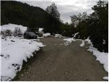
C) From Bela krajina, first drive to Semič, then continue driving towards Črmošnjice and Soteska. Before reaching the left bend with the inscription "Pozdravljeni v Beli krajini", at the settlement Gaber pri Semiču leave the main road and turn right and then immediately right again onto Smuška cesta. Park about 50 meters further on in a suitable spot above the mountain direction signposts.
Path description:
From the starting point, we walk to the mountain signposts, from there we continue along Smuška cesta in the direction of Smuk. Initially, we walk along the asphalt road, along which we quickly arrive at a few houses. Here the road descends slightly and brings us to signposts for the church of St. Primož, which direct us slightly left onto a footpath that continues through the forest. After a short ascent, we step onto a cart track, which we follow to the right to the nearby church of St. Primož and Felicijan.
From the church, we continue in the direction of Semenič and Smuk, along the path that continues through the forest and is further marked with the letter S in a white circle. The path ahead ascends gently to moderately and brings us after approximately 20 minutes of further walking to the forested Semenič.
From Semenič we continue along the marked path, which starts to descend gently to moderately. A little lower, the path splits into a shorter right path and a somewhat longer left path. Already after a few minutes, both paths join again, and we follow the S marks for some time along forest paths, for some time along forest cart tracks. Further on, we cross a few more side paths, then arrive at a forest road, which we reach right at some kind of turning area.
From here we continue in the direction of Smuk and return to the forest on a gentle footpath. For a short time without major changes in elevation, we cross fairly gentle slopes, then arrive at a marked path or forest road, which we follow left uphill.
We continue the path along a somewhat steeper road, which quickly brings us to a marked junction, from where we continue in the direction of Smuk. Here we leave the road and through a strip of forest arrive at the panoramic grassy meadows of Smuk, across which we climb to the summit of Smuk in less than 5 minutes of further walking.
Pictures:
 1
1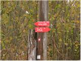 2
2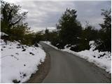 3
3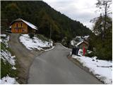 4
4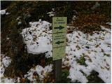 5
5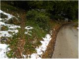 6
6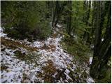 7
7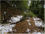 8
8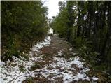 9
9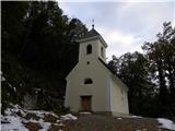 10
10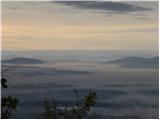 11
11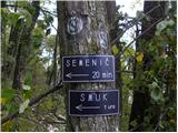 12
12 13
13 14
14 15
15 16
16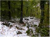 17
17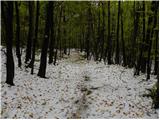 18
18 19
19 20
20 21
21 22
22 23
23 24
24 25
25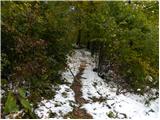 26
26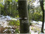 27
27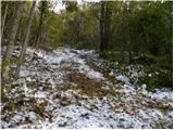 28
28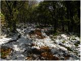 29
29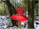 30
30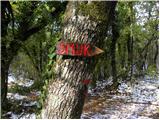 31
31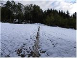 32
32 33
33 34
34 35
35 36
36 37
37 38
38 39
39