Geschriebenstein Passhöhe - Großer Hirschenstein
Starting point: Geschriebenstein Passhöhe (802 m)
Starting point Lat/Lon: 47.34793°N 16.41144°E 
Time of walking: 45 min
Difficulty: easy marked way
Difficulty of skiing: no data
Altitude difference: 60 m
Altitude difference (by path): 85 m
Map:
Access to starting point:
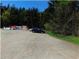
We drive to Rogašovci, and then we continue driving in the direction of Kuzma. After the settlement Sotina, the road towards Kuzma turns right uphill, and we continue straight towards Austria. While driving through Austria at first we follow the signs for Jennersdorf, Güssing, after that to the settlement St. Michael im Burgenland, where we turn right towards the settlement Großpetersdorf. After the mentioned settlement we reach the main road Sombotel / Szombathely - Oberwart / Felsőőr, and we follow it right in the direction of Hungary. We leave the mentioned main road at exit for Rechnitz, and we drive to the mentioned settlement, from where we continue towards the mountain pass Geschriebenstein Passhöhe. We park on a macadam parking lot on the left, western side of the pass.
Path description:
From the parking lot, we head on the path towards the summit Großer Hirschenstein, where we initially walk on a wide, gentle cart track. After some time, rare blazes guide us onto a forest path, along which we reach the eastern secondary peak in a few minutes, where an antenna tower stands, smaller than the one on the main summit. Next follows some descent, and we return to the cart track, where a path from Waldgebiet joins us from the left.
We continue straight towards the summit Großer Hirschenstein and, in a few minutes of further walking, arrive at the mentioned peak, where a large antenna tower stands.
Description and pictures refer to the condition in May 2023.
Pictures:
 1
1 2
2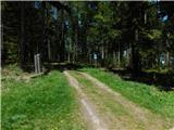 3
3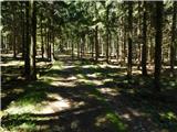 4
4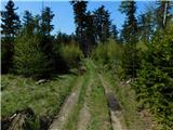 5
5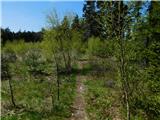 6
6 7
7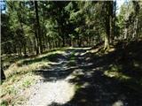 8
8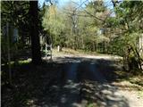 9
9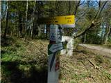 10
10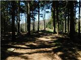 11
11 12
12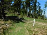 13
13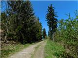 14
14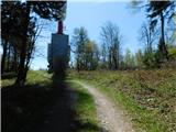 15
15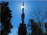 16
16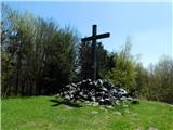 17
17