Gorenje - Gora (Sveti Lovrenc) (gentle path)
Starting point: Gorenje (632 m)
Starting point Lat/Lon: 45.8298°N 14.144°E 
Path name: gentle path
Time of walking: 1 h 45 min
Difficulty: easy unmarked way
Difficulty of skiing: no data
Altitude difference: 387 m
Altitude difference (by path): 420 m
Map: Nanos 1:50.000
Access to starting point:
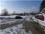
A) From highway Koper - Ljubljana we go to the exit Postojna, and then we continue driving in the direction of Postojna. When we reach old road Ljubljana - Koper we continue right and we drive towards the center of Postojna. Few crossroads ahead we turn left in the direction of Postojna cave, Predjama and Studeno. Further, we drive few more kilometers on the main road towards Predjama, and then we continue straight towards Planina and Studeno. On the main road towards Planina we drive good 200 meters and then we turn left in the direction of village Belsko. A little narrower road quickly brings us in Belsko, where at marked crossroad we turn right in the direction of Gorenje. Further, we drive on a little steeper road, on which we soon get to the beginning of Gorenje. Here we turn slightly right and we drive to the center of the village, where we turn once again right. The village quickly ends, and we continue driving good 100 meters and then we park on an appropriate place by the road.
B) From highway Ljubljana - Koper we go to the exit Unec, and then we continue driving towards Planina. On Planina we reach old road Ljubljana - Postojna, and we follow it to the left (to here we can also come from the direction Kalce at Logatec) and we drive there to a crossroad, where signs for Postojna cave point us to the right. At the end of Planina a road a little steeper ascends, and then it flattens and it brings us to the village Lohača. On the main road we drive also through the village Studeno, and then it starts descending steeper. After a short descent, we will get to a crossroad, where we continue right in the direction of village Belsko. A little narrower road quickly brings us in Belsko, where at marked crossroad we turn right in the direction of Gorenje. Further, we drive on a little steeper road, on which we soon get to the beginning of Gorenje. Here we turn slightly right and we drive to the center of the village, where we turn once again right. The village quickly ends, and we continue driving good 100 meters and then we park on an appropriate place by the road.
Path description:
From the starting point, we continue on the road by which we've parked, and already after few meters it splits into two parts. We continue on the right marked road which is then moderately ascending, and higher turns more to the left. Further, we are gently ascending through a panoramic meadow, from where towards the left a view opens up towards Nanos, and towards the right on Gora or Sveti Lovrenc. A little higher we get to a crossroad, by which we notice some signposts.
From the crossroad, we continue on the left road (straight marked path on Gora, right hunting cottage), which is then ascending gently towards the northwest. Higher, the road is turning more and more to the right, so that it almost circles nearby Župni vrh (946 meters). Further, we for some time walk towards the south, and then the road turns a little more to the left and continues through ample forests of plateau Hrušica. Even a little further, we get to a smaller crossroad north from Srebrni grič (983 meters), where we continue right (left road leads towards the slopes of Veliki Bukovec (1019 meters)). Only about 100 meters ahead we get to the next unmarked crossroad. Here as well, we continue right (slightly left road which leads towards the saddle between Gora (1019 meters) and Špilnik (1018 meters), and there changes into a cart track which descends towards the village Studeno (581 meters)) and we follow the road to its end, or spot where it changes into moderately steep cart track. We continue on the mentioned cart track, and after few minutes of additional walking brings us to the church of St. Lovrenc.
Behind the church, on which there is thermometer and a wish bell we continue right, and then in three minutes of additional walking, we ascend to the summit of Gora (Sveti Lovrenc).
Pictures:
 1
1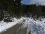 2
2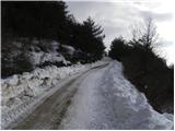 3
3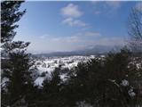 4
4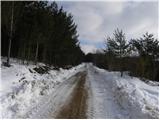 5
5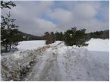 6
6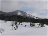 7
7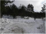 8
8 9
9 10
10 11
11 12
12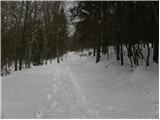 13
13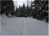 14
14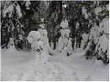 15
15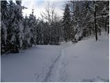 16
16 17
17 18
18 19
19 20
20 21
21 22
22 23
23 24
24 25
25 26
26 27
27 28
28 29
29 30
30 31
31 32
32 33
33