Gorenje pri Zrečah - Rogla
Starting point: Gorenje pri Zrečah (760 m)
Starting point Lat/Lon: 46.40266°N 15.39191°E 
Time of walking: 2 h 35 min
Difficulty: easy marked way
Difficulty of skiing: no data
Altitude difference: 757 m
Altitude difference (by path): 757 m
Map: Pohorje 1:50.000
Access to starting point:
We drive to Zreče, and then we follow the road in the direction of Rogla. After the road sign marking the end of the settlement Zreče, we turn right onto a side road in the direction of Gorenja and Črešnova. Next follows a steeper ascent, and we follow the asphalt road to the beginning of the settlement Gorenje pri Zrečah, where we park in a marked parking lot just before the Center for School and Extracurricular Activities and the Smogavc inn.
Path description:
On the upper side of the parking lot, we reach a marked path that starts in the valley, and we follow the signs for Rogla.
We continue through the center of the settlement, passing the school, and then arrive at Koroška vas, where we turn slightly left onto a side road in the direction of Rogla.
The path ahead leads us past a green house, then we ascend through a strip of forest, and after that, we pass a farm. Above the farm, the path returns to the forest, and a little higher, we continue briefly beside a pasture, then near the next house, we reach an access road, which we follow to the left. The gentle road soon returns to a slightly wider road, which we left at the beginning of village Koroška vas. We follow the road to the left, which leads us past individual houses, and from a smaller crossroad, we go right (slightly left is the road towards Rogla). Next follows a diagonal ascent to the right, and then at a larger, older chapel, we turn left onto a side road and immediately right onto a path in the direction of Rogla. At first, we pass a few houses, then ascend through the forest. Higher up, we approach a farm, behind which we soon reach a road, along which we continue briefly. Further on, at several successive crossings, we follow the blazes, and then, to the left of a renovated chapel, we reach an asphalt road, which we follow a few steps to the left before turning right onto a marked cart track. A little further, we reach another macadam road, which we follow to the right, and in a few minutes, it brings us to a solitary house, which we bypass on the right side; behind it, the road ends, and we continue the ascent on a marked cart track. Next follows an ascent on the cart track, where we follow the blazes at several crossings, and when we reach an indistinct ridge, we join the path from Oplotnica.
A relatively flat path follows, and when we reach a wider cart track, it quickly leads us to a marked crossing.
We continue slightly right towards Rogla, the tower, and the cottage Koča na Jurgovem (to the left are Rogla, the parking lot, hotel Planja, and the church of the Transfiguration of Jesus on the Mountain), ascending moderately at first through the forest and then along the edge of a grassy slope. After a short diagonal ascent, we cross a grazing fence and arrive at the cottage Koča na Jurgovem.
To continue towards Rogla, a few dozen meters before the cottage, we turn left onto a narrower asphalt road, which leads us in a few minutes to the crossroads with the main road Rogla - Pesek.
The mentioned road we only cross, then continue right to the nearby ski track, along which the marked path continues. Further along the path, we notice some educational boards, as our path continues together with the Škratova learning path. Next follows a few minutes of a steeper ascent; at the upper station of the cableway, the path flattens, and to the top of Rogla, where the lookout tower stands, only a short, easy walk remains.
The starting point - Koča na Jurgovem 2:15 Koča na Jurgovem - Rogla 0:20.
Description and pictures refer to the condition in September 2023 and 2024.
Pictures:
 1
1 2
2 3
3 4
4 5
5 6
6 7
7 8
8 9
9 10
10 11
11 12
12 13
13 14
14 15
15 16
16 17
17 18
18 19
19 20
20 21
21 22
22 23
23 24
24 25
25 26
26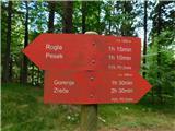 27
27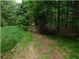 28
28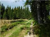 29
29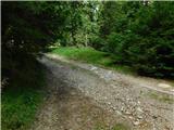 30
30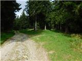 31
31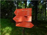 32
32 33
33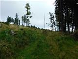 34
34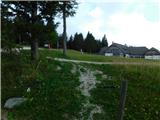 35
35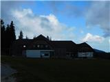 36
36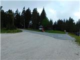 37
37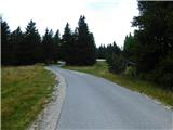 38
38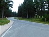 39
39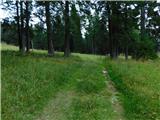 40
40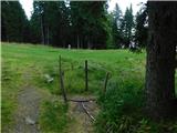 41
41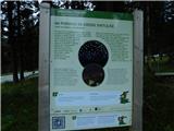 42
42 43
43 44
44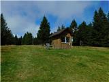 45
45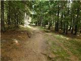 46
46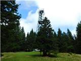 47
47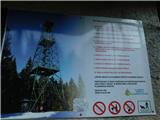 48
48 49
49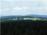 50
50