Gorjuša - Murovica (via Dobovlje)
Starting point: Gorjuša (317 m)
Starting point Lat/Lon: 46.134°N 14.6268°E 
Path name: via Dobovlje
Time of walking: 2 h 40 min
Difficulty: easy marked way
Difficulty of skiing: no data
Altitude difference: 426 m
Altitude difference (by path): 530 m
Map:
Access to starting point:
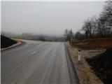
We leave Štajerska highway at exit Domžale, and then we follow the signs for castle Krumperk. The road then leads us past the ski jumping hills SSK Sam Ihan and continues along the high voltage power line. Next follows a relatively short ascent, and then we get to a smaller saddle, where we cross a marked path Domžale - Murovica. Here we park on an appropriate place by the wooden religious symbol. We park still before the castle Krumperk and settlement Gorjuša.
Path description:
Near the religious symbol we notice the blazes, which point us on a cart track which starts ascending towards the south. A moderately steep path mainly leads through the forest, and higher also few unmarked paths join from the nearby starting points. This path we at the crossings follow the rare blazes, and then we follow the path all the way to Veliki vrh, where there is situated an inscription box with an inscription book.
From Veliki vrh we continue straight, on the path which starts moderately descending, and at the crossings we follow otherwise rare blazes. A little lower we come out of the forest and we lightly ascend through a meadow to a macadam road, where there is a marked crossing.
On a marked path continues the path towards Sveta Trojica, and on the macadam road in a minute or two of additional walking, we ascend to the church of St. Kunigunda.
From the church, we return to the last crossing, and then we continue in the direction of Oklo and Sveta Trojica. When we few minutes ahead leave the forest, we cross the route of a high voltage power line, and then we get to equestrian center Konjeniški center Brdo pri Ihanu, where we step on an asphalt road. On the asphalt road at first we descend a little to a crossroad, by which there is a chapel, and then we ascend on the road which continues left from the chapel.
The path ahead leads us on the asphalt road towards the settlement Dobovlje. When we get to Dobovlje an unmarked path branches off to the right towards the church of St. Miklavž and towards Oklo, and we continue straight, at first a little downwards, and then on a gently sloping road which past few houses and through a meadow passes into the forest. In the forest, at the crossroad we continue straight (right - Oklo nad Ihanom), a little further, and at the next crossroad, we go slightly right, on the road by which we notice yellow white blazes. Before the road becomes asphalted, from the right joins also the path which leads past Oklo, and we start ascending past houses in the settlement Žeje. Here at the first crossroad we go left, and when we reach the main road, we go right in the direction of Sveta Trojica.
The path ahead leads us by the main road, where we walk past the fire station, sports field, and then we already get to the settlement Sveta Trojica. Further by the road we are accompanied by the signs of Way of the Cross, and when the road flattens we continue left towards the church of the Holy Trinity, to which we have only 2 minutes of walking. From the church, we return to the last crossroad, and then we continue left to snack bar Okrepčevalnica na Zavrhu, which we bypass on the left side. A little further, we get to a crossroad at the religious symbol, from where we continue on the upper right and still asphalted road which is moderately ascending through the forest. We soon get to a smaller crossing, where a path branches off sharply to the right towards the ruins of the nearby castle and castle well. Here we continue straight and the road which brings us out of the forest, we follow to a hamlet of few holiday cottages, where there is also a smaller parking lot and hiking signposts.
From the signposts, we continue on a marked hiking path in the direction of Murovica and Cicelj. The path ahead at first continues along the fence, and then gradually passes into a dense forest, through which it is mostly moderately ascending. Higher, the path turns a little to the right, and from the left joins also a marked path from the village Zgornja Javoršica. Here we continue straight and after two minutes of additional walking, we get to the top of Murovica, where there are quite a few wooden benches.
The starting point - Veliki vrh 20 minutes, Veliki vrh - Tabor 15 minutes, Tabor - Sveta Trojica 1:15, Sveta Trojica - Murovica 50 minutes.
Trip can be extended to: Cicelj
Pictures:
 1
1 2
2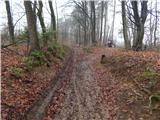 3
3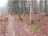 4
4 5
5 6
6 7
7 8
8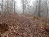 9
9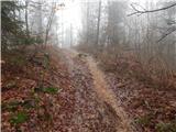 10
10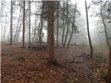 11
11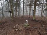 12
12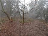 13
13 14
14 15
15 16
16 17
17 18
18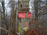 19
19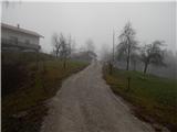 20
20 21
21 22
22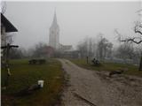 23
23 24
24 25
25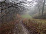 26
26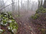 27
27 28
28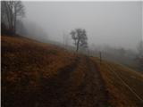 29
29 30
30 31
31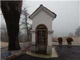 32
32 33
33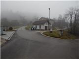 34
34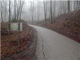 35
35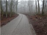 36
36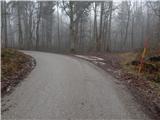 37
37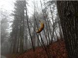 38
38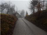 39
39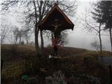 40
40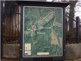 41
41 42
42 43
43 44
44 45
45 46
46 47
47 48
48 49
49 50
50 51
51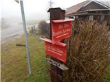 52
52 53
53 54
54 55
55 56
56 57
57 58
58 59
59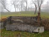 60
60 61
61 62
62 63
63 64
64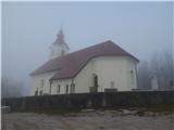 65
65 66
66 67
67 68
68 69
69 70
70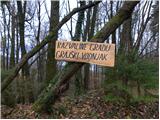 71
71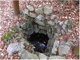 72
72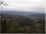 73
73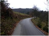 74
74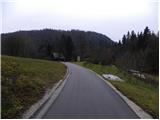 75
75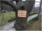 76
76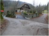 77
77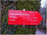 78
78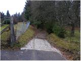 79
79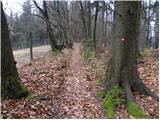 80
80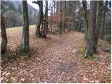 81
81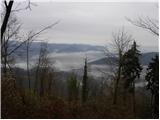 82
82 83
83 84
84 85
85 86
86 87
87 88
88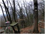 89
89 90
90