Gornja Radgona (OŠ Gornja Radgona) - Norički vrh
Starting point: Gornja Radgona (OŠ Gornja Radgona) (225 m)
Starting point Lat/Lon: 46.67482°N 15.98968°E 
Time of walking: 20 min
Difficulty: easy unmarked way
Difficulty of skiing: no data
Altitude difference: 78 m
Altitude difference (by path): 80 m
Map: Turistična karta Štajerska 1:50.000
Access to starting point:
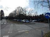
A) We leave Pomurska highway at exit Lenart v Slovenskih goricah, and then we follow the road in the direction of Gornja Radgona. When we get to Gornja Radgona, in the center of the town we turn right in the direction of bus stop, cemetery and primary school. After the bus stop, the road starts ascending, and we are driving there to a larger parking lot between primary school Gornja Radgona and cemetery Gornja Radgona.
B) We drive to Radenci, and then we follow the road towards Gornja Radgona, where in the center of the town we turn sharply left towards the bus stop, primary school and cemetery. After the bus stop, the road starts ascending, and we are driving there to a larger parking lot between primary school Gornja Radgona and cemetery Gornja Radgona.
Path description:
From the parking lot, we continue on the road or sidewalk ahead, where we quickly get to the settlement Hercegovščak. A little further, the sidewalk ends, and we go left towards Police, where past a pond we get to the settlement Norički Vrh. Next follows some of a steeper ascent, and when the road turns right, at the sign which from the opposite side marks the beginning of the settlement, we leave it and we continue sharply left on at first a wider cart track. The cart track quickly narrows and is ascending among vineyards, where with nice views, we get below Norički vrh. Here the path at first turns right, and few steps ahead from the turn, on the fence we notice a door through which we step on the panoramic peak.
Description and pictures refer to a condition in March 2021.
On the way: Hercegovščak (247m), Norički Vrh (255m)
Pictures:
 1
1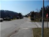 2
2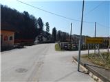 3
3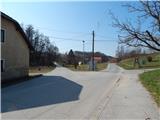 4
4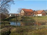 5
5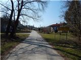 6
6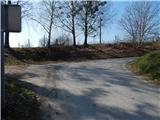 7
7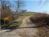 8
8 9
9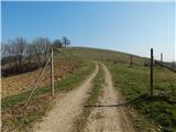 10
10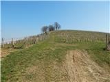 11
11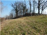 12
12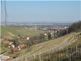 13
13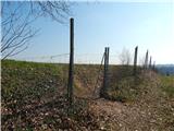 14
14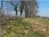 15
15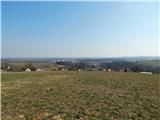 16
16