Greuth - Große Muschenig (via Maria Elender Alm)
Starting point: Greuth (554 m)
Starting point Lat/Lon: 46.5209°N 14.1023°E 
Path name: via Maria Elender Alm
Time of walking: 1 h 45 min
Difficulty: easy marked way
Difficulty of skiing: no data
Altitude difference: 467 m
Altitude difference (by path): 467 m
Map: Karavanke - osrednji del 1:50.000
Access to starting point:
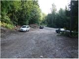
A) Through the Karawanks Tunnel, we drive to Austria, and then we drive on the highway towards Beljaku, which we leave on the first exit. From the point, when we left the highway, we follow the signs for Šentjakob v Rožu / Sankt Jakob im Rosental. Further, we drive few more kilometers on the main road, after that only a little after the settlement Podgorje / Maria Elend we turn right in the village Rute / Greuth. Further, we drive on a narrower road (at the crossroads we stick to slightly right direction), which soon brings us to a narrow underpass under the railway track. Further, we drive past few more houses, and then at the end of the village, we get to a smaller crossroad, by which we notice hiking signposts. We park on an appropriate place by the crossroad.
From toll station in Hrušica to the starting point, there is approximately 23 km.
B) Over the border crossing Ljubelj we drive to Austria, and then we drive on the main road to a roundabout before the bridge over the river Drava. In the roundabout, we leave the main road which leads towards Celovec / Klagenfurt and we continue driving left (direction west) on exit in the direction of Bistrica v Rožu / Feistritz im Rosental. Further, we drive through several smaller settlements, and after the settlement Sveče / Suetschach we need to pay attention. Only about 3 km after the mentioned settlement, we will leave the main road and continue to drive left in the direction of village Rute / Greuth. Further, we drive through the village on a narrower road (at the crossroads we stick to the slightly right directions), which soon brings us to a narrow underpass under the railway track. Further, we drive past few more houses, and then at the end of the village, we get to a smaller crossroad, by which we notice hiking signposts. We park on an appropriate place by the crossroad.
From the entrance into a tunnel, and to the starting point, there is approximately 32 km.
Path description:
From the starting point, we go on the right road in the direction of the mountain pasture Ilič / Illitchalm, Podgorska planina / Maria Elender Alm and Veliki Mošenik / Große Muschenig. The road which is closed for public traffic at first leads through the forest and then it quickly brings us to a stream Velika Suha. We continue on a moderately ascending road which passes below the steep slopes, which are exposed to falling stones. Scenic path, by which we can also notice several smaller waterfalls, higher brings us to a marked crossing.
From the crossing, we continue on the left road (right mountain pasture Ilič), which at first crosses a stream and then it ascends diagonally on a steep slope. Higher, the road passes into the forest and gradually flattens. Few minutes we still walk through the forest and then we step on the mountain pasture Podgorska planina, where on the right side we notice a hunting cottage.
Above the mountain pasture, the road returns into the forest and it brings us to the smaller crossroad, where we continue left in the direction of the path 674a. We continue the ascent on a little worse road, and it already after few minutes brings us to a crossroad of multiple roads, where there is a marked crossing.
At the mentioned crossroad, we leave the road and we continue left on a cart track in the direction of "Aussichtspunkt". We quickly leave the wide cart track, because blazes point us slightly to the right on a worse cart track which starts ascending on a slope straight upwards. This path which continues through the forest, we then follow all the way to a vegetated peak, which we recognize by the sign on a tree G. M. 2021 m.
Pictures:
 1
1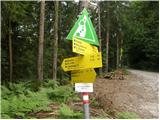 2
2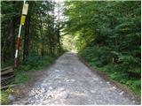 3
3 4
4 5
5 6
6 7
7 8
8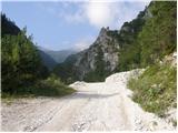 9
9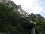 10
10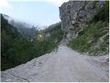 11
11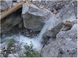 12
12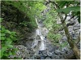 13
13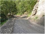 14
14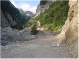 15
15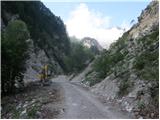 16
16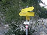 17
17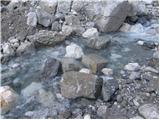 18
18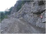 19
19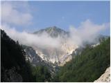 20
20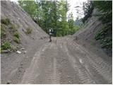 21
21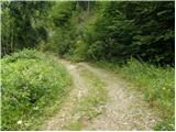 22
22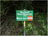 23
23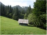 24
24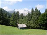 25
25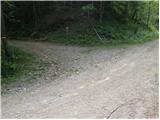 26
26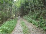 27
27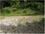 28
28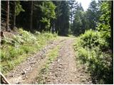 29
29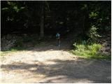 30
30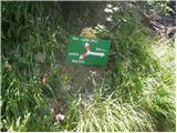 31
31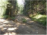 32
32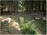 33
33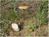 34
34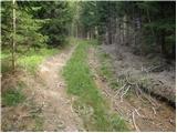 35
35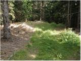 36
36 37
37