Hintergupf - Matzen (via St. Anna)
Starting point: Hintergupf (940 m)
Starting point Lat/Lon: 46.5199°N 14.3938°E 
Path name: via St. Anna
Time of walking: 3 h
Difficulty: difficult marked way
Difficulty of skiing: no data
Altitude difference: 687 m
Altitude difference (by path): 745 m
Map: Karavanke - osrednji del 1:50.000
Access to starting point:
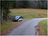
From highway Ljubljana - Jesenice we go to the exit Ljubelj (Tržič), and then we continue driving in the direction of Celovec / Klagenfurt. After Ljubelj tunnel the road starts descending, and we follow it to the crossroad, where slightly right and downwards road towards the settlement Borovlje / Ferlach branches off. The road which is still descending quickly brings us to the mentioned settlement, where we soon cross the railway track. Only a little after the track we join the other road which we follow to the left, and we are driving there only few 100 meters and then we turn right in the direction of Železna Kapla / Bad Eisenkapel. At the end of Borovlje we get to a roundabout, from which we again continue in the direction of Železna Kapla. We continue driving through the village Medborovnica / Unterferlach, Ostrovca / Ostrouza, Trata / Tratten, Glinje / Glainach, Vesca / Dörfl, Ždovlje / Seidolach, Dobrova / Dobrowa to the settlement Kočuha / Gotschuchen, where we turn right in the direction of hamlet Zavrh / Hintergupf. From the spot, when we leave the main road we start ascending steeper on at first still asphalt, and higher on a well maintained macadam road. Just before the hamlet Zavrh we get to a smaller crossroad, where we continue right and we drive to a hamlet, in the middle of which we notice hiking signposts. From the signposts and nearby houses on the road we drive few 10 meters more and then we park on an appropriate place by the road.
To the starting point, we can get to also from the direction Železna Kapla and Koroška.
Path description:
From the spot, where we've parked, we return to the nearby houses, and from there we continue on a marked path number 636. The path at first ascends by the house, and behind it passes on a grassy cart track which is ascending gently by the edge of a larger meadow. On the other side of the meadow, the path goes into the forest and is for few minutes still ascending gently, and then it turns to the right and for some time a little steeper ascends. During the ascent, we cross few cart tracks, and then we join a worse forest road which we follow to the left. Further, we for some time walk on a gently sloping road, on which we eventually get to a smaller crossroad, where we continue right (possible also straight on unmarked shortcut - beaten footpath which is approximately 5 minutes shorter than on the road). Next follows a short descent, and then the road turns sharply to the left and is ascending gently to the spot, where we join a wider macadam road. The mentioned road, we follow uphill, and we ascend there to a saddle Koce / Hansenruhe, where there is a marked crossing.
Here far left continues the road which leads towards Borovnica dammed lake, left leads the path towards Javornik / Jauernig and forward towards the summit Setiče / Freiberg, and in the direction of straight continues the path which descends in Bajdiše / Waidisch, and we continue sharply right on a marked path in the direction of the summit Macna / Matzen.
The path ahead leads us past a resting place (table and two benches) and continues on at first gentle ridge. Only a little further marked path splits into two parts, and we continue on the right path in the direction of the church of St. Ana / St. Anna and Macna past St. Ana (slightly left Macna - direct path).
From the crossing ahead, the path quickly passes on northeastern slopes of Macna, on which it starts ascending diagonally. We continue through the forest, only on the part where we pass on steeper and unvegetated slope, a beautiful view opens up towards river Drau and surrounding mountains. The path quickly returns into the forest, and few minutes ahead it brings us to the church of St. Ana, from which a beautiful view opens up.
Before the church of St. Ana we continue left and through the forest, we ascend on the ridge of Macna. The path ahead continues on a partly vegetated ridge and at first, it is only gently ascending. Next a short steep ascent follows, where from the right side of the ridge we pass on the left side, and then we for some time cross slopes, but we soon return on the ridge, which we reach on some sort of notch. Here a short secured, but not very difficult path on a side secondary peak of Macna branches off to the right, from which a nice view opens up. And the marked path which continues towards Macna doesn't turn on the mentioned secondary peak, but it continues slightly left, where we at first ascend with the help of steel cables, and then the path flattens and it turns left on steep slopes. Through the steep part we also get help from a steel cable, and the path at the end of the crossing turns right and by the steel cable starts very steeply ascending. The steep part is short, because the path quickly brings us to the cross on the northern secondary peak of Macna. Here the path turns to the left and on a slightly vegetated ridge quickly brings us on the highest and unvegetated peak of Macna.
Pictures:
 1
1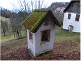 2
2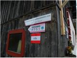 3
3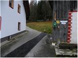 4
4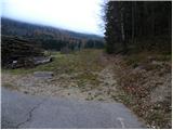 5
5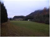 6
6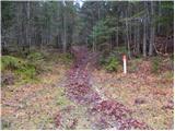 7
7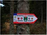 8
8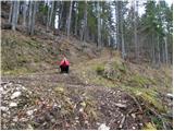 9
9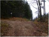 10
10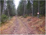 11
11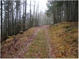 12
12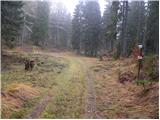 13
13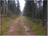 14
14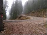 15
15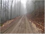 16
16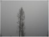 17
17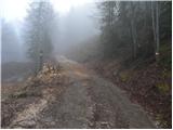 18
18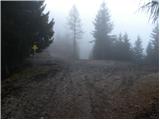 19
19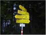 20
20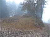 21
21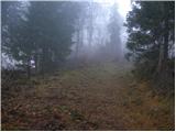 22
22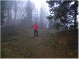 23
23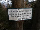 24
24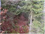 25
25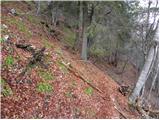 26
26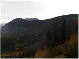 27
27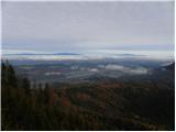 28
28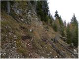 29
29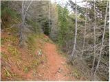 30
30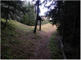 31
31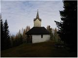 32
32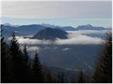 33
33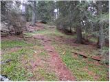 34
34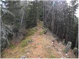 35
35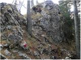 36
36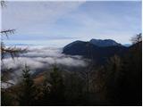 37
37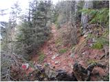 38
38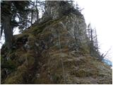 39
39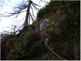 40
40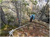 41
41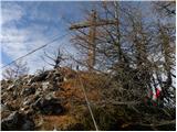 42
42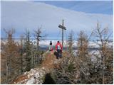 43
43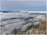 44
44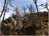 45
45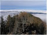 46
46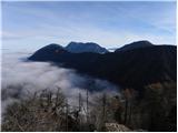 47
47