Hotavlje - Dom na Slajki (via Bela)
Starting point: Hotavlje (409 m)
Starting point Lat/Lon: 46.1072°N 14.1176°E 
Path name: via Bela
Time of walking: 1 h 30 min
Difficulty: easy unmarked way
Difficulty of skiing: no data
Altitude difference: 380 m
Altitude difference (by path): 400 m
Map: Škofjeloško in Cerkljansko hribovje 1:50.000
Access to starting point:
A) From Železniki, Kranj or Medvode we drive to Škofja Loka, and from there we continue driving in the direction of Gorenja vas in the valley Poljanska dolina and Žiri. After Gorenja vas, in the settlement Hotavlje, at the crossroad behind inn Gostilna Lipan we leave the main road towards Žiri and we continue driving right in the direction of the ski slope Cerkno and village Leskovica. Immediately after the crossroad, we park on an appropriate place by the road.
B) From Horjul or Polhov Gradec we drive to Lučine, from there we descend into Gorenja vas. In Gorenja vas we continue left towards Žiri, after that in Hotavlje at the crossroad behind inn Gostilna Lipan we continue right in the direction of the ski slope Cerkno and village Leskovica. Immediately after the crossroad, we park on an appropriate place by the road.
C) From Vrhnika, Logatec or Spodnja Idrija we drive to Žiri, and from there we continue driving towards Gorenja vas and Škofja Loka, and we drive on the main road only to the settlement Hotavlje, where we turn left in the direction of the ski slope Cerkno and village Leskovica. Immediately after the crossroad, we park on an appropriate place by the road.
D) First, we drive to Cerkno, and from there we continue driving through saddle Kladje (Podlanišče) towards Sovodenj. From Sovodenj we continue driving by the stream Hobovščica, and then in a little larger crossroad we continue left in the direction of Gorenja vas (right Žiri). On the main road towards Škofja Loka we drive to the settlement Hotavlje, where we turn left in the direction of the ski slope Cerkno and village Leskovica. Immediately after the crossroad, we park on an appropriate place by the road.
Path description:
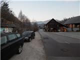
From the starting point, where nearby there is a vending machine of farm Pr Šupc we continue on the road towards the village Leskovica and in the direction of hiking paths on Blegoš, Ermanovec and Slajka. Few minutes we walk by the edge of the road, partly also on a sidewalk, and then signs for Ermanovec and Slajka point us to the left (straight - Blegoš), where over the bridge we cross Kopačnica, and immediately after the bridge at the church of St. Lovrenc we continue left (right - marked path on Slajka and Ermanovec).
Immediately after the church we go right, at first still on the asphalt road which leads to the nearby house, and still before the house we go on a cart track which ascends diagonally to a double hayrack, which we bypass on the right side. When the cart track a little higher turns right, from the left joins the path which starts near the confluence of the rivers Kopačnica and Poljanska Sora (near the crossroad, where we've parked, but on the right bank of Kopačnica, so that we can get here also on this path), and we continue right and we diagonally ascend through a meadow into the forest, through which the path then continues. In the forest, the cart track makes few hairpin turns, and when signs for Slajka point us to the right, we leave it and we short time continue on a forest footpath. We soon return on a cart track which we follow to the right, and a little higher we join the path from Podgora.
We continue right on a wider footpath which soon widens into a cart track, and it turns a little left and at the hunting observatory comes out of the forest. Here by the lower edge on a cart track we cross a meadow, and when we reach the macadam road we follow it to the right. The road soon starts descending and in few minutes brings us to a crossroad, where we reach an asphalt road. On the asphalt road, we ascend to the nearby crossroad from which we continue right in the direction of Slajka.
Next follows an ascent on the asphalt road, and when we leave the forest, from the right joins the marked path from Hotavlje. Asphalt road then leads us past the bench, where the path branches off to the right towards Vrh Slajke, and the road which semicircular turns to the left we follow to the nearby farm, from which to the mountain hut Dom na Slajki separates us only a minute of walking.
Description refers to a condition in December 2020, and pictures are from January and December 2020.
Pictures:
 1
1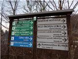 2
2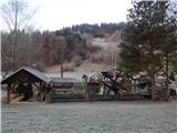 3
3 4
4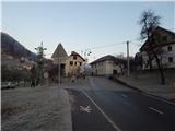 5
5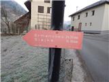 6
6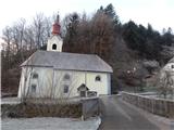 7
7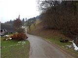 8
8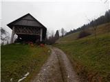 9
9 10
10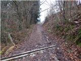 11
11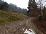 12
12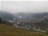 13
13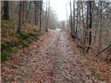 14
14 15
15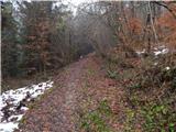 16
16 17
17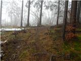 18
18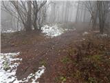 19
19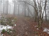 20
20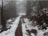 21
21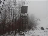 22
22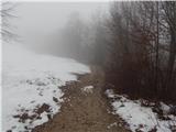 23
23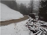 24
24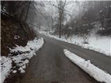 25
25 26
26 27
27 28
28 29
29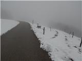 30
30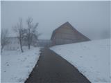 31
31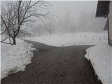 32
32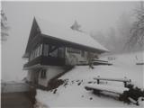 33
33