Izlake - Koča na Čemšeniški planini
Starting point: Izlake (307 m)
Starting point Lat/Lon: 46.1582°N 14.9242°E 
Time of walking: 2 h 45 min
Difficulty: easy marked way
Difficulty of skiing: no data
Altitude difference: 813 m
Altitude difference (by path): 815 m
Map: Posavsko hribovje - zahodni del 1:50.000
Access to starting point:
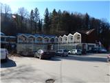
A) We leave the Štajerska highway at the Trojane exit, then follow the signs for Izlake and Zagorje. There follows some descent, then we arrive in the valley of the Orehovica stream. Further, we drive through the mentioned valley, and when we get to the settlement Izlake, just a few meters after the road sign which marks the beginning of the settlement, we turn right and park on the parking lot by the former Medijske toplice spa; today only Bar And Lounge Carpe Diem is open.
B) We drive to Moravče, then follow the road towards Izlake. When we reach the main road Zagorje ob Savi - Izlake, we continue left towards Izlake; before the end of the settlement Izlake we turn left onto the parking lot in front of the former Medijske toplice spa.
C) From the Litija - Hrastnik road, we drive to the settlement Zagorje ob Savi, then follow the signs for Izlake. When we get to Izlake we drive through the settlement on the main road; before the end of the settlement we turn left and park on the parking lot by the former Medijske toplice spa.
Path description:
From the parking lot by the former Medijske toplice spa we continue towards the centre of Izlake, then at the pedestrian crossing we carefully cross the main road and continue on the road which branches off from the main one by the Tuš market Ajda store.
We continue in the direction of Čemšeniška planina and continue walking on the asphalt road, which gently ascends, first still past houses, then past several meadows and individual houses. The gentle road which leads us along the Lesjem stream brings us after a while to a junction, where to the left the road branches off towards the part of the hamlet Brde; we continue straight ahead, and we leave the Lesji potok valley at the spot where the mountain signpost from the road directs us sharply to the left onto the marked footpath. After a shorter traverse ascent the path turns sharply right, a few minutes higher it crosses a cart track. The path ahead leads us through the forest and gradually widens into a cart track which brings us out of the forest. There follows a few minutes of scenic walking and we already reach the village Čemšenik, where at several successive junctions we carefully follow the markings. In a somewhat larger junction in the middle of the village we go left, so that on the right we bypass the Pošta Slovenije branch and the Andrej store, on the left the parish church of Mary's Assumption.
A little further, at the smaller junction we go sharply right in the direction of the markings and bio products pr jezični Alenki. The steep road then leads us past the mentioned farm, at the water reservoir the asphalt ends. We continue on the macadam road, from the nearby junction we go left. We leave the macadam road only a little further and continue right on the marked footpath, which begins to ascend more steeply through the forest. Higher, for a short time we step back onto the road, from it we soon go slightly left on the footpath which leads us past a smaller spring. Higher we cross a somewhat larger clearing, when we return to the forest, from the right a marked path from Zagorje or Kisovec also joins us.
We continue in the direction of Čemšeniška planina and ascend diagonally quite steeply. The traverse ascent ends when we reach the ridge of Čemšeniška planina, at the mentioned spot we also join the path from Trojane or Prvin.
We continue right and continue the ascent on the gentle macadam road, which a little higher we leave and continue slightly right on the marked footpath, which leads us with nice views on Zasavje and Posavsko hribovje with the highest Kum, in the distance we also see Snežnik. A little further we cross a strip of forest, the path then levels out and crosses a steep grassy slope, where when icy there is great danger of slipping, otherwise the path is wide and technically undemanding. A little before the mountain hut we cross the route of a cargo cableway, then with nice views we walk to the mountain hut.
Izlake - Čemšenik 1:25, Čemšenik - Dom na Čemšeniški planini 1:20.
Description and pictures refer to the condition in the year 2019 (February).
On the way: Čemšenik (631m)
Pictures:
 1
1 2
2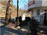 3
3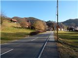 4
4 5
5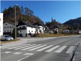 6
6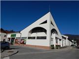 7
7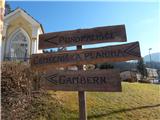 8
8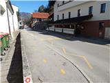 9
9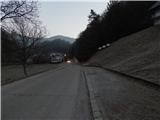 10
10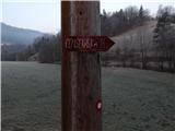 11
11 12
12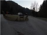 13
13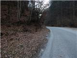 14
14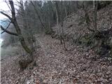 15
15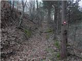 16
16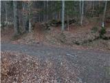 17
17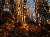 18
18 19
19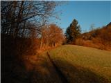 20
20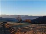 21
21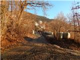 22
22 23
23 24
24 25
25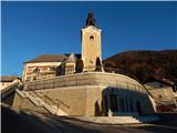 26
26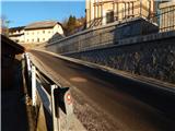 27
27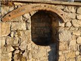 28
28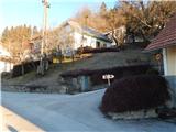 29
29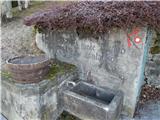 30
30 31
31 32
32 33
33 34
34 35
35 36
36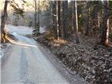 37
37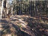 38
38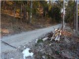 39
39 40
40 41
41 42
42 43
43 44
44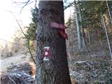 45
45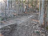 46
46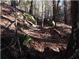 47
47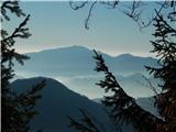 48
48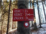 49
49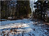 50
50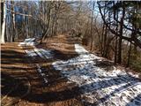 51
51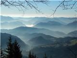 52
52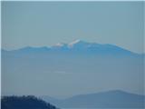 53
53 54
54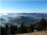 55
55 56
56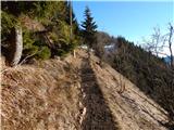 57
57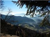 58
58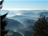 59
59 60
60 61
61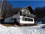 62
62