Javorje - Mala Rodica (via Lepa Suha)
Starting point: Javorje (1050 m)
Starting point Lat/Lon: 46.2496°N 13.8675°E 
Path name: via Lepa Suha
Time of walking: 2 h 20 min
Difficulty: easy pathless terrain
Difficulty of skiing: easily
Altitude difference: 851 m
Altitude difference (by path): 851 m
Map: TNP 1:50.000
Access to starting point:
From highway Ljubljana - Jesenice we go to the exit Lesce and follow the road towards Bled and forward towards Bohinjska Bistrica and lake Bohinj. After the settlement Laški Rovt we will get to a smaller crossroad, where the road which leads towards the starting point of the path on Rodica, mountain pasture Suha, Šija, Vogel... and scout camp Laški Rovt branches off to the left. Macadam road immediately passes into the forest and at first ascend past the mentioned scout camp, and then it is few kilometers relatively steeply ascending. After a little less than 6.5 km of driving on a macadam, we will get to a little bigger crossroad, where a road towards the mountain pasture Planina Storeča raven (starting point of the path on Vogel) branches off to the right. Here we continue straight and after approximately 50 meters of additional driving, we get to the left turn, where there is a starting point of the path towards Planina Suha. We park on an appropriate place by the road.
Path description:
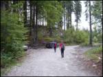
Near the parking lot, on the west side of the torrent we notice a marked footpath which leads towards the mountain pasture Planina Suha. The path is at first ascending on the right side of the torrent, and then it joins it. After few steps of walking on torrential gravel marked path turns to the right and entirely flattens. Gentle walk quickly interrupts steep ascent on a relatively steep slope. The steepness then a little decreases and well-marked path then leads us through a dense forest on and by a torrent upwards. A little higher, the marked path withdraw from the torrent to the left and after few minutes joins it again. The path which then runs on the right side of the torrent soon brings us out of the forest on an ample mountain pasture Suha.
From the mountain pasture, we continue past a shepherd hut by the deposits of torrential gravel. In parts very poorly visible footpath in the upper part of the mountain pasture turns slightly left. Further, the path that starts turning slightly to the right is much easier to follow. After a short ascent, we bypass the hunting cottage, which we notice on the right side.
The path then starts ascending steeper on a slope, which is partly covered with dwarf pines. This increasingly panoramic path, higher brings us to a little bigger cairn, where there is a crossing (straight marked path on a saddle Čez Suho, left unmarked path over Lepa Suha).
For the ascent on Mala Rodica I recommend left path, which will lead us over Lepa Suha. First few steps from the spot, when we leave the marked path is "our" footpath a little poorly visible and then becomes distinct and easy to follow. The path soon turns to the left and starts ascending diagonally on a slope, which is partly vegetated with dwarf pines. Higher, the path brings us on an indistinct side ridge, after which it flattens. The further path is turning towards the right and a little higher brings us in smaller, but distinct small valley (Lepa Suha) through which we are then ascending. The footpath on which we walk is getting worse, and we soon leave it, because we go left on a relatively steep grassy slope straight upwards (we can continue also through a small valley all the way to a marked path, but for the ascent on Mala Rodica we have to quickly leave it). Further, we are ascending on pathless terrain all the way to the top of Mala Rodica, which we reach without any bigger technical problems after 20 minutes of pathless ascent (from the valley Lepa Suha).
From Mala Rodica we can on an unmarked path in 10 minutes ascend to Velika Rodica and then we descend on normal marked path. On Mala Rodica we can also come, if we ascend on a marked path on Velika Rodica and from there we descend to Mala Rodica.
The orientation is difficult in the fog.
The starting point - Planina Suha 1:00, Planina Suha - Mala Rodica 1:20.
Pictures:
 1
1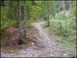 2
2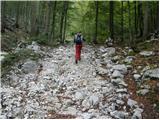 3
3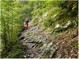 4
4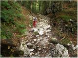 5
5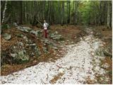 6
6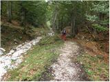 7
7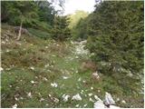 8
8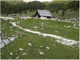 9
9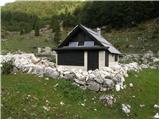 10
10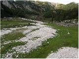 11
11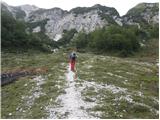 12
12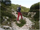 13
13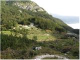 14
14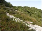 15
15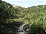 16
16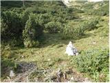 17
17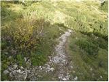 18
18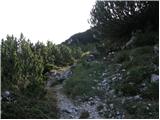 19
19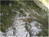 20
20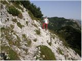 21
21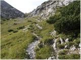 22
22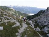 23
23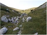 24
24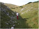 25
25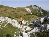 26
26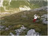 27
27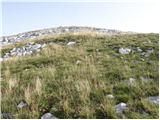 28
28 29
29