Javorje - Šija (via Kratki plaz)
Starting point: Javorje (1050 m)
Starting point Lat/Lon: 46.2496°N 13.8675°E 
Path name: via Kratki plaz
Time of walking: 2 h 40 min
Difficulty: easy unmarked way
Difficulty of skiing: partly demanding
Altitude difference: 830 m
Altitude difference (by path): 830 m
Map: TNP 1:50.000
Access to starting point:
From highway Ljubljana - Jesenice we go to the exit Lesce and follow the road towards Bled and forward towards Bohinjska Bistrica and lake Bohinj. After the settlement Laški Rovt we will get to a smaller crossroad, where the road which leads towards the starting point of the path on Rodica, mountain pasture Suha, Šija, Vogel... and scout camp Laški Rovt branches off to the left. Macadam road immediately passes into the forest and at first ascend past the mentioned scout camp, and then it is few kilometers relatively steeply ascending. After a little less than 6.5 km of driving on a macadam, we will get to a little bigger crossroad, where a road towards the mountain pasture Planina Storeča raven (starting point of the path on Vogel) branches off to the right. Here we continue straight and after approximately 50 meters of additional driving, we get to the left turn, where there is a starting point of the path towards Planina Suha. We park on an appropriate place by the road.
Path description:
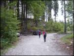
Near the parking lot, on the west side of the torrent we notice a marked footpath which leads towards the mountain pasture Planina Suha. The path is at first ascending on the right side of the torrent, and then it joins it. After few steps of walking on torrential gravel marked path turns to the right and entirely flattens. Gentle walk quickly interrupts steep ascent on a relatively steep slope. The steepness then a little decreases and well-marked path then leads us through a dense forest on and by a torrent upwards. A little higher, the marked path withdraw from the torrent to the left and after few minutes joins it again. The path which then runs on the right side of the torrent soon brings us out of the forest on an ample mountain pasture Suha.
Behind first cottage on the mountain pasture, we will on the right side notice signs Vogel. We go after those signs which brings us on a badly beaten footpath. We follow it upwards at first over some grass, and then the path goes into dwarf pines. The path is at the beginning marked, and then the footpath slowly vanishes and then blazes vanish as well. The path for many years hasn't been marked so that also those blazes are poorly visible. When the footpath vanishes we follow passage among dwarf pines, which are in parts hard to find. Here and there we notice traces but only for a short time. The path then after approximately one hour from the mountain pasture brings us on the saddle between Zavitar (right) and top of the cableway on Vogel (left).
Here we go left towards the top of the cableway, which we see. Here pathless terrain ends. We go on a cart track which in a gentle descent brings us on a ski track below one-seater chairlift on Visoki Orlov rob. Here we ascend to the top of one-seater chairlift Visoki Orlov rob, where we also step on a marked path (further orientation is easier). Ahead we walk on the path which descends a little from Orlove glave and brings us below the foot of Šija. The path then again slightly ascends and it brings us to a crossing, where we continue straight in the direction of Šija (left Rodica, right Vogel). The path ahead becomes pretty steep and in five minutes of walking on the upper slope brings us on a grassy peak.
Orientation between the mountain pasture Suha and cableways on Vogel is very difficult, therefore I don't recommend an ascent in a fog.
The starting point - Planina Suha 1:00, Planina Suha - Šija 1:40.
Pictures:
 1
1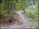 2
2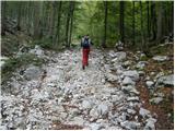 3
3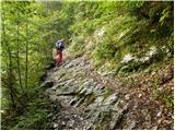 4
4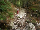 5
5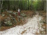 6
6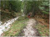 7
7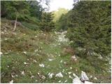 8
8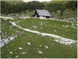 9
9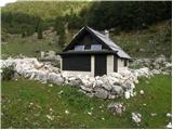 10
10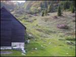 11
11 12
12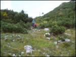 13
13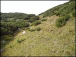 14
14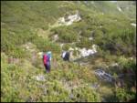 15
15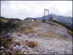 16
16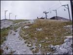 17
17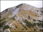 18
18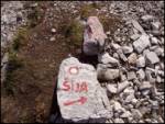 19
19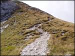 20
20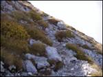 21
21 22
22