Juranščina - Ivanščica (via valley of stream Brana)
Starting point: Juranščina (340 m)
Path name: via valley of stream Brana
Time of walking: 2 h
Difficulty: easy marked way
Difficulty of skiing: easily
Altitude difference: 721 m
Altitude difference (by path): 721 m
Map:
Access to starting point:
a) We arrive in Croatia via the border crossing MP Gruškovje / Macelj. We leave the Macelj-Zagreb motorway near the town of Zabok. We then continue towards Bedekovčina, Zlatar Bistrica. After the settlement of Poznanovec, we leave the main road and head towards Mače, Zlatar (it is also possible to reach Zlatar by continuing straight and turning in the town of Zlatar-Bistrica). In the settlement of Zlatar, we will notice signs for Belec, which is another fifteen minutes on a poorer road.
b) From Prekmurje, we drive onto the Goričan-Zagreb motorway and exit at Novi Marof. From Novi Marof, we continue towards Zlatar, but only as far as Budinščina, where we turn onto a worse road that takes us to the village of Belec after twenty minutes.
The official start of the trail is at the church in Belec, but from there to "our" starting point in the village of Juranščina it is half an hour's walk on asphalt.
Path description:
The official start of the trail is at the church in the village of Belec. I recommend driving further to the village of Juranščina, as it is half an hour's walk on flat asphalt to it.
In Juranščina there is a junction where we will notice mountaineering signposts. We go left towards Belecgrad (right Kopanja and Židovina). Asphalt ends soon, and the trail enters the forest (there are still some parking spots here).
We walk through the forest on a mostly level path, but between the trees we get some views of the ruins of Belecgrad castle, and on the left side of the path flows the pleasant Brana stream descending to the valley in numerous rapids. After half an hour of walking we reach the Mountain Hut Belecgrad.
Behind the hut is a larger junction from which we continue straight (right to summit Minđalovec, left path by Belecgrad and Beligah). Soon we reach a short spruce forest section, then the trail leads to a water supply facility. From here the valley along Brana stream narrows increasingly, and the path becomes steeper.
Higher up the trail turns right, crossing a steeper section where there is a slip risk when wet. At the next left bend a somewhat more demanding section follows, with the main difficulty being slippery ground and slight exposure. The trail turns right again to the north side. Entering a thinner forest belt, another junction appears where right leads to summit Hanjžico, we go straight. After a few minutes we leave the cart track right into the forest (continuing on the cart track would lead to the service road to Ivanščica summit).
The trail steepens again, crossing another forest cart track during ascent. After a few minutes we leave the forest and reach a service road which we follow.
During the ascent on the road the trail passes another junction where an asphalt road branches to the former barracks, we continue straight then at the bend leave the road joining the Mrzljak trail from Ivanc. Few minutes in forest, then onto a road leading to Mountain Hut Pasarićeva koča and nearby summit.
Juranščina - Belecgrad hut 45 min
Belecgrad hut - road 1:00 h
road - summit 15 min
On the way: Planinska koča Belecgrad (440m)
Pictures:
 1
1 2
2 3
3 4
4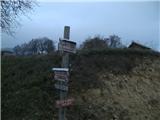 5
5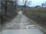 6
6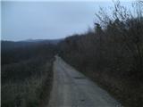 7
7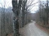 8
8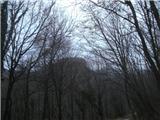 9
9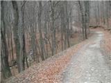 10
10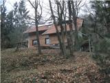 11
11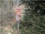 12
12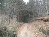 13
13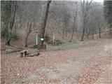 14
14 15
15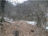 16
16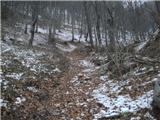 17
17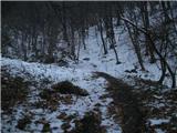 18
18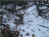 19
19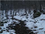 20
20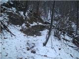 21
21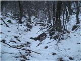 22
22 23
23 24
24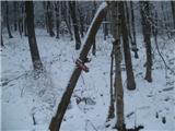 25
25 26
26 27
27 28
28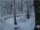 29
29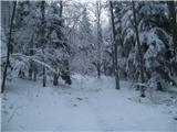 30
30 31
31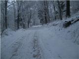 32
32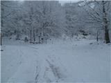 33
33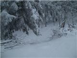 34
34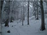 35
35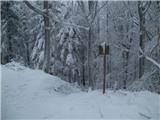 36
36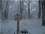 37
37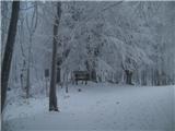 38
38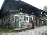 39
39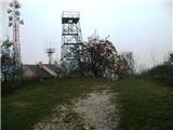 40
40