Kisla voda - Golarjeva peč
Starting point: Kisla voda (1140 m)
Starting point Lat/Lon: 46.4323°N 14.6409°E 
Time of walking: 30 min
Difficulty: easy unmarked way
Difficulty of skiing: no data
Altitude difference: 136 m
Altitude difference (by path): 150 m
Map: Kamniške in Savinjske Alpe 1:50.000
Access to starting point:
A) Via the mountain pass Volovljek (Kranjski Rak) or from Mozirje we drive to Luče, from there we continue driving towards Logarska dolina. A few kilometers after the settlement Solčava we will come to an intersection, where the road into Logarska dolina branches off to the left, we continue straight in the direction of the mountain pass Pavličev vrh (Pavličevo sedlo) and Solčava Panoramic Road. From the road on which we continue driving, soon the road to Matkov kot branches off to the left, a little higher we arrive at the next intersection (the intersection is located in the middle of a sharp left bend), where we continue right or straight in the direction of the panoramic road and Podolševa (left Pavličev vrh and further Austria). We then drive along the panoramic road, which is initially asphalted for some time, until the parking lot above the spring of Kisla voda or iron water. At the parking lot there are signs for Kisla voda.
B) Via the border crossing Jezerski vrh we drive to Austria, there in the valley of Bela / Vellach we turn right in the direction of the border crossing Pavličev vrh (Pavličevo sedlo) / Paulitchsattel. When we arrive on the Slovenian side we descend for a short time, then we turn left in the direction of the panoramic road and Podolševa (straight down Logarska dolina and Solčava). We then drive along the panoramic road, which is initially asphalted for some time, until the parking lot above the spring of Kisla voda or iron water. At the parking lot there are signs for Kisla voda.
C) We drive to Črna na Koroškem (to here from Ravne na Koroškem or from Šoštanj via the mountain pass Spodnje Sleme), then we continue driving towards Luče. Initially still an asphalt road, higher it becomes macadam and brings us to the intersection of several roads at the mountain pass Spodnje Sleme. We continue on the main road, which begins to descend transversely towards the settlement Podolševa. At the intersection where the road to Solčava branches off sharply to the left we continue straight in the direction of the panoramic road and Podolševa. Behind the Church of the Holy Spirit the road begins to descend gradually, we drive along it to the parking lot at the spring of Kisla voda.
Path description:
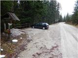
From the parking lot we continue on the macadam road towards the Church of Sv. Duha in Podolševa (if we arrived at the starting point by description c, we head in the direction from which we came), thus along the panoramic road. The road first crosses a stream, then through the forest brings us to a smaller intersection, where we continue on the main road (left forest road). After the intersection we cross another stream, then in a moderate ascent we arrive from the forest to a scenic hay meadow, from where a nice view opens up on Golarjeva peč and Kamniško Savinjske Alpe. The road bypasses the hay meadow on the left upper side, where it also arrives at a smaller saddle, on which there is a smaller intersection and next to it a table with bench, nearby also a smaller wooden cross.
On the mentioned saddle we leave the panoramic road and continue the trail right on the worse road, which descends slightly and quickly brings us to the turning area. After the turning area the road turns into a wide cart track, from it a somewhat narrower and ascending cart track branches off to the left, on which we continue the ascent. At the next junction we continue slightly right quite steeply upwards. The cart track soon levels out and brings us through somewhat sparser forest to the top of Golarjeva peč, from where there is only a small view. For a better view we continue a little further to the edge of the scenic cliffs of Golarjeva peč.
Pictures:
 1
1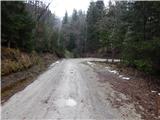 2
2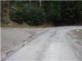 3
3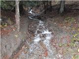 4
4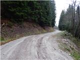 5
5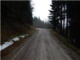 6
6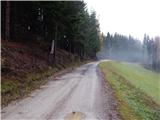 7
7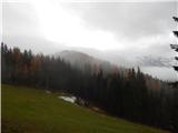 8
8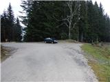 9
9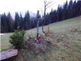 10
10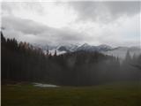 11
11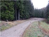 12
12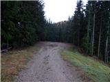 13
13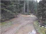 14
14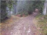 15
15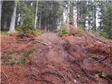 16
16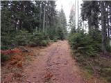 17
17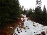 18
18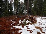 19
19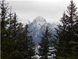 20
20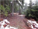 21
21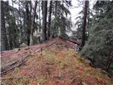 22
22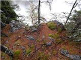 23
23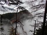 24
24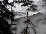 25
25