Kisovec - Koča na Čemšeniški planini
Starting point: Kisovec (271 m)
Starting point Lat/Lon: 46.14011°N 14.96302°E 
Time of walking: 3 h 25 min
Difficulty: easy marked way
Difficulty of skiing: no data
Altitude difference: 849 m
Altitude difference (by path): 890 m
Map:
Access to starting point:
a) We leave the Štajerska highway at the Trojane exit, and then follow the road towards Zagorje ob Savi. When we arrive in the settlement Kisovec, opposite the Pekarna Kisovec, by red trail markers, the described path begins. We park at one of the parking lots in the settlement.
b) We drive into Zagorje, and then follow the road towards Izlake and the highway. When we arrive in the settlement Kisovec, opposite the Pekarna Kisovec, by red trail markers, the described path begins. We park at one of the parking lots in the settlement.
Path description:
From the starting point, we follow the signs for Čemšeniška planina, initially walking through the center of the settlement, where we pass on the left side of the kindergarten, then cross the stream Medija over a pedestrian bridge, and on the other side of the stream, we arrive in the settlement Loke pri Zagorju, where we walk past houses to a crossroad by the NOB monument.
Behind the NOB monument, we carefully cross the road, then bypass the parish church of Mary's Immaculate Heart - Our Lady of Fatima on the left side, and on the right side, we bypass the fire station PGD Loke pri Zagorju.
The path ahead leads us past the last houses, then continues along a narrower road that ascends by the stream Graški graben. When, a few minutes higher, the gorge widens, we choose the slightly left road, marked with signs for Čemšeniška planina (on the right, there are some houses in the settlement Zavine), then ascend over a grassy area to a small hamlet, where we continue sharply right at the houses. When, a few minutes higher, we reach the chapel below the hayrack, we turn right again, and the asphalt ends a few steps further. We continue along the slopes of the hill Petelink, and upon reaching the northern ridge of the hill, we come to another asphalt road, which we follow to the right. The path ahead leads us past individual houses, then we moderately ascend through a strip of forest. When we leave the forest, a view opens up to the hill with the ruins of the castle Gamberk, and after a short crossing, we reach a crossroad where we join the path starting in Zagorje ob Savi.
Here, we continue left (straight to the castle Gamberk, right to Zagorje ob Savi) and keep walking on the asphalt road, which gradually turns north, leading us partly along meadows, partly through the forest, and partly through individual hamlets. The path also takes us near the farm Virant Pr Grivc, where homemade dairy products are sold, and we then begin to gently descend. We then leave the village Ržiše and arrive at the settlement Razbor pri Čemšeniku, where, at the bus stop and chapel, we join the path starting in the settlement Izlake.
We continue straight toward Čemšeniška planina (left to Izlake) and keep walking on a narrower macadam road, which, past a few houses, brings us to an asphalt road that we follow left upwards.
Further on, we pass the bottom station of the cargo cableway leading to the cottage Dom na Čemšeniški planini (there is also a parking lot by the cableway, and parking here shortens the path by about two hours). After the bottom station, the road turns slightly left, but before the start of the settlement Razbor pri Čemšeniku, we leave it and continue slightly right onto a cart track. From the cart track, we go once again right, so that to the "last" house we ascend on a panoramic grassy slope.
The last house we bypass on the right side, and then we start steeply ascending through the forest. A steep path brings us by the edge of panoramic cliffs, from which a beautiful view opens up on surroundings and nearby hills, and when higher the path flattens a little, we get to a marked crossing.
From the crossing, we go left (right - church of St. Primož and Felicijan 5-10 minutes) and then in few minutes of a diagonal ascent, we ascend to a macadam road which we follow to the left, and we walk there only until it is ascending, and then we go slightly right on a cart track. From the cart track, we soon go right as well, and then we join the path from Izlake via Čemšenik, where we go once again right.
We continue in the direction of Čemšeniška planina and we are diagonally quite steeply ascending. The diagonal ascent ends, when we reach the ridge of Čemšeniška planina, and at the mentioned spot we join also the path from Trojane or Prvine.
We go right and we continue the ascent on a gently sloping macadam road which a little higher we leave and we continue slightly right on a marked footpath which leads us with nice views on hills of Zasavsko and Posavsko hribovje with the highest Kum, and in the distance we can also see Snežnik. A little further, we cross also a lane of a forest, and the path then flattens and crosses a steep grassy slope, where when there is ice, it is quite dangerous for slipping, otherwise the path is wide and technically undemanding. A little before the mountain hut we cross also the route of a cargo cableway, and then with nice views, we walk to the mountain hut.
Kisovec - Ržiše 1:00, Ržiše - Razbor pri Čemšeniku 1:00, Razbor pri Čemšeniku - Koča na Čemšeniški planini 1:25.
Description and pictures refer to the condition in February 2019 and January 2025.
On the way: Loke pri Zagorju (278m), Zavine (389m), Ržiše (563m), Kapelica sv. Družine Na pilu (549m), Razbor pri Čemšeniku (651m)
Pictures:
 1
1 2
2 3
3 4
4 5
5 6
6 7
7 8
8 9
9 10
10 11
11 12
12 13
13 14
14 15
15 16
16 17
17 18
18 19
19 20
20 21
21 22
22 23
23 24
24 25
25 26
26 27
27 28
28 29
29 30
30 31
31 32
32 33
33 34
34 35
35 36
36 37
37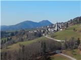 38
38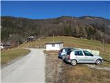 39
39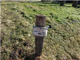 40
40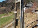 41
41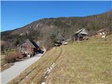 42
42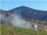 43
43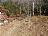 44
44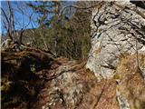 45
45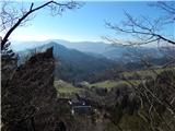 46
46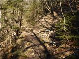 47
47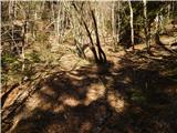 48
48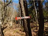 49
49 50
50 51
51 52
52 53
53 54
54 55
55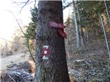 56
56 57
57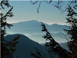 58
58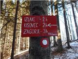 59
59 60
60 61
61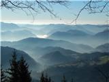 62
62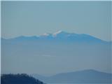 63
63 64
64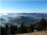 65
65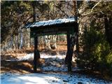 66
66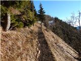 67
67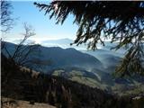 68
68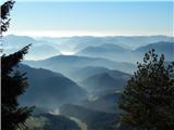 69
69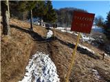 70
70 71
71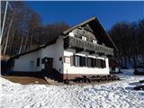 72
72