Klammbrückl - Große Gamswiesenspitze (Madonnen Klettersteig)
Starting point: Klammbrückl (1092 m)
Starting point Lat/Lon: 46.79024°N 12.76478°E 
Path name: Madonnen Klettersteig
Time of walking: 5 h
Difficulty: extremely difficult marked way
Ferrata: C
Difficulty of skiing: no data
Altitude difference: 1396 m
Altitude difference (by path): 1400 m
Map:
Access to starting point:
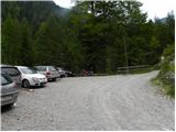
Through the Karawanks Tunnel, we drive to Austria, then continue driving towards Spittal and further towards Lienz (a little after Spittal the highway ends). Further, we drive on a relatively nice and wide road through the Drau valley. In the center of Lienz, at the main roundabout we continue »left« and continue driving towards Italy (exit from the roundabout in the direction of the villages Leisach, Anras and Silian). Soon after the village Leisach, we will notice on the left side of the road signposts, which direct us to a narrow wooden bridge over the river Drava (direction Kerschbaumer Alm, ÖTK – Schutzhaus 1902 m). The road narrows only a little after the bridge and starts ascending steeply. We follow the mentioned road to the parking lot at Klammbrückl.
Path description:
From the parking lot, we continue on the road which is closed to traffic. Already after a few dozen meters, we come to a crossroad where we continue right following the signs “ÖTK Schutzhaus”. Further, we can follow the mountain road all the time or go on a footpath which runs through the forest and later joins the mountain road a few times for a short time.
When the road ends we continue on a footpath which starts ascending on the right side of the valley. The path through a thin forest brings us to somewhat steeper slopes and then to the vantage point from where we can nicely see the waterfall Klapffall. After that, the path turns slightly to the left and gets close to the mountain stream. Next follows an ascent by the stream and then the path brings us to the mountain pasture Kerschbaumer Alm. The path here runs on the left side of the mountain pasture and follows only a short ascent on a grassy slope past rare trees to the hut Schutzhaus.
From the hut, we continue left following the signs Kerschbaumer Törl. At first, we cross a grassy slope and the riverbed of a torrent and then we come to a path junction. At the crossroad, we continue straight and through larch forest we cross slopes on the right side of the valley. After that, the path turns slightly to the left and crosses some smaller streams. Later, the path turns again to the left and then runs on the left side of the valley. Here we come into dwarf pines and we start ascending a little steeper. The path ascends for some time still through dwarf pines, and then we come to a path junction where we go left following the signs “gr. Gamswiesenspitze”.
The path then ascends on a partly grassy slope and soon brings us to another junction and thus to the entry into the climbing part of the path. We continue left on the extremely demanding path “Madonnen Klettersteig”. The path already at the beginning starts ascending by the steel cable on a steep slope. Further, the path a few times crosses the slope slightly to the left, otherwise it ascends all the time towards the north steeply upwards. Later, the path turns left and crosses a steep exposed wall, which brings us to a hanging bridge. After crossing the bridge, the path turns again right upwards and by the steel cable brings us to the logbook, which is located before the entrance into the most demanding part of the path.
From the logbook, we continue left upwards and then a few times ascend almost vertically by the steel cable. Such a path brings us to the west side of the mountain. Here we will notice in front of us an interesting rock, to which they added a “halo”, so that from afar it looks like a statue of the Virgin Mary. After that, the path turns slightly to the right, so that it goes around the mentioned rock, and then turns to the left and a few times ascends vertically by the steel cable. This part of the path is extremely demanding and is marked with difficulty level C. Towards the summit the path becomes less steep and after a short ascent along the ridge an easier path joins us from the right side. From here follows only a short ascent on a panoramic ridge to the summit.
The described path is extremely demanding and is suitable only for the most experienced mountaineers with enough strength in their arms and with mandatory self-belaying. The ascent is especially demanding because the entire path is secured only with a steel cable, which is often placed so that it can be used only for protection, not as aid for climbing.
The descent is recommended on the easier path (Normalweg) over the notch between Große Gamswiesenspitze and Kleine Gamswiesenspitze.
Pictures:
 1
1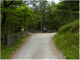 2
2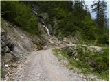 3
3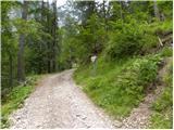 4
4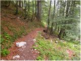 5
5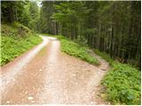 6
6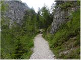 7
7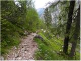 8
8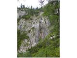 9
9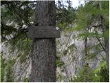 10
10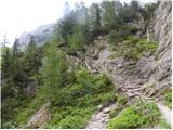 11
11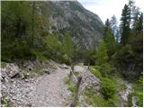 12
12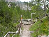 13
13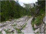 14
14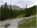 15
15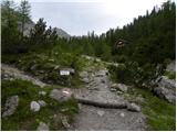 16
16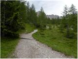 17
17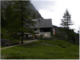 18
18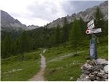 19
19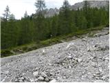 20
20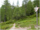 21
21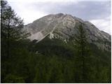 22
22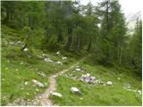 23
23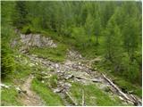 24
24 25
25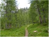 26
26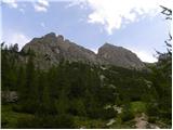 27
27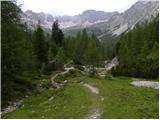 28
28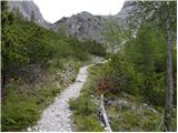 29
29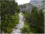 30
30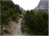 31
31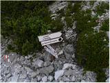 32
32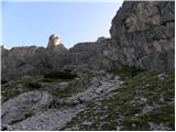 33
33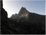 34
34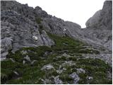 35
35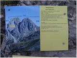 36
36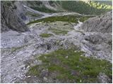 37
37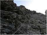 38
38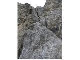 39
39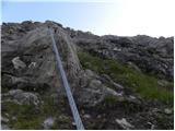 40
40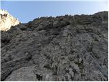 41
41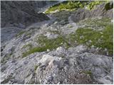 42
42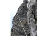 43
43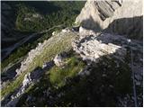 44
44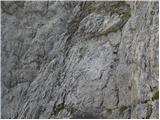 45
45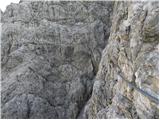 46
46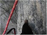 47
47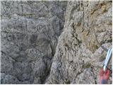 48
48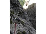 49
49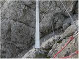 50
50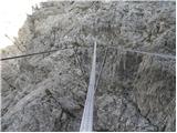 51
51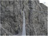 52
52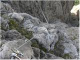 53
53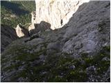 54
54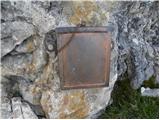 55
55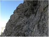 56
56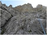 57
57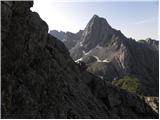 58
58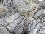 59
59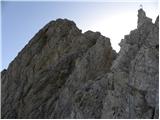 60
60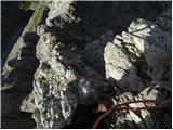 61
61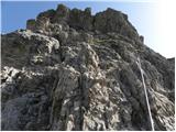 62
62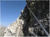 63
63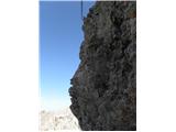 64
64 65
65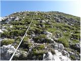 66
66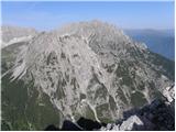 67
67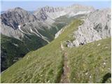 68
68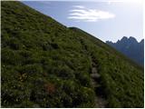 69
69 70
70 71
71