Starting point: Klösterle (1000 m)
Starting point Lat/Lon: 46.7303°N 13.9143°E 
Time of walking: 2 h 50 min
Difficulty: easy marked way
Difficulty of skiing: no data
Altitude difference: 909 m
Altitude difference (by path): 915 m
Map:
Access to starting point:
A) Via the Ljubelj border crossing we drive to Austria, then we follow the road towards Celovec / Klagenfurt. In Celovec at all crossroads we continue straight, when the main road turns markedly to the right, a little further on we leave it and continue left towards the settlements Dhovše pri Celovcu / Lendorf and Trg na Koroškem / Feldkirchen in Kärnten. When we arrive at the motorway junction we go left towards the settlement Trg na Koroškem, when we arrive at the mentioned settlement we go from the traffic-light intersection right towards the alpine pass Turracher Höhe. After the Himmelberg settlement we go left towards Gerlitzen / Osojščica and begin to ascend noticeably. When the road stops ascending we follow it to parking lot 6a.
From the Ljubelj border crossing to the starting point there is approximately 73 km.
B) Through the Karawanks Tunnel we drive to Austria, then we drive on the motorway to the motorway junction, from where we continue towards Spittal an der Drau / Špital ob Dravi and continue driving on motorway A10. We quickly leave motorway A10 and drive to the exit for Ossiacher See / Osojsko jezero, at the nearby roundabout we choose the third exit (if there were no roundabout we would go left) and further we drive on Millstätter Strasse. On the mentioned road we drive to an intersection, where we turn right towards the settlement Arriach and Gerlitzen ski resort / Osojščica, so further we drive on Teuchen Landesstraße. On the mentioned road we drive to parking lot 6a.
From the Karavanke border crossing to the starting point there is approximately 47 km.
Path description:
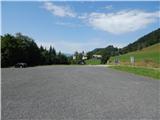
From the parking lot over a wooden bridge we cross the Arriachbach stream, then we walk to the lower station of the Klösterlebahn I cableway, which we bypass on the right side. Behind the chairlift station we continue right, so we continue to the edge of the forest. When we step into the forest we notice the first blaze, the path splits a few steps ahead.
The marked path continues straight and leads to Wurzelpark, we go left, where after a few steps we notice a trodden path, which after a short ascent turns right and ascends transversely above the archery range. After approximately 5 minutes of walking on the unmarked path we return to the marked path, which we reach on the section where it runs on the macadam road (the path past Wurzelpark is approximately 15 minutes longer).
We follow the road to the left, along it we quickly arrive at the edge of the ski slope, from where a nice view opens up, the path turns right and continues along the road. Higher we make some hairpin turns, then we return to the ski slope, along which we ascend for some time, then the path again enters the forest, where we continue on a poor road. After crossing the pasture fence the path for longer passes onto the ski slope and also becomes steeper, as it ascends straight up the ski slope. When we approach the upper station of the Klösterlebahn I cableway we go right into the forest again. In the forest the road turns sharply left and brings us to the station of the mentioned cableway, a few dozen steps before it we continue right uphill. We quickly reach the next road and continue along it amid ever finer views reaching to the highest peak of Austria. Some junctions follow, where we follow the blazes, then past the reservoir lake, from which a nice view of Wintertalernock opens up, we arrive at a junction near the Huaba Hittn hut.
Here we go left (right Stifterboden) and in a few steps reach the mentioned hut.
From the hut we continue straight and continue walking along the macadam road, at the nearby junction we go left, so we return to the ski slope. When we reach the ski slope, on the right we notice a water trough, the path leads us along the road, which on the ski slope makes some longer hairpin turns. Higher the road changes into a cart track, which turns slightly right and brings us to a marked junction, from which we continue left onto the footpath (straight Neugarten Almsee).
A few minutes of ascent follow, then we reach the next junction, where we go right.
The path ahead leads us already very close to the summit, but first crosses the slopes towards the west, then gently descends to the Alpin hotel, where we go left and ascend along the asphalt road to the summit of Osojščica / Gerlitzen, where the Gipfelhaus hotel stands.
From the summit we can descend to the nearby viewpoint, from which a nice view opens up on Osojsko jezero / Ossiacher See.
Klösterle - Huaba Hittn 1:40, Huaba Hittn - Osojščica / Gerlitzen 1:10.
The description and photos refer to the conditions in 2019 (August).
On the way: Huaba Hittn (1605m)
Pictures:
 1
1 2
2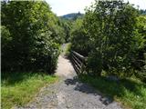 3
3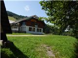 4
4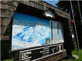 5
5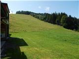 6
6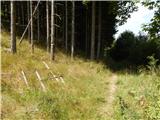 7
7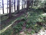 8
8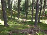 9
9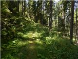 10
10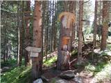 11
11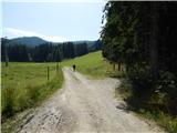 12
12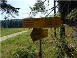 13
13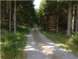 14
14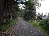 15
15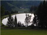 16
16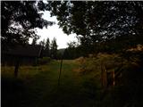 17
17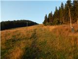 18
18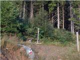 19
19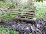 20
20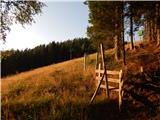 21
21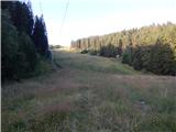 22
22 23
23 24
24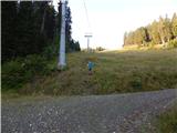 25
25 26
26 27
27 28
28 29
29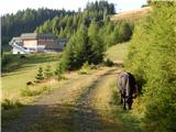 30
30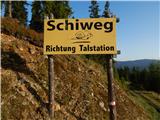 31
31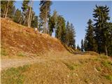 32
32 33
33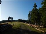 34
34 35
35 36
36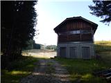 37
37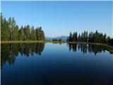 38
38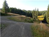 39
39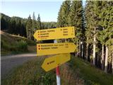 40
40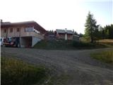 41
41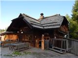 42
42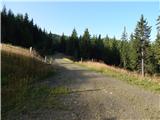 43
43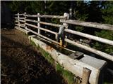 44
44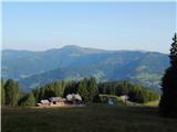 45
45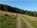 46
46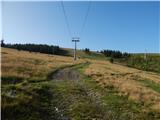 47
47 48
48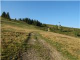 49
49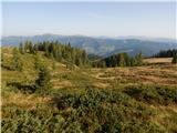 50
50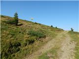 51
51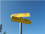 52
52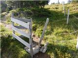 53
53 54
54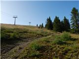 55
55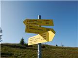 56
56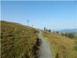 57
57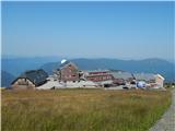 58
58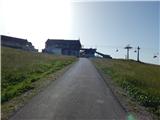 59
59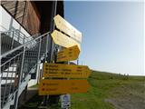 60
60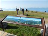 61
61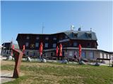 62
62 63
63