Koča pri Savici - Bogatin (via planina Govnjač)
Starting point: Koča pri Savici (653 m)
Starting point Lat/Lon: 46.2896°N 13.8022°E 
Path name: via planina Govnjač
Time of walking: 5 h 30 min
Difficulty: partly demanding marked way
Difficulty of skiing: demanding
Altitude difference: 1324 m
Altitude difference (by path): 1530 m
Map: TNP 1:50.000
Access to starting point:
From highway Ljubljana - Jesenice we go to the exit Lesce and follow the road towards Bled and forward towards Bohinjska Bistrica. We continue driving towards the lake Bohinj (Ribčev laz), where we come to a crossroad, where we continue straight on the left (south) side of the lake in the direction of Ukanc and waterfall Savica. This more and more narrow road, we then follow to a large parking lot at the mountain hut Savica. The parking lot is payable.
Path description:
From the parking lot, we go on a wide footpath in the direction of waterfall Savica and Dom na Komni. After a short gentle ascent the path already brings us to a marked crossing where the tourist path towards the waterfall Savica branches off to the right, we continue slightly left or straight on a wide footpath in the direction of Komna. The path ahead is for a short time still ascending by Savica, and then it brings us on the first of 48 marked hairpin turns. After an hour and a half of a moderate ascent through the forest, the path brings us to the mentioned 48th hairpin turn, from which a beautiful view opens up on lake Bohinj. Here the path turns a little to the right and passes into a valley named Pekel, where for some time it is ascending gently, and then turns to the right and it ascends a little steeper again. Already after few 10 strides the path turns left again and is then ascending parallel with the valley. Further, gentle to moderately steep path, gradually passes into a more thin forest, from which we can soon see the mountain hut Dom na Komni. The path ahead leads us past a smaller artificial cave, and higher also past a natural abyss, which is fenced, so that the hikers don't fall in it. Further, the path ascends a little steeper and after few steps of additional walking brings us to a crossing, where the path towards the lake Črno jezero branches off to the right.
We continue straight on a wide path (mule track), which only a little higher brings us to the next crossing. We again continue left (right mountain hut Koča pri Triglavskih jezerih) on a path, which ascends even a little steeper and after few minutes of additional walking brings us to the mountain hut Dom na Komni.
From the hut, we continue left in the direction of the mountain pasture Govnjač, Vogel and Mahavšček (right saddle Bogatinsko sedlo and Krn) on the path which soon after the mountain hut starts steeply descending. The path soon flattens and after a good 5 minutes from Dom na Komni brings us to a marked crossing, where we continue right in the direction of the mountain pasture Govnjač. The path ahead runs on an old military mule track and it is with the exception of few shorter ascents, descending. After approximately 30 minutes of walking from Dom na Komni, we come to the information board on the mentioned mountain pasture.
From the information board, we continue on a poorly visible path (direction Mahavšček), which after few steps brings us to numerous ruins (hinterland for Krn battlefield in the first world war). On the other side of the mentioned ruins we come to the next signposts, where we have two options to continue.
We continue straight in the direction of "Mahavšček - bližnjica (shortcut)" (slightly right Mahavšček, on map TNP 1:50.000 PZS, is as marked drawn "shortcut") on at first poorly visible path, which soon becomes more distinct and then it starts ascending steeper below the steep cliffs. The path which in a diagonal ascent crosses few lanes of smaller scree, higher flattens and from the right joins the gentle path.
We again continue the ascent on an old military mule track, which only a little higher brings us on a pleasant and relatively large grassy plain. In the upper part of the plain, the path turns to the right and starts moderately ascending through a small valley. Only few steps ahead smaller valley splits into two parts (here we will notice a cairn, which marks the beginning of unmarked footpath on Tolminski Kuk), and the marked path continues by the edge of right valley. The path ahead leads us past some smaller hollows, and then it starts ascending steeper, on at first a grassy slope. The path higher crosses smaller scree, after that with increasingly beautiful views brings us to a marked crossing.
We continue right in the direction of Bogatin (left Tolminski Kuk) on an old military mule track, which then crosses slopes of Vrh Škrli. A little further, the path brings us on the main ridge of Spodnje Bohinjske gore, and the path is for some time very lightly ascending. Higher the ridge narrows a little, and the path starts ascending steeper towards Mahavšček, which we reach after few minutes of additional walking.
From Mahavšček we descend on a panoramic ridge path, which after few minutes of descent brings us on the saddle between Mahavšček and Bogatin. From the saddle, we continue on a steep and slightly exposed ridge path, on which in good 10 minutes of additional walking, we ascend to the summit of Bogatin.
Savica - Komna 2:30, Komna - Mahavšček 2:30, Mahavšček - Bogatin 30 minutes.
Pictures:
 1
1 2
2 3
3 4
4 5
5 6
6 7
7 8
8 9
9 10
10 11
11 12
12 13
13 14
14 15
15 16
16 17
17 18
18 19
19 20
20 21
21 22
22 23
23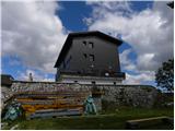 24
24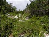 25
25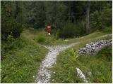 26
26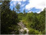 27
27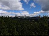 28
28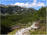 29
29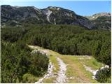 30
30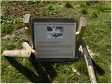 31
31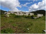 32
32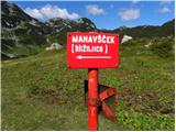 33
33 34
34 35
35 36
36 37
37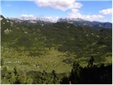 38
38 39
39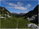 40
40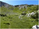 41
41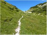 42
42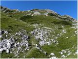 43
43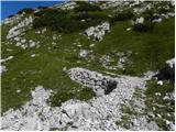 44
44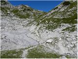 45
45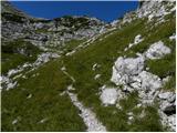 46
46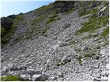 47
47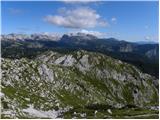 48
48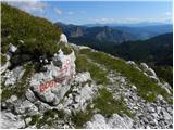 49
49 50
50 51
51 52
52 53
53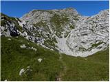 54
54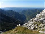 55
55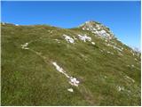 56
56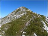 57
57 58
58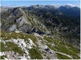 59
59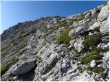 60
60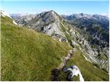 61
61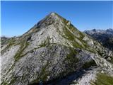 62
62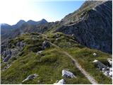 63
63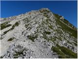 64
64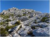 65
65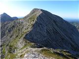 66
66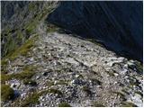 67
67 68
68