Starting point: Koča pri Savici (653 m)
Starting point Lat/Lon: 46.2896°N 13.8022°E 
Time of walking: 5 h
Difficulty: difficult marked way, easy pathless terrain
Difficulty of skiing: very demanding
Altitude difference: 1537 m
Altitude difference (by path): 1650 m
Map: Triglav 1:25.000
Access to starting point:
From highway Ljubljana - Jesenice we go to the exit Lesce and follow the road towards Bled and forward towards Bohinjska Bistrica. We continue driving towards the lake Bohinj (Ribčev laz), where we come to a crossroad, where we continue straight on the left (south) side of the lake in the direction of Ukanc and waterfall Savica. This more and more narrow road, we then follow to a large parking lot at the mountain hut Savica. The parking lot is payable.
Path description:
From the parking lot, we go right in the direction of the lake Črno jezero, mountain hut Koča pri Triglavskih jezerih and Hotel Zlatorog. The path at first leads on a macadam road which over a bridge crosses the river Savica. Only a little after the bridge, signs for Komarča point us to the left (straight Hotel Zlatorog) on at first quite wide and relatively gentle forest path. The path soon starts ascending steeper and a little higher brings us to the spot, where the path towards the source of Savica branches off to the left, and we continue right on the more and more steep path.
Well maintained and relatively wide mountain path, soon passes on very steep and for slipping dangerous slopes of Komarča (there's also a great danger of falling stones). The path ahead is steeply ascending on mostly forested wall of Komarča, where on harder spots we have fixed safety gear for help (mainly steel cables).
Higher from the path some views open up towards Bohinj, and the path brings us to short technically demanding spot, where with the help of stemples and a steel cable we cross otherwise not very exposed gully. The path ahead is for some time still steeply ascending and with the help of some fixed safety gear brings us to the top of Komarča, from where a beautiful view opens up on our starting point. Next follows a short moderately steep ascent, and then the path starts gently descending towards the lake Črno jezero, which we reach after less than 5 minutes of additional walking.
Near the lake is marked crossing, where the path towards the mountain pasture Viševnik branches off to the right, and we go slightly left and we continue on a marked path, which on the right side bypasses lake Črno jezero. On the other side of the lake from the left joins the path from the mountain hut Dom na Komni, and we continue on a relatively gently sloping path which continues by the edge of valley Lopučniška dolina. Higher, the path starts moderately ascending and by the edge of overhung cliffs, brings us to a smaller well, which in dry periods dries up.
We continue on a marked path, and which near Bela skala turns sharply to the right and steeply ascends. Next follows few minutes of a steep ascent, and then the path flattens and it brings us to a marked crossing, where from the right side joins the path from the mountain pasture Blato. We continue left in the direction of the mountain hut Koča pri Triglavskih jezerih and we continue on a relatively gently sloping path, on which in 10 minutes of additional walking, we get to the lake Dvojno jezero. The marked path bypasses the lake on the right side and before we come on the other side brings us to a crossing, where the path towards Štapce branches off to the right.
Here we continue right (straight mountain hut Koča pri Triglavskih jezerih 5 minutes) and we ascend through a lane of thin forest, which ends among dwarf pines. Next follows a short ascent through dwarf pines, and then relatively steep path continues on the scree. The increasingly panoramic path quickly brings us below the mountain walls of Štapce, where it turns to the right and becomes technically a little more demanding. With the help of a ladder and steel cables, we diagonally ascend over smaller wall, and then the path brings us into a notch, where it turns left. Next follows a short secured steep ascent and the path flattens on a saddle Štapce, where there is a marked crossing.
On Štapce we continue left in the direction of Tičarica and Zelnarica (right mountain pasture Ovčarija) and we continue the ascent on the path which at first ascends through a lane of dwarf pines, and then it brings us to a short steep and mainly in wet for slipping dangerous jump. Above the jump, the path flattens and passes on moderately steep grassy slopes, on which in few minutes of additional walking, we ascend to a small saddle, where the marked path branches off to the left on Mala Tičarica (10 minutes).
We continue in the direction of Zelnarica on a relatively gentle path, which at first crosses slopes of Mala and then also Velika Tičarica. After Velika Tičarica path passes on a wide grassy ridge on and by which we are then ascending. After few minutes of easy walking, the path starts ascending steeply on a partly grassy slope. The steepness quickly decreases and the path brings us on ample meadows south from precipitous and overhang Kopica. Through the ample meadows we walk to the foot of the upper slopes of Kopica, after that when we reach the edge of the wall, marked path turns to the right and it ascends diagonally over smaller scree. After the scree, the path turns to the left and then in a diagonal ascent starts ascending steeply. The marked path at a smaller indistinct hollow gets closer to the ridge and turns slightly towards the right. At this spot, we leave the marked path and on easier pathless terrain over moderately steep grassy slope in few steps ascend on the ridge of Kopica. Here we go left and we continue on narrower, but technically undemanding ridge. After less than 5 minutes of walking from the spot, when we left the marked path we reach a panoramic and precipitous peak Kopica.
In fog we will hardly find the beginning of pathless terrain on Kopica.
The starting point - Koča pri Triglavskih jezerih 3:00, Koča pri Triglavskih jezerih - Kopica 2:00.
Pictures:
 1
1 2
2 3
3 4
4 5
5 6
6 7
7 8
8 9
9 10
10 11
11 12
12 13
13 14
14 15
15 16
16 17
17 18
18 19
19 20
20 21
21 22
22 23
23 24
24 25
25 26
26 27
27 28
28 29
29 30
30 31
31 32
32 33
33 34
34 35
35 36
36 37
37 38
38 39
39 40
40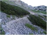 41
41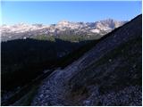 42
42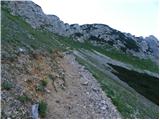 43
43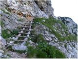 44
44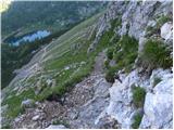 45
45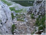 46
46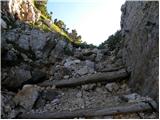 47
47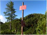 48
48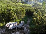 49
49 50
50 51
51 52
52 53
53 54
54 55
55 56
56 57
57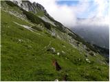 58
58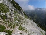 59
59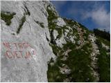 60
60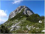 61
61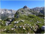 62
62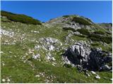 63
63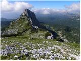 64
64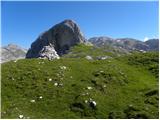 65
65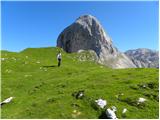 66
66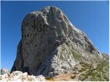 67
67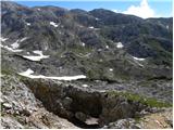 68
68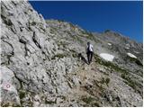 69
69 70
70 71
71 72
72 73
73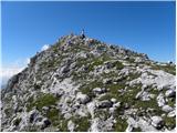 74
74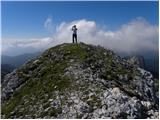 75
75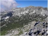 76
76