Koča pri Savici - Mahavšček (via Bogatin)
Starting point: Koča pri Savici (653 m)
| Latitude/Longitude: | 46,2896°N 13,8022°E |
| |
Route name: via Bogatin
Walking time: 5 h
Difficulty: partly demanding marked way
Elevation gain: 1355 m
Elevation difference along the route: 1450 m
Map: TNP 1:50.000
Recommended equipment (summer): helmet
Recommended equipment (winter): helmet, ice axe, crampons
Views: 23.825
 | 3 people like this post |
Access to starting point:
From the Ljubljana - Jesenice motorway, take the Lesce exit and follow the road towards Bled and further towards Bohinjska Bistrica. Continue driving towards Lake Bohinj (Ribčev Laz), where you reach a crossroads and continue straight along the left (southern) side of the lake towards Ukanc and Savica Waterfall. Then follow this increasingly narrow road to the large parking lot at Koča pri Savici. The parking lot is paid.
Route description:
From the parking lot, we head to the wide footpath in the direction of Savica Waterfall and Dom na Komni (right path over Komarča). After a short gentle ascent, the path brings us to a marked crossroads, where the tourist path to Savica Waterfall branches off to the right, but we continue slightly left or straight on the wide footpath in the direction of Komna. The path further ascends for a short time along the Savica, then brings us to the first of the marked 48 switchbacks. After an hour and a half of moderate ascent through the forest, the path brings us to the mentioned 48th switchback, from which a beautiful view of Lake Bohinj opens up. Here the path turns slightly to the right and enters the valley called Pekel, where it ascends gently for some time, then turns right and ascends somewhat steeper again. After just a few dozen steps, the path turns left again and continues to ascend parallel to the valley. Further on, the gentle to moderately steep path gradually enters a sparser forest, from which we soon see Dom na Komni. The path further leads us past a small interesting cave, higher up it brings us to a crossroads, where the path to Black Lake branches off to the right, but we continue left and further on the wide path. Follows some traverse ascent, at the natural abyss, which is fenced for safety, the path turns right, then ascends to the next crossroads, where the path from Black Lake joins us.
A little further, the path splits again, but we choose the left path in the direction of Dom na Komni, or we can also take the slightly shorter path that continues straight and bypasses Dom na Komni (right Koča pri Triglavskih jezerih).
Follows an ascent past the hut Pri Hubertu and in a few minutes we reach Dom na Komni.
From Dom na Komni, we go past a small chapel and follow the signs for Koča pod Bogatinom (left Vogel, Tolminski Kuk and Planina Govnjač), but we soon join the previously mentioned slightly shorter path.
We continue slightly left in the direction of Koča pod Bogatinom and along the wide and quite scenic path we quickly arrive at Planina na Kraju, where past the pyramid (ossuary at Koča pod Bogatinom - mountain memorial monument) we reach Koča pod Bogatinom, which is located in the middle of the alpine pasture.
We bypass the hut on the right side and quickly arrive at a marked crossroads, where the path over Lepa Komna branches off to the right, leading further to Lanževica or Oslovi škrbina, but we continue straight, further on the wider gentle path in the direction of Bogatinsko sedlo. On the western part of Planina na Kraju, another path to Planina Govnjač branches off to the left, but we continue for a few minutes in a light ascent along the southern side of Kozji rob. The path further becomes completely flat for some time and enters the edge of the Gracija valley, where we start to ascend traversely, first along the slopes of Srednji vrh, later along the slopes of the pre-summit of Vrh nad Gracijo. In the continuation, the path becomes somewhat steeper and brings us with beautiful views to the place where it splits.
We can continue further on the mule track, which makes a longer switchback or on the slightly shorter steep path that ascends directly to Bogatinsko sedlo, where both paths merge.
From the crossroads at Bogatinsko sedlo, from where a beautiful view of Krn and the surrounding mountains opens up, we head left in the direction of Bogatin and Mahavšček (straight down Lepena, Prehodci, Krn, Krnsko jezero and Koča pri Krnskem jezeru, right Lanževica).
The path that continues south quickly brings us to the northern slopes of Bogatin, where we start to ascend steeply, soon reaching the northwest ridge of the mentioned mountain, where we ascend on crumbly terrain, where due to the considerable steepness greater caution is needed to avoid slipping, and the danger of falling rocks is also increased, especially if someone is above us. Higher up, the steepness eases, the ridge narrows and flattens, and only a few dozen steps of scenic walking await us to the summit of Bogatin or Mali Bogatin.
From Bogatin, we continue along the ridge path, which begins to descend steeply towards the saddle between Bogatin and Mahavšček (due to the considerable steepness, there is also a danger of slipping here).
From the saddle (we can also get here by the marked path that bypasses the summit of Bogatin on the southwest side, the latter is easier and slightly shorter) we continue further along the ridge path, which starts ascending again. Higher up, the path moves away from the ridge to the Bohinj side, where it ascends traversely over small screes. Further on, the path returns to the main ridge and after a few minutes of further walking brings us to the summit of Mahavšček.
We can descend along the path mentioned in the description that bypasses the summit of Bogatin, or along the easy mountain path over Planina Govnjač.
Starting point - branch to Black Lake 2:15, branch to Black Lake - Memorial plaque to Matej Koblar 0:10, Memorial plaque to Matej Koblar - Dom na Komni 0:05, Dom na Komni - Koča pod Bogatinom 0:15, Koča pod Bogatinom - Bogatinsko sedlo 1:15, Bogatinsko sedlo - Bogatin 0:30, Bogatin - Mahavšček 0:30.

Along the route: Jama ob poti na Komno (1303m), Odcep k Črnemu jezeru (1411m), Brezno pod lovsko kočo na Komni (1430m), Spominska plošča Mateju Koblarju (1481m), Pri Hubertu (1492m),
Dom na Komni (1520m), Piramida (1520m),
Koča pod Bogatinom (1513m), Bogatinsko sedlo (1803m),
Bogatin (1977m), Sedlo med Bogatinom in Mahavščkom (1909m)
Photos:
 1
1 2
2 3
3 4
4 5
5 6
6 7
7 8
8 9
9 10
10 11
11 12
12 13
13 14
14 15
15 16
16 17
17 18
18 19
19 20
20 21
21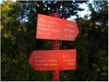 22
22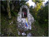 23
23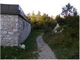 24
24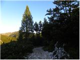 25
25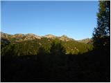 26
26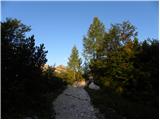 27
27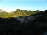 28
28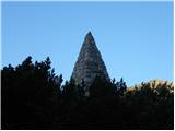 29
29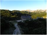 30
30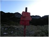 31
31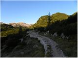 32
32 33
33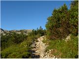 34
34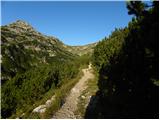 35
35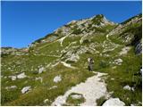 36
36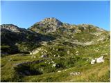 37
37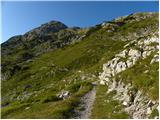 38
38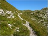 39
39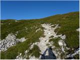 40
40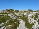 41
41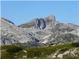 42
42 43
43 44
44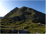 45
45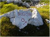 46
46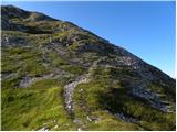 47
47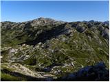 48
48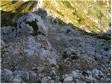 49
49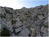 50
50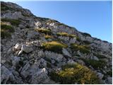 51
51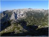 52
52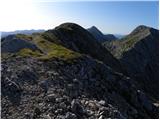 53
53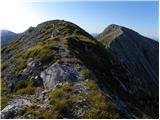 54
54 55
55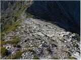 56
56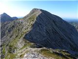 57
57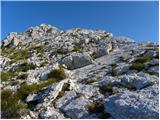 58
58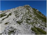 59
59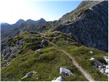 60
60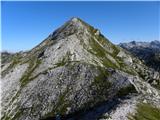 61
61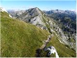 62
62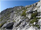 63
63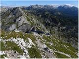 64
64 65
65
Discussion about the trip Koča pri Savici - Mahavšček (via Bogatin)
|
| VanSims13. 06. 2010 |
Helmet on this tour might be more necessary to Komna on those serpentines.
Otherwise it sounds scary: 48 serpentines. But they are quite gentle. To Bogatinsko sedlo it's actually very gentle and suitable even for beginners.
Then the path from Mali Bogatin to the saddle between the Bogatins is really a bit dangerous. For those not accustomed, it might be easier to descend back to Bogatinsko sedlo and then bypass Mali Bogatin and continue to Mahavšček.
For descent, the path via Govnjač might be easier.
|
|
|
|
| katty13. 08. 2012 |
The path to Dom na Komni via Komarča is more pleasant for me, as you ascend quite quickly, the protections are in excellent condition and the path itself is quite wonderful . Only from Črno jezero to Komna it really drags on like guts . Only from Črno jezero to Komna it really drags on like guts . From there we had quite dense fog, so no views at all. Perhaps part of the path is quite exposed and steep, probably unsuitable for some beginners with vertigo. Descent via planina Govnjač is pure poetry. Recommended. . From there we had quite dense fog, so no views at all. Perhaps part of the path is quite exposed and steep, probably unsuitable for some beginners with vertigo. Descent via planina Govnjač is pure poetry. Recommended.
|
|
|
|
| Ruzowski23. 06. 2014 |
Tour done on Saturday (not from Savica but from Lepena) Lepena-Krn lakes-Bogatinsko sedlo-Mali Bogatin-Mahavšček-Bogatinsko sedlo-Lanževica-sedlo-Krn lakes. Winter gear stayed in the backpack, some snowfields that can be avoided. Mahavšček cold and foggy, gloves and hat very useful. Lanževica a bit off-trail, fairy-tale solitude by the lake.
Despite warnings, still people without basic gear, shorts, sneakers, crossing snowfields under the saddle despite the dry right path..On seeing the ice axe, the question "Were you on Mont Blanc?"
|
|
|
|
| Enka27. 06. 2020 |
Is it true that the descent from Bogatina to Mahavšček is much harder than the descent back to Bogatinsko sedlo?
|
|
|
|
| Enka27. 06. 2020 |
@A, is it true that the descent from Bogatina towards Mahavšček is much more difficult than the descent back to Bogatinsko sedlo?
I mean, is it substantially more awkward? Scree, steepness?
|
|
|
|
| Gogl27. 06. 2020 |
Nothing special,
from afar it looks awkward, up close it's quite friendly. You'll stumble somewhere sooner towards the saddle.
Lp
|
|
|
|
| NVF13. 09. 2020 |
The new cylindrical box for the logbook is missing its lid. The old square one contains a completely full logbook. It calls for replacement. I didn't see the stamp, but I didn't look for it either.
|
|
|
|
| smatjaz14. 09. 2020 |
I also didn't find the stamp at the summit, but got it at the hut below Bogatin.
|
|
|
To post a comment you must log in:
If you do not yet have a username, you must first
register.